Thursday – Llanidloes – A town in mid-Wales, the first one on the River Severn as it flows down from its source in the Cambrian Mountains and on the confluence of the Severn and the River Clywedog. The town lies at the heart of the old kingdom of Arwystli. The name is from “The Church of St Idleos”, an early 7th century saint. It received a charter to hold markets in 1289. We are staying on a camp-site, Dol-llys Farm, to the north-east of the town and enter via the Long Bridge whose three arches spans the River Severn which is flowing through banks of gravel. The bridge was built by Thomas Penson in 1826. A small park lies beside the river, the Severn Porte. This land would have stood outside the mediaeval stockade of the town . A gate or portal in the stockade would give access to a river crossing. There were some 30 houses crammed into the area at the turn of the 20th century but all had gone by the end of the Second World War. Long Bridge Street is wide with a good range of shops and hostelries. It meets Great Oak Street where the Market Hall, a fine half-timbered building stands in the middle of the crossroads. Great Oak Street is also full of a wide variety of  shops, the Town Hall under which is a market and The Trewythen Arms, a large hotel where three Chartists were held on 30th April 1839. They were released by the townspeople, but were re-arrested along with 32 other townsfolk, who received heavy sentences. There is a quite excellent selection of shops, which is an interesting comparison with many other small towns in Wales and the Marches. We have a drink and meal at The Angel Inn, which is a very pleasant pub.
Friday – Llanidloes – It is a wild morning with the wind shaking the tent. An orange gash is in the eastern sky as the sun fights the clouds but it soon loses and greyness prevails. Out of Dol-llys Farm and up the road to the east. Rooks pass by noisily. The road passes between high  hedges of Hawthorn, Beech and Blackthorn. Flies are already a nuisance. A few late Foxgloves and an occasional Fumitory are the only flowers. A Wren chatters crossly, a Great Spotted Woodpecker calls. The road passes through high banks topped with Victorian era Oaks and younger Birches and Hazel. The road starts to rise. A massive caterpillar, an Elephant Hawkmoth, moves down a Rosebay Willowherb stem. Three Goldfinches disappear over the hedge. The road drops down to Oakley Park, a scattering of houses with a school of 1875 and a Presbyterian chapel of 1879, the latter still in use. A lane crosses to join another which forms a triangle with the original. The lane is edged with Black Knapweed and Meadowsweet. The lane rises to Cefn Bach, a farm with at least a dozen cats.
Llyn Clywedog – North of Llanidloes is this lake formed by the damming of Afon Clywedog. The dam was built between 1965 and 1967 and was controversial at the time with a number of protests 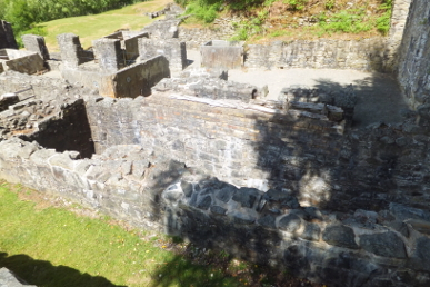 and a bomb being detonated on the site in 1966. Now a beautiful blue lake lies between the high hills. When built, the dam was the highest in the British Isles at 235 feet. The main purpose of the damming is to regulate the water flow in the upper Severn, holding it back in the winter and then releasing it steadily during the summer months. We walk along the viewing point then follow the road up onto the hill and back down again. Heathers, Lings and Rosebay Willowherb flower on the roadside banks. The sun is very hot now. Down in the narrow valley below the dam are the remains of mid 19th century processing plant for Bryntail lead mines. Production peaked in 1851 but was only 384 tons. Around 1870 production switched to barytes, white lead for paints, but the whole enterprise collapsed in 1884. We then drive right around the lake taking in the many delightful views.
Llanidloes – We head into town again. The Market Hall stands at a crossroads, Long Bridge Street, Great Oak Street, China Street and Short Bridge Street. We head down the last named. The Short Bridge was also built by Thomas Penson in 1850. There is a Flannel Mill by the bridge, now apartments. There are also two chapels in the street. Like many Welsh towns, chapels are everywhere. These two, an Independent and a Wesleyan Baptist; in China Street a huge Calvinistic Methodist, a smaller Calvinistic Bethel Hall in Bethel Street and a Wesleyan Methodist Chapel in Long Bridge Street. There are also a very decent number of pubs! We retire again to The Angel. To the east of the pub was the railway station, originally the Cambrian Railway, Mid-Wales Section. The station, opened in 1864, was also the headquarters of the company. 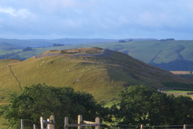 The station closed in 1962, the line in 1967.
Saturday – Llyn Clywedog – I return again to the lake after a night of heavy rain. First I have a look at Pen-y-castell hill-fort which is a partly ploughed-down, bivallate contour fort, resting on steep natural slopes to the SE and having a staggered entrance to the SW. The whole area is covered in bracken and there is little to see. Back round to the lake view-point and up the hill. The Glyndŵr trail passes through here. Up the hill and along the hill top. The views are stunning, the wind really quite cold! Behind is Pen-y-gaer hill-fort, a ditchless oval enclosure surrounded by stone-walls.
Sunday – Home – Yesterday the rest of the potatoes were lifted and this morning some more leeks are planted out in the bed. These leeks are very small but hopefully they will get to a usable size by late autumn. Courgettes are coming thick and fast, they can grow remarkably big in only a couple of days. Several squashes are developing on the plant by the chicken run. A decent amount of French and runner beans are picked, prepared and frozen, saving a few for dinner. Some carrots, grown in large pots are pulled. Several tomatoes are turning red and there are quite a few sweet peppers getting fat. Rain sets in during the afternoon.
Monday – Croft Ambrey – It rained almost continuously overnight and is now on and off. The woods that had taken on a dull, dusty appearance during the hot, dry weather of July are now verdant and shining again. A mist hangs over the tree tops. Several Common Buzzards are mewing. Branches on the trees hang, weighed down with water giving them a tropical rain-forest appearance. Up to the Iron Age hill-fort. Views are obscured by low cloud. A small flock of Crossbills, maybe a dozen birds, are feeding and chattering with sharp tics at the top of a conifer. It starts to rain heavily and both Maddy and I are soaked by the time we reach the castle car-park.
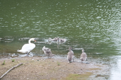
Wednesday – Bodenham Lakes – An overcast morning, rather humid. The first Dark Mullein flowers are coming out. Blackberries are beginning to ripen. Purple Loosestrife with long whorled spikes of pink flowers grow in the water margins. Mute Swan pen is with six cygnets in the scrape. There are fifteen adult Mute Swans visible on the lake. The usual other wildfowl are present, Mallard, Tufted Duck, Coot and Moorhens. It appears there are only four Cormorants here today. A single Great Crested Grebe is at the southern end. Three more Cormorants arrive, circling the lake before landing. A raptor, almost certainly Common Buzzard, is calling from trees in the opposite side of the lake but remaining hidden. A single young Great Crested Grebe appears, chasing after the adult. Butterflies, mainly Gatekeepers and Small Whites and Blue Damselflies are flitting over Ragwort but fewer than last week. A Peacock flutters around the hide. Fat Hen is growing over the clear parts of the copse. Darker clouds are building in the sky but rain stays away.
Home – A clear sign that the nights are drawing in is the sight of the first satellite I have seen since the late winter. Cosmos 2322, launched from the Balkonur Cosmodrome in October 1995 glides across the sky, heading south. Hopefully we will have some clear night for the next few days as the Perseid meteorite showers are about to peak.
Friday – Radnor Forest – Dark threatening clouds hang over the Radnor Forest. Overnight rain has filled the brook which bubbles down the side of the lane. To the other side the hillock on which the castle stood rises steeply. Up Mutton Dingle. House Martins scythe around the tops of trees in the valley. A wind is building. The surrounding hills are crystal clear. Up to the Forestry Commission plantation where Long-tailed Tits squeak, a Wren churrs like a tiny machine gun and warblers chase. It is strange to find raspberries growing profusely beside the track. Rosebay Willowherb, Gorse, Heather and Tormentil, a yellow, creeping plant, are all in flower. Clumps of yellow 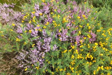 Gorse, diffused with purple heathers make an enchanting sight. Small Goat Willow, also known as Sallow, grow all over the bare areas of the plantation. Swallows pass over. A hint of a track climbs Whinyard Rocks through grass and heather. A Kestrel hawks along the side of Whimble. Towards the top the ground is covered by heather and bilberries and no path. I collect some bilberries, although they are so small that it takes a long time to gather a reasonable amount. On top of the hill are two Bronze Age barrows looking out over the Walton Basin, Hergest Ridge, the Black Mountains and beyond. Back down to the track and along towards Stanlo Tump. Five men and dogs are driving sheep down from the track near Whimble towards Bache Farm. A track is shown on the OS map to the triangulation point on Bâch Hill (now called Bache Hill) but it is almost a figment of the imagination.
It is another hard slog across heather and bilberries to get to another barrow. Bees are visiting the heather, a Peacock butterfly passes by and Meadow Pipits chase, squeaking loudly. Two barrows are on the hilltop, one surmounted by the triangulation point. Again the views are extraordinary, from the Brecon Beacons, Pen-y-Fan and Corn Ddu are blue in the haze, the Black Mountains, the Malverns, the Clee Hills and the South Shropshire range to Stiperstones. The Walton Basin lies below. The four standing stones can be seen through 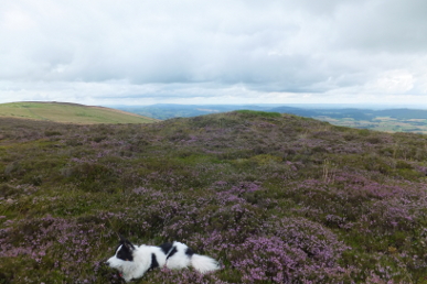 binoculars. I find what may be the track in the map, although this one is overgrown with grass. It is easier to traverse although there is no indication of its existence from the main track. Into the woods on Ednol Hill. As soon as I enter the woods, I am surrounded by flies. Meadow Browns, Small Whites and a Red Admiral butterflies flit around the path. Birds-foot Trefoil, the leaves of Coltsfoot (the flowers come and go before the leaves), one of the Dandelion family, possibly Smooth Hawksbeard, Heather, Bilberry, Spear Thistles, St John’s Wort, late Foxgloves, Angelica, Selfheal, Bramble and more Raspberries are growing by the path. Deer hoof prints, some very small, are impressed into patches of mud. The path comes round to the area above the deep valley of Ystol Bâch Brook, below Black Mixen. Ravens fly high overhead. The farmers must have been rounding up all their sheep as the are none on the flanks of the valley and very few up on Whimble, Whinyard Rocks or across Mynydd yr Eithon. The path descends to the road above Cwm Broadwell. A car is trying to get up the road to the car park but three sheep are making it difficult. I get Maddy out of the way because if the sheep see her it will be even more chaotic. Just as the car approaches the junction, I let Maddy stand and this sends the sheep up the track which I have just descended and off the road. I have a brief conversation with the woman driver who tells me she is going Whinberry picking. I comment I have already got some. “Where are your purple fingers?” she asks and I display my stained digits. She laughs and heads up to the car park. Back down in New Radnor, House Martins twitter on the roof of old town hall.

Monday – Mortimer Forest – It is warm although the sun only makes brief appearances from behind fast moving clouds. Flowers are few and far between, Angelica being the most prevalent with a few Rosebay Willowherbs and dandelion species. However, the recent warm weather has brought out the butterflies: Small Whites, Small Heaths, Gatekeepers, Peacocks, a Red Admiral and most excitingly, a couple of Silver-washed Fritillaries. The second fritillary is a tatty specimen with its rear wings worn away around the edges. The woods are busy with people with barely controlled dogs which insist on approaching Maddy, always a bad move, but she confines herself to warning barks. One wonders where these people are when the weather deteriorates or during the winter months when I often see no-one here. Do the poor mutts never get a walk then?
Tuesday – Leominster – Overnight was the peak of the Perseid meteorite showers, fragments of the comet Swift-Tuttle, also known as the “Tears of St Lawrence”. They are supposed to peak to over forty per hour but I see only three in twenty minutes in the late evening. One is a bright, slow moving meteorite, the others fast flashes. A rocket body passes over, Meteor 1-30 Rocket, launched by the CCCP in June 1980, followed a few minutes later by another, one of the Cosmos rockets. In the early hours I check the skies again and see another two meteorites, again a very bright one and a flash. Crossing the churchyard this morning, there is a sudden flurry under a large bush and a lot of high pitched screaming as a Sparrowhawk grabs a Blackbird and flies off. Yet again it appears that the Swifts have slipped away to southern climes without me noticing.
Wednesday – Leintwardine – Up Watling Street, one of the branches of the famous old Roman road. The houses lining the street are a delight as nearly everyone is different, from 17th century timber-framed to Georgian three-storey farmhouse, solid Victorian semis, to modern barn conversion. Sadly the general store and Post Office are no more. Off a side street, Tipton Street, the Ebenezer Congregational Church, a lovely yellow stone building with cream and black trim constructed in 1869, is now converted into homes. It is interesting that sandstone was used in the building of the church which seems not to have weathered as well as the local limestone used in most other buildings around here. The primary school stands opposite the cemetery, alpha and omega so to speak. There is a cattle grid in the entrance to the rectory, a very large house. Off along the Kinton lane. The by-way that passes around Kinton is reduced to a narrow path. The “main” road is close to being a track. The lane reaches the A411, the Ludlow road. A field of oats has an old bailer/lifter mouldering away in the corner. House Martins sweep over the ripe crop. Rain is approaching from the west. A lane climbs a slight hill from Lower Todding, past an old quarry and Todding to Mocktree Farm. Wood Pigeons call. The front edge of the rain is closing fast. Limestone outcrops along the side of the lane, Silurian limestones of the Ludlow Series and soon lays in plates underfoot. Vermilion berries of Wild Arum peep out from beds of nettles. The rain arrives as a fine drizzle. A pair of Fallow Deer are on the far aside of the thin strip of woodland and gallop off across the field in our approach.
At Mocktree Farm there is an old cottage in ruins with a much extended one nearby. Past Mocktree Cottage and the lane, Mocktree Turnpike, turns north. A field is 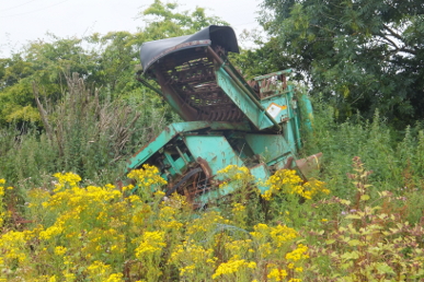 separated from the lane by a line of coppiced Hazels. Past a ruined wall that appears from the old maps to have been a Methodist Chapel (Primitive). The lane is now a track and is passing fields of potatoes. Farmers are looking at the crop, presumably deciding when to harvest. The wind has built up but so far the rain has stayed very light. White-tailed bees are visiting Rosebay Willowherb flowers. The track continues past Lawnwell Barn towards Shelderton Hill. Past a field of some sort of beet. Redshank, a sprawling plant with pink flower spikes and Fat Hen grow on the edge of the field. A silly young pheasant ruins along in front of Maddy who behaves impeccably. The crop turns to barley and the rain becomes a little more intense and penetrating. Things start to get complicated. This is supposed to be a major foot path, the Herefordshire Trail, but signs are few and far between which is especially unhelpful when the farmer has sown grain crops right over the paths. I completely miss the start of a path through a wheat field, but can see the stile. So I head down to Woodhead and go round the bottom of the field and over the stiles. Across another field of barley and then over a stile. The sign points vaguely at a bare field. So I go down the edge of the field and then down another field of barley. However, there is no way out so I traverse the bottom of this field and climb a fence to get onto a track. I am fairly certain I can get back to Lower Todding further down this track. Into a field of sheep and not very friendly looking Hereford cattle. To the west is Stormer Hall, an early 19th century house. My route is again confused by a footpath being somewhere in a field of tall maize. In the event I head back to Lower Todding and find a gate through which I can proceed to the main road. Back down Kinton lane past a large group of ramblers. I take off my over-trousers so of course it starts to rain more heavily. Through Kinton Farm, all barn conversions. A fine house is called Candlemas but I know not why. Through Whitton, a small hamlet. A small house has a corrugated iron roof, unusual but it seems in good condition and probably does the job! At the bottom of Church Hill, a lane goes back into Leintwardine past the fire station and the famous Sun Inn, open but I am, alas driving.

Friday – Great Rhos – The sun us breaking through after a night of rain. It is humid and warm. Up the track from the car park. A large flock of Chaffinches fly out of the track-side hedge and into Silver Birches on the edge of a Forestry Commission plantation. The track is lined with Rosebay Willowherbs, Burdocks and the seed heads of umbellifers and docks. Past a road sign, apparently no motor cars, motorcycles or horse-drawn hay wagons! Into the relative cool of Warren Wood and then into the twilight of the deep gorge carved by a little stream, the Somergill, running down Cwm Du. Mosses and ferns glow green. To the end where the waterfall, Water-Break-Its-Neck pours down the steps of limestone. The growth by the waterfall is even more luxuriant, Wilson’s Filmy Fern being one of the plants here. Enchanter’s 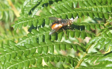 Nightshade is also flowering in the damp gloom. Back to the track and up a path through Sweet Chestnut trees. Wrens and Robins call their alarms, a Jay squawks and Nuthatch calls from high in a pine. The path is partially blocked by wet bracken and I am soaked pushing through it. Across two Meadows and into a young plantation Rowan berries are ripening. More Chaffinches pink. Also pink are the thistles growing on the meadows through the plantation is a piece of moorland and bog. Heathers, bilberries and sedge cover the ground. Common Buzzards and Ravens soar over the hills. Dragonflies pass to quickly to discern any colours or patterns. Bees, Small Heath and flies in heather. Redstarts flit through the Spruces. A fly with an orange abdomen with a broad black stripe sits on a bracken leaf. It is Tachina fera which apparently has no common name and parasitises moth and butterfly larvae.
Out of the plantation onto open moorland, Esgairnantau, formerly two words, Esgair Nantau meaning “ridge with brooks”. Grasshoppers are chirping in every direction. Hills roll away to the west. A pair of Red Kites glide over. A Common Buzzard rises from the moor and although it glides effortlessly it does not seem to have the elegance and bouyancy of the kites. The sky is now almost cloudless and it is very warm. I have reached a gate on the moor but it is clear that my target, a Bronze Age barrow beyond Great Rhos peak, is beyond several fences. That is rather annoying to say the least. I could bypass them but that is a length detour, maybe for another day. So back down to Davy Morgan’s Dingle.  Getting down the top of the dingle is not easy. It starts with a small semi-circular ledge in the moor where the water flows out of the peat, then proceeds down a very steep gorge. Other little gorges join the dingle making little headlands with steep sides. Eventually I meet the path that crosses from the west and cuts across the defile. A Raven is tussling with a Kestrel overhead but both seem to get bored. A gate opens over a rill of copper coloured water. Peacock and Small White butterflies are scattered over the moors, but no other species. Down the side of Fron Hill for a while then straight down the steep valley side to Black Brook. Down the stream, past little hollows, rushing narrows and bubbling shallows. It is utterly peaceful. The path starts to climb back into the Forestry Commission plantation. Opposite the hillside rises, the lower section green with bracken, the upper parts purple with heather. Ravens and Common Buzzards continue to pass over. The path comes to a forestry track and heads down the valley. Another Redstart is on the tall pole of a broken pine. By the time we emerge from Warren Wood, Maddy has grown bored with her ball and keeps dropping it for me to pick up. I refuse and tell her to carry it which she does sullenly, just like a teenager!
Monday – Gladestry-Newchurch-Huntington – Through Gladestry. The sun is shining but the hills have high clouds over them. Collared Doves and Wood Pigeons coo. House Sparrows chirp. Down the Offa’s Dyke path, here it is a lane. Past the Wesleyan Methodist chapel, built 1838, now a luxury dwelling. Hunting horns sound from Hergest Ridge. Burnt House stands back from the road with with life-size statues of horses and a prancing deer in front of the house. Stone House, a fine Georgian farmhouse bought by James Watt, the steam engine pioneer, in 1798. The way leaves the lane and heads up a hill past an old quarry. Blackbirds scurry around the bracken and Hawthorns. Goldfinches twitter. A willow tree grows over a spring. The landscape is slightly odd, a deep ditch runs alongside the track, full of nettles and lined by Hawthorn, Hazel and Blackthorn. A deeper defile is in the other direction a short way across the fields, full of Ash and Willow. The trail continues across pastures and around Stonehouse barn. Across a minor road and on through sheep pastures. Small Whites, Meadow Browns and Red Admirals flit around thistles. The view changes subtly but quickly. Hergest Ridge is now just a slope, the Radnor Forest rises gloomily to the north and the unmistakable Titterstone Clee sits to the east. Across another lane and down a track past Hill Farm, a delightfully traditional looking set of buildings, although I suspect it is not an active farm. An old chap is mixing cement to rebuild the garden wall. The path leaves the farm and enters the moorland of Disgwylfa Hill. Disgwylfa means “look out” in Welsh. From the top of 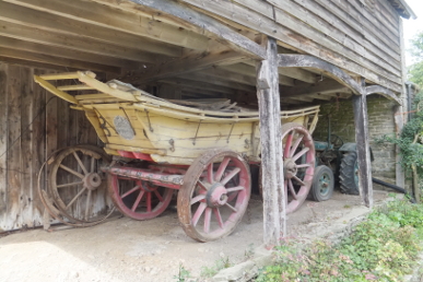 this not particularly high hill, rising to only 362 metres, the vista of the Black Mountains and the Brecon Beacons opens out. It is beginning to rain but it blows over quickly. Past a small herd of horses. Swallows chatter as they sweep across the gorse. The path drops down towards Newchurch. A flock of Linnets fly across a wide area of thistles.
Into Newchurch, over the River Arrow. A Dipper flies off downstream. Past the Ebenezer Welsh Calvinistic Methodist chapel where the graveyard is still in use, to the church of St Mary. The church was wholly rebuilt in the mid-19th century. Newchurch was marked on 14th century maps but the existence of a church was not recorded until 1458. There was a notice of sequestration (the bishop protecting his income in the absence of a rector) dated 1497. Refreshments are available in the church as at Gladestry. Back over Disgwylfa Hill. Common Buzzards quietly scream as they circle the moorland. A wind is blowing, cooling the air. Over the top of the hill trying to identify the many hills laid out beyond. Some like the Malverns are easy, others take some thought, the woods above Whitney-on-Wye, is that Dinmore over there? Below is a paddock of alpacas or llamas, I do not know which. Meadow Pipits fly about the bracken. The Swallows and Buzzards seem to have moved on. Back to the road and east to Huntington. Honeysuckle and brambles flower the hedgerows. It looks like the Hazel nut crop will be good, they are some way from ripe yet. Into Huntington, crossing the border into England a few yards before the village, past the village hall built in 1996, past the Post Office, now of course a private house, the Swan public house, Upper House and through the farm yard and arrive at St Thomas a Beckett church. The church lies about half a mile west of Turrent Castle and south of Huntington Castle. It has been suggested that the former was a Saxon stronghold and the church may be on a Saxon site, but others believe Turret Castle was built by William Fitz Osbern or his son Roger, Earl of Hereford around the 1070s, Roger rebelled against the king and lost his lands. The manor of Huntington was given to Adam Port by William Rufus as part of the barony of Kington. Reginald Braose held the barony until his death in 1227. His son William became lord but was executed in 1228 by Llywelyn after being found in bed with the Welsh prince’s wife. The barony ended up with the Bohuns. A story tells that the church was built as a penance for the murder of Thomas a Beckett in 1170. Henry III granted Humphrey de Bohun a charter for a three day fair at Huntington in 1256. This remained an important fair until relatively recently. The oldest part of the church dates from the early 13th century, the main 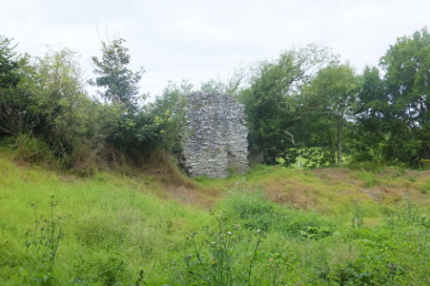 building was enlarged about one hundred years later. The bell tower is 17th century. The wall plaster was removed in 1892 during a major restoration by P.R. Kempson, removing a display of the Ten Commandments, The Apostle’s Creed and The Lord’s Prayer. The interior looks ancient being in pale grey stone. A replica of a Pilgrim’s Token, given to those who visited St Thomas a Beckett’s tomb in Canterbury, is on the wall. Henry VIII made a proclamation that Beckett’s death was “untruly called martyrdom” and he was decanonised. Most churches carrying his dedication was re-dedicated to other saints and now only four remain dedicated to St Thomas a Beckett. In the graveyard are six Victorian gravestones placed together in a line, all of the Watkins family.
Back past Huntington Court, an 18th century house where the adjoining field has a scattering of Brown Hay Cap toadstools, Panaeolina foenisecii, also known as Mower’s Mushroom. At Lower House another large farm, there is a lovely yellow-painted old wagon in a barn. Mossy steps rise to the platform on which milk churns were placed to await collection. Round a footpath through the yard of a house where a big old retriever steals Maddy’s ball. The owner retrieves it. A steep bank rises into the bailey of the Norman castle. Only a couple of pieces of the curtain wall remain. The motte rises high over the site. The castle was built between 1217 and 1224 because it is known that Kington castle was destroyed in 1216 by King John and records show Reginald Braose was looting oak for building operations around this period. In 1263 the castle was given to Roger Mortimer but returned to the Bohuns in 1266. Documents show the castle was being used as an administrative centre through the 1370s. It was re-roofed and placed on a war footing again after Glyndŵr destroyed the English army at Pilleth. Although the keep was still being used as a prison in the 16th century, it was a ruin by the Civil War. Despite the apparent importance of the castle, Huntington never prospered and always remained a village whilst Kington grew into a town. Back down and onto a bridleway back in the direction of Stone House. The bridleway is sunken by several feet indicating it is of some age and covered by a scattering of stones. The track narrows to a path after passing, Lanerch-yr-frain, which is just a house. There is a bit of an altercation with a black labrador called Johnson!
Home – We eat the first of our Worcester Pearmain apples – very sweet. Kay found three Elephant Hawkmoth caterpillars this morning. Blackberries are ripening rapidly now. Some huge berries are on a bramble hanging over the back wall. Courgettes seem never-ending. The pumpkins are growing larger each day, there are five now. Pigeons have been at my pak choi which is extremely frustrating. Wire netting is placed over the damaged seedlings. More oriental greens have been planted and wire is also placed over them as a precaution. I pull a few beetroot, they should have been thinned much earlier. However, there are some roots of a decent size. So much needs doing in the back area of the garden, it has overgrown extremely quickly again. All the weeds have to be bagged and taken to the recycling centre as our composting does not get hot enough to kill the weed seed. Raspberries are beginning to appear. Tomatoes and peppers are doing well.
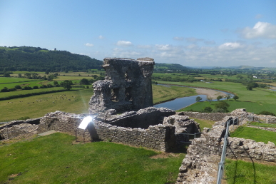
Thursday – Dryslwyn Castle – On our way to West Wales we stop at this castle which lies on a hill high above the River Tywi, lying between Llandeilo and Carmarthen in the Welsh Kingdom of Deheubarth. It was probably originally built around 1220 by one of the sons of the Lord Rhys, Rhys Grug. It passed to Maredudd ap Rhys then to Rhys ap Mareduddin 1271. In 1287, Rhys rose against Edward I of England over a land dispute with Robert de Tibetot, the new justiciar of west Wales (1281-98) and the castle was besieged by 11,000 English commanded by the Earl of Cornwall. The walls were undermined and pounded by a great siege engine. One wall fell, killing many of the attackers including Nicholas, Lord Stafford! After the castle was captured a small town grew up within the walls. The castle was demolished in the early 15th century. Maddy and I set off up the long path that winds up the hill to the castle. It is a beautiful day. The ruins are extensive and the views sublime. Way below the River Tywi meanders through the valley in large loops. Across the valley a line of cows head for the river to drink. Goldfinches fly off from large stands of fluffy thistles. Ravens fly overhead, cronking as they pass. Sheep are annoyed at being disturbed as they rest in the shadows of the walls, towers and ruined halls. Across the river valley, on top of the hills stands Paxton’s Tower, a neo-Gothic folly built by Sir William Paxton around 1806-1809 to commemorate Nelson’s death at Trafalgar. We return to the lovely picnic site where Kay waited. Two slate plaques lie in the grass, one marked Dryslwyn, the other Llangdog with, I guess the river zigzagging between them with little stones for other castles; Dinefwr and Tre-gib.
Boncath – We set up our tent in a field on Rhydhowell farm just south of Boncath. Afternoon warm, sun beating down on us. Nuthatches and a Great Spotted Woodpecker call from the trees surrounding the field. We set off to Boncath, a small village on crossroads. The lanes are lined by tall banks with hedges on top, they have been here many decades. A Small Magpie moth, Eurrhypara hortulata, flies into the grasses at the base of the hedge. The inn sits in the crossroads with the village shop nearby. I would guess the inn served the coaches on the crossroads travelling between Lampeter and Cardigan and the village grew around it. Certainly the inn dates from the 17th century. The place was also a stop on the Whitland and Cardigan Railway, the line closing in 1963. House Sparrows chirrup in hedges, flying up to the eaves of a house. House Martins zip overhead. We have a couple of pints and a meal. Back at the campsite it getting cool. A Tawny Owl calls the distance. Rooks circle overhead, steadily moving east despite the seemingly random motion.
Friday – Rhydhowell Farm – Awoken by Rooks. Down the farm track to the lane and on down the hill. The lane passes over a small stream which shortly joins Afon Dulas. Two beehives are in a clearing in a piece of woodland. A Chiffchaff sings vigorously. Flowers are clearly at the end of the season but there are still some – Red Campion, Meadow Sweet, Angelica, St Johns Wort and Honeysuckle. A fine Georgian farmhouse stands on the hillside. It has a semi-circular arch and window in a pediment and semi-circular panes over each of the main windows matched by an arched doorway. A milk churn stand is disappearing into the hedge from which Blue Tits chatter.
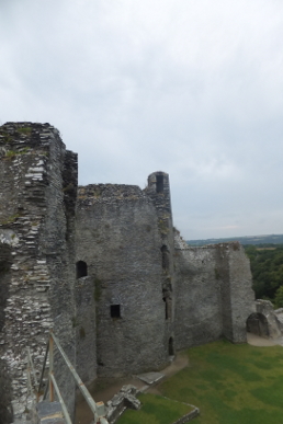
Cilgerran Castle – A castle built on a promontory high above the confluence of the Plysgog with the River Teifi. The land plunges down precipitously to the river which is at its tidal limit so the castle both controlled the crossing and the passage of any sea-going shipping. It is not certain when the site was first fortified, it may have been site of a Norman castle, Cenarth Bychan from which Nest, the wife of Gerald Fitzwalter of Windsor, ran off with Owain, son of the prince of Powys in 1109. It is worth mentioning that other sources place the castle at Cenarth, some miles to the east, and say that Nest was abducted by Owain and taken to Llangollen. Cadwgan tried to persuade his unruly son to return the lady but it was not until some years later, that Owain was killed in a skirmish with a force commanded by Gerald that Nest was returned. Gerald died shortly afterwards and Nest married Stephen, constable of Cardigan. The Lord Rhys (who was Nest’s nephew) captured a castle here in 1164 and it changed hands several times between the Welsh and the Earl of Pembroke, William Marshall from 1204 to 1223, when the site passed to Marshall’s son, also William. It was he who was responsible for the castle whose remain we see today. The castle passed through marriage from the Marshals first to the de Cantelupes, and then to the Hastings family. In 1370, with the French threatening invasion, Edward III ordered the now rather derelict castle to be refortified. In 1389 the Hastings family died out and the site became Crown property. Owain Glyndŵr may have captured the castle and held it briefly but by the Tudor period it had ceased to be a fortress and was occupied by the Vaughan family until they built a new house nearby in the early 17th century. The ruins are very fine with walkways between the massive towers and magnificent views down the river. Across the valley is Coedmore, a site once occupied by Roger de Mortimer and now a fine early 19th century house built by Thomas Lloyd stands there. Common Buzzards are chasing over woods on the side of the valley. Jays are squawking. Swallows pass. A large wicker-work owl stands in the grounds as does a pair of stocks, which we try out for size!
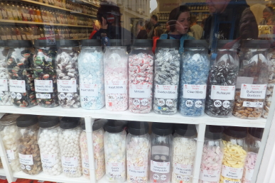
Cardigan – A very busy town, called Aberteifi in Welsh, with a bustling high street. Although many of the national chains are here, a lot of the shops are local independents. There are also markets and halls for small traders. Formally the county town of Cardiganshire, the town grew around a castle built in 1093 by Robert Montgomery. The castle was in private hands until recently when it was acquired by the local authority in 2003 and is now undergoing extensive restoration after years of neglect. The Guildhall, built from 1858-1860, was erected on the site of the 1804 Grammar School and is now a craft centre. The world’s largest cardigan hangs in the market hall. A sweet shop has a row of over 30 jars in the window all containing a different variety of mint. We wander down a side street to St Mary’s church which is sadly locked up. Kay heads back into the high street for fish and chips (which came in a plastic tray, oh for good old newspaper) which were very good. We are on the estuary where an old ship has been made to look somewhat oriental and houses an Indian restaurant. In the 18th and early 19th century, Cardigan was the most important seaport in South Wales. In 1815 it possessed 314 ships totalling 12,554 tons. The estuary is now silted up. A Grey Heron stalks the far side of the river and gulls feed on the water.
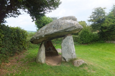
Nevern Estuary – The Iron Bridge crosses the wide estuary. A stone bridge was built here, recorded in 1598 as having six arches, but it was demolished in the early 17th century and replaced by stepping stones. Lots of gulls, Mallard, a couple of Grey Herons, large numbers of Carrion Crows and Jackdaws are on the mud and in the pools but not a single wader. We continue down to the beach at Cesig Duon. Despite the large area of sand there are few people here. It seems the lifeguard will have a quiet day. One of the Evening Primroses grows near the car park. Nearby is Carreg Coetan Arthur, a neolithic dolmen consisting of a capstone on four supporting rocks, although the capstone is not actually touching two of them. It would have originally been covered in earth but this has eroded away. Excavations have revealed cremated bone, Beaker and Grooved ware potsherds.
Strumble Head – We take the long, narrow, winding road out of Fishguard to Strumble Head. It is over thirteen years since I last came here to sea watch. Today absolutely nothing passes out at sea. A couple of gulls fly overhead. The place is crowded with visitors.
Wednesday – Credenhill – Autumn approaches, the early morning walk is now much darker and mists hang over the grass. It is still dull later in the morning under a grey overcast sky. Blackberries and elderberries ripening rapidly now. A Jay rasps in the woods, a Common Buzzard mews overhead. The sound of gunfire comes up from the SAS base below. The woods are now looking tired. Nuthatches, Blue and Great Tits call. Out onto the vast open area of the Iron Age hill-fort. The early history of Credenhill is not clear. It is very possible that Neolithic people settled and cleared the area of woodland. There is evidence from soil samples that the land was cultivated before the ramparts of the fort were thrown up. Bronze Age pottery made in South Shropshire and/or around the Malverns has been found. The hill-fort that can be seen today was probably started around 350BCE. This dating comes from pottery fragments found. The ramparts were almost certainly topped by a wooden palisade. Internally there is some evidence of houses and a rectangular feature containing pottery has been shown in other sites to be ritual. The Romans used the site in all likelihood as a way-station. A large wooden structure has been identified which is most likely to have been used for storing grain. Other Roman pieces have been found; parts of several amphora, one from southern Spain which would have contained olive oil, another from the eastern Mediterranean which could have contained wine, oil or maybe dates from Syria or Palestine. A brooch, a fine glass drinking vessel and a gaming piece are other finds. A document of 1274 identifies a park here and it is assumed that at this time this site was known as Credenhill Park Wood. A little over 50 years later a charter for a warren was granted which means that rabbits as well as deer were being kept within the park at that time. An apple tree grows by the eastern gate, its fruit is not yet ripe. Wrens call warnings. Most flowers are now seed heads, fluffy thistles, hawksbeards and Rosebay Willowherbs, large brown umbellifer disks, darkening St John’s Wort, red docks and little spiky mace-heads of one of the buttercups. Red berries have fallen from the Yews planted in the 19th century. A wide path has been mowed across the centre of the hill-fort.
Friday – Radnor Forest – The sky is grey, clouds lay across the Radnor hills and the wind shakes the leaves. Flowers have now finished and only seed heads remain. The sad corpse of a mole lies on the path up Mutton Dingle. It is interesting to note how the countryside changes. Here there is a track leading to a gate into a field on Knowle Hill but the trees growing in the middle of the track are at last 15 to 20 years old. Why did the farmer stop using this route? Indeed it is clear that the track up Mutton Dingle was once used by something larger than walkers’ boots but no more. Rowan berries shine vermilion. A Common Buzzard circles overhead on wings with gaps in them from the autumn moult. Higher still are Swallows hoovering up insects in preparation for the journey south. Up to the Forestry Commission plantation. A Jay rasps as it flies off into the trees. A Willow Warbler wheeps. The hills ahead are still shrouded in cloud. The raspberries of a few weeks ago are gone to be replaced by ripening blackberries. The path to the track is hard going with gorse and heather encroaching. Maddy makes a real fuss about it! I am saturated as my coat may have excellent wicking qualities but that is pretty much useless when the air is so wet. From the barn at the foot of Whinyard Rocks some hills are lit in green splendour, others remain a misty blue-grey. Into the mist. Purples and yellows of heather and gorse glow. Meadow Pipits squeak.
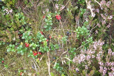
A track leads to Black Mixen, the name from the Old English meaning Black Dungheap! The mast looms out of the mist but the top cannot be seen. A Raven flies close by croaking as it passes. The triangulation point is 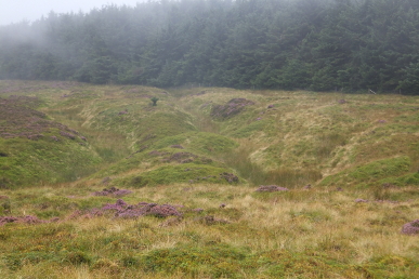 situated atop a large round barrow. The barrow has suffered damage, probably mainly erosion but a triangulation point does not help. A path heads north west but is somewhat ephemeral. There is a mound that looks like a damaged barrow some 75 yards from the first barrow. Eventually it passes the edge of Mynydd Ffoesidoes, a Wildlife Trust nature reserve. In the middle of the reserve, through some horrendous tussocks is the second Black Mixen barrow. Cowberries and Bilberries are abundant. This is because there are no sheep in this area. Back to the track and to the edge of the Forestry plantation. The Shepherds Well is marked on the map at the top of a deep ditch. Another ditch and rampart called the Cross Dyke crosses the hillside. It is believed that both these features are defensive but the date of them is unknown. The mist is clearing although clouds drift across. The Raven is still barking over the hillside. A path heads out across the top of Harley Dingle. A yellow striped dragonfly whirrs by, darting this way and that, searching for prey. It is almost certainly a Gold-ringed Dragonfly, Cordulegaster boltonii. A dead conifer has fallen across the fence and provides a perch for a Spotted Flycatcher, which seems unsuccessful at catching anything whilst I watch. A path crosses the moorland to a round barrow with a fence built through it. To the north-east is a valley, Cwm Bwch (called Cwm Bâch on old maps) then a promontory which is topped by two more round
 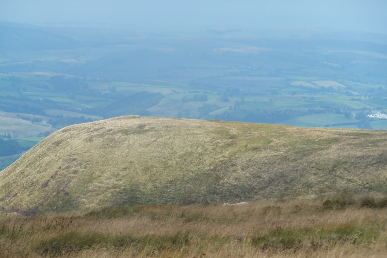 barrows.
The views from here are stunning with Montgomeryshire stretching into the distance. Below is the village of Llanfihangel Rhydithon, in the distance Llandeilo and Newtown. The path crosses top of a valley where two stream join, Cwm Bâch and Cwm Merys. This is the north-west edge of the Radnor Forest. The path heads for a hill, Cowlod, but I cut south to pick up the path across towards Great Rhos. Just as I think the views could not be better, a Red Kite rises up from the west. From here, Whimble and Whinyard Rocks look entirely different and it takes a few moments to recognise them. A troop of little toadstools, the Sphagnum Brownie, Hypholoma elongatum grow in the mosses. Across the top of Davy Morgan Dingle and up the hillside. There is supposed to be a footpath here but I cannot find it. Kestrels hunt along the ridge. One swoops down but appears to rise empty-clawed. Up to the ridge, however this is not the route and it is also inside the army testing range exclusion zone. I move down the ridge and see I am on the wrong side of the red flag – whoops! Back down to a track towards Upper Harley. The path drops down a small defile. A Stonechat is calling from the bracken below and it takes a while to find him. He looks splendid in his black and red uniform. Past an old quarry where the remaining exposed rock has been eroded into weird shapes. The path drops down seemingly forever. The army sheds are below in the valley, Cwm Nês. A stream which is the fusion of two streams, Ystol Bach Brook and Cwm Nês, which appears to be the old name for Harley Dingle. Hazel and Ash trees line the lower part of the path. Some of the Hazels have abundant nuts, others none at all. The path reaches a ford at Lower Harley and a path leads round Harley Gorse, where there is a waterworks in the woods and turns east to end up at the church yard in New Radnor. The gate to the cemetery is a beautifully made piece of the blacksmith’s art.