Friday 1st February – Denby Dale – A mill village in the Upper Dearne Valley, stands on the Barnsley-Huddersfield line, next stop from Penistone. The approach from Penistone is via a towering viaduct which dominates the village. The first viaduct constructed in wood between 1846 and 1850. The complete viaduct was 112 feet high and 400 yards long with 40 perpendiculars. A porter kept a line of half filled water buckets (half filled because the vibration of the trains spilled the other half) along its length to use in case of fire. The present stone viaduct was started in October 1877 and was built by Naylor Brothers at a cost of £27,650. It was opened on Whit Sunday, May 16th 1880 and has 21 arches. From the main road, the Wakefield road, the village rises up to fields to the north and is a solid mass of housing to the south. Much infilling between the old mill cottages has taken place throughout the 20th century and continues to this day. Unfortunately, very few of the modern houses have any architectural merit or character. I have lost my OS map for the area and am navigating using a bit of the 1851 map. The viaduct seems to have an extra section added at the north end, although it is not clear why. It is bright sunshine but a gale is blowing. A Great Tit is calling his “rusty bicycle” song nearby. Down past Wood Nook and Pecketts Row (although there is no reference to the latter on the ground). A road leads down to Springfield Mill, now commercial units. The River Dearne is gurgling down between old stone walls and disappears under the road and under the mill. Along Dearneside Road, where a slope leads down beside an old cottage with stone steps leading down from further along the road, although the way is blocked from the top. The river has re-emerged and is meandering around the backs of yards and cottages. The landscape here has changed over the years and it is now complex and difficult to resolve the original layout. The road twists and drops down into Revel Bottom. It now joins Miller Hill and crosses Miller Bridge and leads back up to the main road. Just before the bridge is a long building called Lowfield House. It looks like an old mill and there is a reference on the map to a corn mill around this area, but it is not clear it was this building. Just before the main road is the old Salvation Army hall (or citadel), with stones set into the walls dating from 1926, but the building has been converted to domestic use. The sky has been getting darker and as I reach the main road a torrent of hailstones falls. I shelter by a building with a useful alcove. The hailstones slowly turn to sleet and eventually it peters out. Opposite is the Victorian school, sadly disfigured by a prefab attached to the front. It is now a nursery.
By the old school, Leak Hall Lane leads up the hill northwards through modern dwellings. At the top is a group of buildings, once a large farm now all converted to domestic dwellings. I had assumed this is Leak Hall as the main house looks like a mixture of typical farmhouse with a rather more imposing section to the rear, but it appears this was simply the farm as I had first supposed and Leak Hall is no longer standing. A footpath leads across Cliff Hill where there is a small trough of water under a large Hawthorn – either the old well or a drain, there were both in the area according to the map. The path comes out into Cumberworth Lane. Just down the hill is the imposing Methodist chapel, built in 1799 and enlarged in 1859. This was the Wesleyan chapel, the Primitive chapel being on the hill opposite. Down the hill to the main road where stands the White Hart Inn, present in the early part of the 19th century and probably far older. I detour round Wood Nook which is a little loop of probably the original road, passing Wood Nook Farm with a splendid old barn whose roof is sagging conspicuously. A muddy track (too muddy for me) leads off, once it was Wood Lane. Then back down to Springfield Mill and up the other side of the valley to Holy Trinity church, constructed in 1938. It is a traditional shape but obviously relatively modern and its date is a testament to the strength of the non-conformist movement here. Back down to the mill and then follow the Dearne up to the viaduct. A worn stone footbridge crosses the river, which is only a couple of yards across, by a weir that feeds into a small circular basin. Steps lead back up to the main road. There is little sign of what Denby Dale is famous for – its giant pies. The first Denby Dale Pie was made in 1788 and was said to celebrate the recovery of King George III from a bout of “madness”. The second was baked in 1815 celebrated the end of the war with France and the defeat of Napoleon. The pie, by today’s standards was relatively small and was said to contain “two sheep, twenty fowls and a half a peck of flour for the crust.” The third on August 19th 1846 celebrated the repeal of the Corn Laws. On August 27th 1887 a pie was baked to celebrate the Jubilee of Queen Victoria. However the pie was left for some days in hot weather and went rotten and had to be buried in a pit of quick lime. A second pie known as the “Resurrection Pie” was baked on September 3rd. A pie on August 1st 1896 celebrated the 50th anniversary of the Repeal of the Corn Laws, the next on on August 26th 1928 as a belated Victory pie and to raise money for the Huddersfield Royal Infirmary. On September 5th 1964 the eighth pie celebrated four Royal births, Prince Edward, Lady Helen Windsor, Lady Sarah Armstrong Jones and James Ogilvy. The next pie was baked on September 3rd 1988 celebrated the bi-centenary of the first pie. 2000 saw the making of the tenth record breaking Denby Dale Pie, weighing 12 tons and measuring 40 feet long. As well as obviously celebrating the new Millennium, The Millennium Pie coincided with the Queen Mother’s 100th birthday and the 150th anniversary of the Penistone Railway Line.
Saturday 2nd February – Hoylandswaine – It has snowed overnight. There is a light dusting over the garden. Up to Hoylandswaine from where the view stretches east towards the Vale of York and the Yorkshire Wolds on the horizon and west to the Pennine Moors. In both directions the snow cover is patchy. I am disappointed as there has not been a decent blanket of snow around here for years and although it can be a major nuisance if it hangs around, a few days of deep snow are fun. However, it is not to be so after a short walk through a patch of woodland I return home.
Monday 4th February – Eyam – A return visit to the famous “Plague Village”. I gave the basic story on my visit in July 2002, that is the plague was brought to the village in 1665 by a visitor from London, possibly carried by fleas in a bundle of cloth he brought with him. (There was some thought that the disease was not the flea borne bubonic plague but a human to human outbreak of a haemorrhagic fever similar to Ebola but DNA evidence confirms the disease was caused by Yersinia pestis.) The villagers agreed to close off the village to stop the spread of the disease and by the end of the outbreak in October 1666, 260 out of 800 villagers had died. The name of the village is Old English meaning “islands”, indicating the village was between streams. The village is built, in the main, using the local gritstone or limestone which was quarried on Eyam Edge above the village. The geology is important – the gritstone sits on limestone which provided the lime mortar used in local construction and beneath is shale which being impervious to water results in springs providing a good water supply. Igneous rocks have pushed through and into the limestone carrying ores, especially lead and fluorspar which is still mined locally. We start at the the Bull’s Head, built in 1606 and in the ownership of the Talbot family for centuries but is now, sadly flats. Past the Town Hall and opposite is the Plague Cottage where the plague started. Like the rest of Eyam it is a pretty building. It has a plaque outside recording the four persons who perished. A number of dwellings have these plaques but the beauty and tranquillity of the place refuses to convey the sheer horror of the days of the plague. It is not until later I begin to comprehend, maybe only slightly, how people must have felt watching their loved ones die, one after another, not knowing if they would be next.
Up the road from the cottages is a small green with a sheep roasting “machine” – it looks like a vertical spit. By the green are two large stone water troughs. The springs mentioned above were channelled into troughs around the village in 1588 creating what was effectively the first public water system in the country. Next to the green is Eyam Hall, a Jacobean manor house, home to the Wright family for the past 300 years. Opposite is The Brick House, formally Stag’s Parlour Inn which was demolished and rebuilt in brick in 1828, the only brick built building in the village. Next to the Brick House is the 17th century Market Hall with the village stocks on the green in front of it. The road winds round lined by a delightful mixture of cottages and houses, one with a faint badge high on the side wall inscribed 1799. Hawk Hill leads off with another set of troughs and leads up to the site of now demolished Bradshaw Hall. The museum is sited here with surmounted by a weather vane bearing the image of a rat. Back up the main street is the only remaining part of Bradshaw Hall. The hall was built by Francis Bradshaw in the Tudor Period but was sited on a building from the reign of King John in the late 12th century. The Bradshaws left the village in 1660. On up the road and a fine house is identified as originally being an inn called “Heart of Oak”, a reference to British seamen. It was built in 1587 and rebuilt in 1660 and called the “Royal Oak” in tribute to restoration of the monarchy. The building was extensively rebuilt in 1907 and is now a private residence. A carving of an Oak tree adorns the portico over the front entrance. Next is the herbalist’s cottage, Humphrey Merrill. He died in September 1666, but his wife Anne survived as did Andrew Merrill who left the village and built a rough shelter on the edge of Eyam Moor where he lived with his pet cockerel until the plague had passed. We come to the house of Richard Furness, the poet, who was born here on 2nd August 1791 and died in Dore on 13th December 1857. West End Cottage was built in 1553 and nine members of the Willson family died there in the plague. Townhead Factory was built in 1735 to weave silk. Ralph Wain discovered how to weave a pattern on both sides of silk. In the apex is a pigeon loft used for carrier pigeons to take messages to the mills in Macclesfield. Town Head Inn opposite was built in the 17th century and lodged drovers who carried the mill’s silk to Macclesfield. Like most the other inns in the village it is now a private dwelling place.
We head back through the village to the church of St Lawrence. In the graveyard as one approaches the church is a fine Celtic cross with runic knots and the Mother and Child carved on it. Above the Priest’s Door is a sundial, first placed over the main entrance to the church in 1775 but moved to its present location in 1883. It is thought the church may be on Saxon foundations, but there is no reference to an ecclesiastical building in the Domesday Book. The present church was originally built in the first half of the 12th century after Henry I bestowed the Manor on William Peverill. The nave dates from 1350. Further changes were made in the early 16th century and, of course, by the Victorians. The most exciting things to greet the eye on entering the building are paintings around the nave upper wall. They date from the late 16th and early 17th century. They were covered in 1643 during the Commonwealth and not uncovered again until the mid 19th century. After the chancel was rebuilt in 1868 many were destroyed and the others covered again to await rediscovery in 1963. Originally there would have been twelve cartouches of the tribes of Israel, but only four remain, Asher, Napthali (which should be Naphtali), Issachar and Dan. On the belfry arch is the painting of a skeleton apparently on a grid. This was taken to be a depiction of the martyrdom of St Lawrence, however, the dedication of the church to him is only about 100 years old, before which the church was dedicated to St Helen. It is thus likely this is The Grim Reaper. There is also a fragment of a painting of a portion of the Creed. Near where there was originally a chapel of St Helen, used as a private pew for the Stafford and later the Bradshaw families, is a wall carving of a cross dedicated to St Helen. Here is also a fine Saxon font, which came from the garden of Brookfield Manor in Hathersage and was donated to the church by Sir Charles Cammell in 1888. The current font, by the church entrance is Norman. There are a number of good stained glass windows. Back outside in the graveyard are a number of interesting graves, including that of Catherine Mompesson, wife of the rector, who died of the plague. Down in the rear graveyard is the gravestone of Henry Bagshaw who played cricket for Derbyshire and the M.C.C. The stone depicts a ball sending stumps and bails flying with, at the top, the finger pointing upwards, indicating the player is out and has come the the end of his innings. The scripts records:
Wednesday 6th February – Rotherham – The manor of Rotherham was Saxon in origin. The Romans had built a fort further west at Templeborough; it was excavated in the 19th and early 20th centuries and was then built over by steel works. The name is recorded in the Domesday Book as Rodreham from the Old English, “Homestead or village on the River Rother”. Rother is a Celtic river-name meaning “chief river”. Pre-Conquest, the land was held by Acuin, but William handed the estates to Robert of Mortain, with Nigel Fossard as chief tenant. The manor passed family of Vescy, one of whom, in the reign of Edward I gave it to Rufford Abbey, in Nottinghamshire. After the Dissolution, it was granted to the Earl of Shrewsbury and then passed down to the Effingham family. The town developed around the Rotherham Bridge where the Chapel of Our Lady was erected in 1483. Only four such chapels remain, many having been destroyed in the Dissolution. It is said that the Rotherham chapel survived because it is such an integral part of what was then the only bridge across the Rother here. The whole town around the centre has been destroyed by mid to late 20th century development of the poorest type. In the centre, above an open space now dominated by a huge television screen, stands the Minster of All Saints. The church is considered one of the finest examples of mediaeval perpendicular architecture in the country. The spire stands at 180 feet having been erected in the early 15th century. A Saxon church was recorded in the Domesday Book and a Norman church was built on the site in the late 11th century. In the nave, above the altar is the line of the roof of the Norman church, much lower than today. The ceiling is of oak with 77 carved bosses coloured gold. At the top of the nave pillars are carvings of the “Green Man”. The church was restored in 1873 by Sir Gilbert Scott who treated many of the original features sympathetically. The chancel has a fine painted ceiling and stone sedilla (seats for the clergy) and a squint beside them allowing people in the Jesus Chapel (created by Thomas Rotherham) to see the high altar. The organ dates from 1777 and was built and installed by Johann Snetzler, one of the best organ builders. A records chest from 1540 sits behind the organ. Nearby is a beautiful funerary brass dedicated to Robert and Ann Swyft dating from 1561. The Swyfts were ancestors of Jonathan Swift, author of Gulliver’s Travels. Outside the walls are local sandstone, Rotherham Red, with limestone from Roche used for details. Gargoyles stare out high on the tower and the windows have heads at their edges, one holding a large key. From the Minster I head up the hill to The Crofts. Here once stood the main market, one of the largest in South Yorkshire. In 1861, 3000 fat sheep and 200 fat cattle were sold a week. However, the market was closed for two years from 1865 because of the bovine disease, rinderpest. By the time the market reopened it had been superseded by Sheffield market. From here, a path drops down to Wellgate and then Doncaster Gate leads up to Clifton Park. Here stands Clifton House, built between 1783-4 for Joshua Walker, second son of Samuel Walker, founder of Rotherham Ironworks. The house was designed in the Palladian style by John Carr of York, who built Keppel’s Tower. It now houses the town museum.
Friday 8th February – Darton – I wander across the road and discover a bus is due. After all these years this is the first time I have caught a bus that passes the house. Darton is one of the villages that makes up Barnsley Metropolitan Borough. It is mentioned in the Domesday Book as Dentune – probably meaning a deer park or enclosure. I get off the bus opposite the church of All Saints. Beside the bus stop is the Rose and Crown, an old pub from the 18th century at least. Opposite was The Malt Shovel, now the Liberal Club. Up the road is the Town Hall, standing beside what used to be the old Huddersfield Road which swung round and up the hill. Now there is a large bridge crossing the six lanes of the M1 motorway and the old road is sliced off. Standing by the motorway bridge, the songs of a Song Thrush, Dunnock, Robins and Blue and Great Tits are constant despite the noise of traffic. The church was founded by a member of the de Laci family in the 12th century, but the present church is the result of rebuildings between 1480 and 1520. In 1484 King Richard III gave the living of Darton to Monk Bretton Priory in exchange for Holcombe Forest in Westmoreland. When King Richard III was defeated by Henry Tudor all his acts were revoked, and David Hunter, the first vicar of Darton, was replaced in 1486 but later re-instated. After the dissolution of Monk Bretton Priory, the advowson passed back to the crown, thence to the Marsh family at the end of the 16th century to their relative George Carr, and after the civil war to the Wentworth family of Woolley. At the end of the 18th century the patronage passed to the Beaumont family of Bretton Hall with whom it remained until 1959 when Viscount Allendale’s trustees gave the Right of Patronage to the Bishop of Wakefield. (This information was extracted from “A Short History of All Saints Church Darton” in Barnsley Central Library.) The church is closed, indeed there is a notice stating that it cannot remain open because of “repeated theft and vandalism”. The large graveyard has litter strewn about it. Strange how a nation that can get hysterical about the death of a princess who had very little bearing on their lives can be so uncaring about the remains of their own people. One gravestone appears to have a cut around the month of death. I wonder if the stone mason made an error and cut out it out and inserted a piece of stone with the correct month inscribed upon it. Another, one of the oldest, records the passing of Anthony Dury of Shires Moor 1723; I have been unable to locate Shires Moor. Snowdrops are in bloom. On into the village past a fine building that was once the vicarage. The village has little interest apart from the old Sunday School. There are signs of the recent flooding – the Post Office remains closed and sandbags litter the pavement. The road passes under the railway and then turns sharp right and heads for Mapplewell. The road rises past the old school, still in use and then past the wide open space where there were brickworks and the North Gawber Colliery Railway. As the road rises and turns a house stands with a black plaque high on the wall reading: “Mrs Fountain’s Nurse’s House 1908”. A park stands just further up. Starlings are chattering noisily at the top of a tree, whilst a small charm of Goldfinches twitters on a lower tree. From Mapplewell I turn down Spark Lane past Methodist Chapels, one still in use, and on down to Lower Barugh to The Millers where I partake of a pint before wandering back up the Huddersfield Road.
Sunday 10th February – The Moors – It is a glorious sunny day, hard to believe it is February. Had to remove a wasp buzzing up the kitchen window yesterday. Quick stop at Ingbirchworth Reservoir. The water seems quite crowded with a large flock of Canada Geese and a large roost of gulls. Some Mallard, Coot and Tufted Duck are also present. Up onto Royd Moor where the sails of the wind-farm are stationary except for a single windmill revolving slowly. Skylarks are rising into the air singing their little hearts out. The views from the lookout point are limited as there is quite a haze across the middle distance. Down through Millhouse Green, past the Flouch and up across the moors. I am able to stop at Saltersbrook bridge and look down the steep ravine to where the old Salt Road packhorse bridge crosses the stream. It is further down the hillside than I had thought. Next to it are the low walls of the ruined Miller’s Arms inn, which must have been a vision of heaven after the long haul up Longdendale.
Monday 12th February – Heptonstall – This village stands high above the valley of Colden Water as it flows down into Hebden Bridge in West Yorkshire. The car park is on the western edge of the village looking across the moors and the Calder valley towards Stoodley Pike Monument. Into the village past modern stone built council housing. The main street up through the village is narrow and cobbled. The cottages that line the street and lead off in small terraces from it all have the large windows associated with weavers’ cottages, and indeed this village was an early centre of the woollen trade. There had been a battle here in 1643 during the Civil War, resulting in much of the village being burnt. The Cloth Hall remained, situated on the main street and a ginnel leading towards the church and old Grammar School, now a museum and being re-roofed currently, built in 1642 from money left in the will of the Revd Charles Greenwood. The Cloth Hall was the trading centre for the woollen cloth produced in the cottages. It was built by the Lords of the Manor, the Greenwoods around the mid 16th century and originally named “Blackwell Hall” after the great cloth exchange in London. It is the oldest cloth hall in Yorkshire. The church comes as a surprise because there are two churches here. The original church was founded around 1172 and building continued until 1250. The church was dedicated to St Thomas à Beckett, who was canonised in the founding year. The church was closed as a result of “an effusion of blood” in 1482 - the precise historical details of the incident are unknown, but a local legend, ironically in a church dedicated to St Thomas à Becket, tells of a priest slain in the church for performing an illicit marriage. In 1530, 14 armed men entered the church and destroyed the seat used by the Wadworth family, (why, I know not). The building was enlarged in the 16th and 17th centuries. In 1765 it is recorded that, “The vestry of ye church of Heptonstall was broken open and out of ye chest there the communion plate was stolen on ye night between ye 15th and 16th December”. In 1779, John Wesley preached there and again in 1780 and 1786, when he remarked, “I preached at 10 in Heptonstall Church (the ugliest I know)”. In 1847, a great storm destroyed the roof and part of the walls. It was decided not to repair the church but build a new one in the Victorian Gothic style. The new church of St Thomas was finished in 1854 at a cost of £6666. In the 1960s the interior of the new church was modernised, causing considerable dissent in the village (and not without reason as it may look modern but has little character). An old painted panel of the Royal coat of arms hangs over the entrance. There are some pleasant stained glass windows, one with an unusual amount of green glass. Outside the majority of the churchyard between the two church buildings is covered by laid down gravestones. The site is said to contain over 100,000 corpses. Beyond the church wall is the new graveyard. Apart from a number of graves of Farrar’s, there is the grave of Sylvia Plath, the poet. She was married to the late Poet Laureate, Ted Hughes but committed suicide in 1963. On her headstone (which is regularly vandalised to remove “Hughes” from it) are the lines, “Even amidst fierce flames, The golden lotus can be planted”, which Hughes credited to the Hindu Bhagavad-Gita but in fact comes from the 16th century book “Monkey” by Wu Ch’Eng-En, in which Monkey is taught the way of longevity. It is a peaceful in the brilliant sunshine. Starlings are chattering in the trees and keening of a Curlew floats from over the surrounding moorland. The Old Vicarage has a sign indicating that a cock-pit existed here in the times of the Napoleonic Wars. Back up the main street, where it is called “Top o’ th’ Town”, is a side lane that leads past a rough stone arch inscribed “IB 1778”. This leads to Whitehall Farm, which was previously called “Bentley’s” after the family who were copyholders until 1722. Several of the Bentleys were literary figures, especially Dr Richard Bentley, (1662-1742) who was Master of Trinity College, Cambridge. A little on, down on the steep hillside is the Methodist chapel, the oldest still in use in the world. The foundation stone was laid by John Wesley in 1764. Up the main street further is a pump and well, the Smith Well, one assumes as the street is now called that. At the Lane Top the road heads off into the moors.
Friday 15th February – Marsden – The Colne Valley runs west from Huddersfield. The River Colne rises on the moors which climb high above the western end of the valley to Standedge. It is a steep and narrow valley whose floor and sides are almost continuously occupied by mill towns. Many of the huge mills still stand down by the river. The railway and Huddersfield canal also run along the valley, the former often clinging the the valley side on arches. Marsden is the last town before the great dividing moor that falls away westwards into Oldham and Greater Manchester. According to tradition the evocative sound of the first cuckoo is heard in the Colne Valley on 24th April at Marsden Spring Cattle Fair. The legend of the cuckoo, not unique to Marsden, has several variants. A cuckoo had taken up residence in a field and several people decided to capture the bird, in order to keep the Spring, by adding an extra course to the wall. As they added stones to the existing wall the bird became frightened and flew away, just skimming the wall, thus proving to a Marsden onlooker that the wall was a course of stones too low.
A Roman road ran through the the town. Small hamlets developed around the end of the Colne Valley and Marsden, from Marchdene meaning a boundary valley, grew up in the early 15th century. The National Trust have a car park on what was in Victorian days a cricket pitch. The canal is rising through locks to one side and the railway to the other. A small cobbled bridge crosses the canal and Station Road drops down into the town. Near the bottom of the hill is The Green, a lane rather than an open space. Mellor Bridge is an old packhorse bridge which crosses the river to St Bartholomew’s church. The first chapel was built in 1453 and held 311 people. It had fallen into decay by 1480 as the locals were unable to afford its upkeep, so Edward IV gave an endowment of 4 Marks, which enabled the church to continue. In 1697, Isaac Walton, (not the Walton who wrote “The Complete Angler”) aged 24, was ordained and came to live in Clough Lea. 15 years later he was ordained a priest, and served for the next 32 years until his death in 1728, at the age of 56. He was a scholar who became known for his sermons, which were so long they were delivered in instalments. A new chapel was built on the same site in 1758, at a cost of £1,145. In 1779, the Reverend Lancelot Bellas became the minister – a preacher from Saddleworth who was the popular choice of the village. He was in Marsden for 36 years, 1779-1815, gaining a reputation for eloquence and his drinking habits. He left such an impression that Marsden was nicknamed, Bellas Town. In 1798, Black Fever killed 15% of the population. There was not enough room in the churchyard for the bodies, so its level was raised three feet by carting soil from Clough Lea. The church now standing was built in 1895, mainly through the efforts of Revd Buller. It has a large graveyard with a number of wonderfully pretentious Victorian headstones and monuments. Jackdaws are calling around the tops of the trees and the church tower. Marsden also has a strong tradition of non-conformism. John Wesley visited in 1746 and again in 1757, when he “road over the mountains to Huddersfield”. In Marsden he met, “A wilder people I have never saw in all England”. However, Methodism flourished.
Across the road from the church is the tomb of Enoch Taylor and his family. Enoch and his brother James were iron founders who made shearing frames for the mills. These frames were the targets of the Luddites, who were opposed to the mechanisation of their jobs. A local saying of the Luddites was “Enoch makes them and Enoch breaks them”, the latter being a reference to the large hammers used to smash the frames. Things came to a head in April 1812 when a local mill owner William Horsfall was shot dead. Several alleged ringleaders were hanged at York. In the end, the mechanisers won. Just by the tomb are the old town stocks, last used in 1821 when Dutch Harry was placed in them for ringing the church bells late at night. An iron bridge crosses the river into the centre of the town which is dominated by the Marsden Mechanics Institute, built in 1861 “to improve the intellect of the working classes”. Street names are displayed on small stone tablets. The high street leads up to the main A62 across which is a pleasant park with its bandstand. A road runs west past a new development of houses, which whilst built in the same pale stone as the rest of the town, still looks crowded and unpleasant. The local pub rejoices in the name of “The Old New Inn”. Up the road is a large mill. A temporary bridge has been placed over the road, from one side of which a rushing stream issues and runs under another large industrial building. A road leads back to the church passing under the A62. I head back up Station Road to the canal and follow it westwards. The canal is called the Huddersfield Narrow Canal, as opposed to the Broad Canal which runs east out of Huddersfield. It is clear why it is so named when one looks at some of the locks. They are truly the most narrow I have seen. The canal winds westward. Pairs of Mallard swim along, nearly always the female leading with the male following attentively – spring is coming! The canal used to end where the hills of Standedge rise and goods were then taken to and fro from Lancashire in the original way, by packhorse. In 1794 a 3¼ mile long tunnel was built under Standedge. It is the longest, deepest and highest canal tunnel in Britain. It is 5,500 yards long, 638 feet underground at the deepest point and 645 feet above sea level. It was never a great success, the lack of tow-path meant men had to lie on their backs and “leg” the boats through, whilst the horse was taken over the tops by Boat Lane. In 1849 the first railway tunnel was constructed, a second in 1870 and the present double track tunnel in 1894. The canal tunnel was closed in 1943 but reopened in 2001 and a large visitors’ centre opened. Up the hill is a reservoir feeding the canal via a water course that crosses the railway via a bridge which then curves round and down back under the railway and into the canal. Houses are scattered across the hillsides, one far above seems to have been built across a clough, or stream valley. High above, stands Pule Hill, site of both Mesolithic and Bronze Age sites. A mound and a cross stare out down the valley.
Saturday 16th February – Barnsley Canal – It was probably the coldest night of the winter. There is a heavy frost but the canal has only a glazing of ice. The air pressure remains very high at 1042mBars. Mistle Thrushes stand at the top of trees surveying the area. A Robin is preening, red and white bright against an azure sky. A male Reed Bunting with his jaunty black head is flitting from tree to tree. Dill the Dog plods along. We got a telephone call whilst at the pub last night from Rhys saying that Dill the Dog had fallen in one of the ponds and was covered in mud. We told him to lock her in the kitchen until we returned. We got home to yelping from the kitchen, she was obviously less than pleased at being left there. However, it had been the right decision as she was covered in stinking black muddy slime. It took forever in the shower to clean her off. We then covered all the chairs in the main room with towels and she slunk off into there for the night. This afternoon there is a major upset in the FA Cup – Barnsley beat Liverpool 2-1.
Monday 18th February – Pugneys Country Park – After another bitterly cold night, frost has whitened the world but it soon disappears in the sun, although those areas to which the rays do not reach remain frozen all day. Pugneys is really quite busy with people walking themselves and dogs. A few seem to think it is necessary to continuously shriek excitedly at their dog which somewhat ruins the peaceful morning air. A young Mute Swan glides along the edge of the lake. A gaggle of yelping Canada Geese fly in. Four Goldeneyes are out on the water, the males half-heartedly flicking their heads back in courtship display before resuming their preening. By the early evening, the weather is changing. It mists over at home and the air pressure begins to fall. In places the pressure over the weekend was the highest on record.
Tuesday 19th February – Grenoside – Everywhere is white with frost and fog. Drive up into Grenoside, north of Sheffield, past where the Council offices stood, now demolished and replaced with the bog standard modern three story flats, French windows opening onto nothing and the old workhouse in Salt Box Lane, more recently used as the local Health Trust premises. Grenoside is derived from the Anglo-Saxon Grave-ho, dig and hole, probably meaning a quarry. The village developed around the crossroads of two important routes – Ecclesfield Priory to Bradfield and Sheffield to Wortley and beyond. I set out walking from the top of Blacksmith Lane. A double water trough stands on the junction. Across the road and up Skew Hill Lane. Cobwebs on the hedges and trees are like decorations, white threads of frost. A large farm, once Cross House, is now the Cow and Calf pub. A new entrance to the crematorium is on the left. Sadly, by the lane is a dead badger. Over the wall, Redwings are feeding in a field; they fly up and disappear into the whiteness of the fog. A junction appears at Lane Head. The road to Oughtibridge rises and then drops suddenly down to a sharp corner. The hill is called “Jawbone Hill”. One story states that whale jaw bones formed an arch on the hill top, whilst others think it was simply the bend in the road that resembles a jaw bone. Just off the road stands the Birley Stone, a standing stone, the base of which may be original although the shaft is later. The stone was first recorded in 1161 as the Burleistan, as a boundary marker between the lands of Richard de Louvetot, Lord of the Manor of Hallamshire and the monks of the Abbey of St Wandrille in Normandy, who founded the priory at Ecclesfield in 1273. By the stone is a “toposcope”, a plaque that points the direction of various landmarks from this point – none of which can be seen in the dense fog. It was erected by the Parish Council of Wortley to celebrate the Festival of Britain in 1951. I head back towards Grenoside, back past Lane Head and into Stephen Lane. It is a strange and quite exhilarating experience following the route with the 1855 map and all the landmarks lost in the fog. The cottages in the village are mainly 18th and 19th century with much 20th century infill. Off of Stephen Lane runs Middle Lane where a delightful old barn stands with its upper door having a double bow shaped hole for a window. Middle Lane forms a junction with Bower Lane, Top Lane and Rough Lane, the latter leading past a farm and new build onto a farm track. An old stone stile, well worn lies by the gate and a bright ginger hen scratches around it.
Down Bower Lane and off along Frederick Drive. The 20th century housing estate stands on The Cupola, which often refers to the dome on a church but in this instance it refers to a vertical furnace for smelting iron. In the 18th century the Walker Brothers started making iron here before they went on to move to Masboro’ where they were very successful iron masters. A number of other foundries followed, particularly those of the Ashton and Tingle families, and a nail making industry developed. That was overtaken by larger nail makers in Sheffield so the locals diversified into other metal products particularly filecutting. Above Frederick Drive is a large woodland. Stones in the ground indicate old metalled road surfaces and larger ones may indicate demolished buildings. There are also some old tree stumps of large trees in the undergrowth. Robins are singing, but they are subdued and the songs are short snatches. A crack of wings above and looking up to see the ghosts of Wood Pigeons disappearing into the mist. A ginnel leads down to Main Street and across is Grenogate. This leads down to a fine house, Greno Lodge, which looks like it is being renovated. A footpath leads to Lump Lane. The leads around an area called The Lump. From here Well Lane is a path to Norfolk Hill. The well is now under the car park of the new school opposite. The old Victorian school is boarded up and, sadly will be demolished for more housing. Down the hill is the Methodist Chapel. The original was built in 1807 but this building was built in 1919, designed according to a stone plaque, by LH Ward, Architect. Further down is a small row of cottages not in Woodside Lane, but were named Pitthroat Row on the 1855 map. The pit would have been once of the numerous sandstone quarries and mines around the area. Sandstone blocks were used for buildings both locally and in Sheffield and the mined sandstone was called ganister, a fine powdered stone used to make refactory bricks for lining furnaces. School Lane turns off Norfolk Hill. The school house has a sign dating it to 1737. School Lane turns left and travels to the Halifax Road, the A61, at the bottom, but this road was once called Riders Lane. Back up at the junction of Norfolk Hill and Main Street is the centre of the old village with The Angel and Old Harrow inns (the “old” being a modern addition to the name). Outside the Harrow on Boxing Day there is the Grenoside Sword Dance, a traditional dance that can be dated to the 1750s and it is said that the Norman Lord de Tingle (of whom I can find no trace) recorded the dance was passed on by Norman soldiers. The village green is a modern construct having been an air-raid shelter in the war and more lately site of the library. Main Street leads back down Blacksmith Lane past St Mark’s Church built in 1884.
Wednesday 20th February – North Barnsley – It is damp, cold and grey in town, but as one heads out towards Darton, the trees are covered in hoarfrost giving them a magical appearance. Further out on South Lane that links Cawthorne with Hoylandswaine the hoarfrost is so heavy it looks like snow. Evergreens glisten with a dusting of white whilst deciduous varieties are white limbed ghosts. A little further on I ease over to give room to an oncoming car and hit something on the edge of the road. This buckles my wheel and gives me a flat tyre. I suppose it is good exercise changing the wheel but I could have done without it!
Thursday 21st February – Barnsley – How fast the weather changes. The glass has dropped considerably bringing rain and wind, but much milder temperatures. It is pretty grim at Penistone market, but improves returning to Barnsley. To get to the new Rob Royd farm shop (they bake their own bread, probably some of the best in the area) I go up Houndhill Lane. Half way up is Houndhill, a half-timbered house on private grounds. A mediaeval manor stood here, first recorded in the possession of Robert de Elmhirst in 1306. The house became a fortified Tudor mansion which Richard Elmhirst (1597-1628), agent of the Earl of Stafford, held for the King against Parliament during the Civil War, keeping 40 soldiers in arms to defend it. Cromwell easily took the house and it is said he dined in the kitchen. Richard managed to keep his head. Elizabeth Elmhirst relinquished the property upon her marriage in 1683 and it was nearly 250 years until it was re-acquired by A. Elmhirst in the 1930s. Walls and a tower still stand on the roadside. Further up the hill is an art deco house, square, flat-roofed and pristine white.
Friday 22nd February – Wombwell-Barnsley – Out of Wombwell Station and off down a lane from the car park. Overhead a Kestrel is bouncing in the blustery wind. A Greenfinch is singing his nasal song over the other side of the tracks. Tiny green buds adorn the Hawthorns. Between the track and the railway are abandoned yards and allotments. Beyond this are fields and a hedgerow containing twittering Goldfinches, squeaking Long-tailed Tits and silent Chaffinches. The field opposite used to contain railway sidings for Wombwell Main Colliery. The track comes out into Summer Lane. Opposite is rough ground and scrub where once the pit stood. This area was once a complex of railway lines, now only the Barnsley-Sheffield line remains. That line was the Chapeltown Branch Extension of the LMS. Crossing it were two LNER lines, the Tinsley and Aldham Junction and West Silkstone and Wombwell Main. Summer Lane seems to have stopped here, but now travels up the hill to join Dovecliffe Road, which on the 1930s maps was only a track. The road runs around the hillside on which stands Wombwell Wood. Large stones of gritstone lay near the road, partly hidden by dead brown bracken. The road continues past a large hole, an old quarry. It then becomes Wentworth Road and reaches the junction with Station Road. The old railways are only discerned by the sides of a demolished bridge or a muddy track through thick woodland. Down Station Road to the Trans-Pennine Trail, which is on the old LNER line to Penistone. I wander along the trail and then up Edmund Road. There is a pub here, The Boat, that stood beside the Dove canal and one I have never visited. However, the presence of a funeral director’s car and a lot of people in black indicates that a wake is in progress and I decide to give it a miss. Through Worsbrough Dale and up the Sheffield Road. At the junction with Kingwell and Bank End Roads is an old milepost stating “Barnsley 2 miles, Sheffield 12 miles, London 175 miles”. One forgets the importance of this road before the M1 motorway was built. Whilst the main route out of London was The Great North Road, the A1, the A61, running from Derby to Thirsk, linked the major industrial centres of Leeds and Sheffield with the south and north. On the opposite corner is an old stone shelter with an ancient plank of wood for a seat. After a rest, I plod on up into Barnsley, pausing at the new refurbished Dove Inn, now an Old Mill Brewery house.
Sunday 24th February – Royd Moor – Past Ingbirchworth reservoir where the brisk wind is whipping up waves. All the Mallard have retreated to the bottom corner of the water where is it calmer but they still bob up and down. Onwards up Annat Royd Lane, where a Hawthorn tree is full of Fieldfares. They drop out of the branches and fly off low across the fields. They will be a migrating flock heading back to the north of Scandinavia and the tundra. A lone Lapwing is wheeling over the fields. Along the top of the hill runs Spicer House Lane. Along the sky line are the great turning blades of the wind farm mills. Being over the brow of the hill, they are set lower down and look weird with the blades apparently sweeping close to the ground. The roads meet at Spicer Plantation. We head along the lane, Annat Royd, the old farm in the lee of the hill, past Royd Moor Plantation to the junction of Royd Moor Road and Spicer House Lane. Just up to the right is Royd Moor look-out point, standing at 1100 feet above sea level. I had hoped that the windy conditions, and it is really blowing powerfully up here, would have resulted in clear views, but both the Pennines and north-east towards York are hazy. Whitley Road runs along the top of Whitley Moor. The steep bank that drops away has many names along it, most lost now – Carr House Bank, Eagle Nest, Small Shaw Bank to Whitley Height and Stammering Scar.
Tuesday 26th February – Willowbank – Down the hillside with Dill the Dog plodding on gamely behind. The sun is bright and there is a brisk northerly wind. A Goldfinch and Robin gleam as rays of sun catch them atop a large bramble patch. Down in the valley, Black-headed Gulls are squabbling noisily whilst chasing and twisting in the air. Blue Tits feed on the edge of the long Hawthorn hedge that runs down the hillside. A male Bullfinch is at the top of the bushes, pink breast bright, picking at the Hawthorn leaf buds. A pair of Great Tits fly across, chasing and chirping. A Dunnock slips through a tall wall of Ivy clinging to the Hawthorns. Back at the top of the bank, a Song Thrush is singing from a Hawthorn next to a stand of Silver Birches through which Long-tailed Tits search for breakfast.
Wetherby – A market town in North Yorkshire standing where the Great North Road crossed the River Wharfe. There is evidence of settlement here since Neolithic times. The town was recorded in the Domesday Book as Wedrebi meaning a farm of wethers, or rams. In 1240 the Knights Templar were granted by Royal Charter of Henry III the right to hold a market on a Thursday and a yearly fair was permitted lasting three days over the day of St James the Apostle (25th July ). After the battle of Bannockburn in 1314, marauding Scots burned the town and many people taken and killed. We walk a short distance down the river. A tall arching bridge can be seen downstream carrying the A1, the Great North Road, now a motorway for most part and bypassing all the towns and villages that grew up around it. The river is wide and flowing fast. Daffodils and Snowdrops are flowering profusely around the small park at the end of the car park. Snowdrops seem much commoner these days as people plant them out and they spread. Their old name of “Fair Maids of February” seems more appropriate in these days of so little snow. Beyond the park is a low cliff of pale yellow sandstone, the stone that has been used to build the town. Back towards the town is the bridge that carried the Great North Road. Up the street are numerous old coaching inns – Wetherby is more or less half way along its length from London to Edinburgh. The Angel had stabling for 100 horses, 40 of which were kept here for posting purposes. It had its own smithy and shoeing shop. In 1837 it serviced two mail coaches daily, between London and Edinburgh and Hull and Manchester. The Swan and Talbot, first licensed in 1678 had a soldiers’ room under the eaves and a malt kiln to brew beer. It had stabling for horses for the Leeds coach. Gas House Lane once was the site of gas works built in 1845.
A pleasant garden stands on the site of the old court house. The manor house was home to the Lords of the Manor who, from 1602 until 1824 when they sold the town, were the Cavendish family, later the Dukes of Devonshire. The first Lord of the Manor was William Cavendish, son of Bess of Hardwick. St James’ Church was built between 1839 and 1841 at a cost of £4,000 raised by subscription from the locals and enlarged later in the 19th Century. Externally it is typical Victorian Gothic and internally is very plain. From the church, Bank Street leads into Westgate on the Harrogate road. Here is an extraordinary yard selling statues and gargoyles. Most are modern but there are some genuine mediaeval monsters costing nearly £2000. The main shopping street leads back towards the bridge. The market place contains the town hall, built in 1845 on the site of the old chapel of ease. It has a plaque with the market charter on the wall along with a memorial to Squadron Leader J.H. (Ginger) Lacey DFM and Bar, Croix de Guerre who was one of the most successful fighter pilots in the Battle of Britain, shooting down the Heinkel that bombed Buckingham Palace. Off of the market place is the Shambles, built in 1811 by the Duke of Devonshire as ten butcher shops, only to open on market day. In 1888 they were converted to a covered market. Although there has been some modernisation and infilling with modern buildings, overall the town centre has retained its charm. Back down by the river, a splendid walk and viewing spot has been created. The steps lead down to the the Weir Garth where there was a mill since before 1221. A cog wheel from the mill stands beside the wide weir. Passing under the bridge, the arches of earlier bridges can be seen. The arched, hump-backed bridge was built in 1233 when Walter de Gray, Archbishop of York, forgave the sins of those who contributed towards its cost. The bridge was only 12 feet wide and in need of frequent repair. It was widened in 1773 and again to its present width in 1826.
Thirsk– Some 30 miles to the north of Wetherby is Thirsk, another fine market town on the junction of several routes– the A19, the Doncaster-Newcastle road; the A61, the road from Derby and the A170, the road to Scarborough. The town stands on Cod Beck, a tributary of the River Swale. It is believed the area was an area of marsh, hence its Domesday Book name of Tresche from presk, Viking for a marsh. The Domesday Book records that “Orm held eight Carucates to be taxed, land to four ploughs taxable value 20 shillings. A second manor was held by Tor, who had twelve Carueates of land to be taxed; and one Hugh had here ten villanes, having two ploughs and eight acres of meadow”. To the south-west of the town stood a castle said to have been first thrown up in 959. After the Conquest, the land was granted to Robert de Mowbray, Earl of Northumberland. Roger de Mowbray, son of Nigel d’Aubigny, possibly Robert’s cousin, joined with the Princes Henry and Richard in their rebellion against Henry II in 1173. The rebellion was crushed and de Mowbray lost his lands and the castle was destroyed in 1176. We start from outside the church. Opposite are The Holmes, an area beside the Cod Beck, which was once said to be “the finest Willowgarth in the county”. The willows would be pollarded or coppiced to form growths of straight withies for basket making, a local industry. The church of St Mary Magdalene has been described as “the Cathedral of the Yale”. It stands on the site of a Norman church and building was started in 1430 and completed during the 16th Century. It is an excellent example of the perpendicular or florid style, the tower is 80 feet high finished with an embrasured and pierced battlement. Next to it is Thirsk Hall, home to the Lords of the Manor, the Bells and then the Franklands. It was built in 1723 and extended by John Carr of York in 1773. Kirk Gate (Church Lane) runs into town past the veterinary surgery where Alf Wight, who wrote as James Herriot, worked. It is now a museum. Also here stands the birthplace of Thomas Lord (1755-1832) who founded Lord’s Cricket Ground. The street enters the main square, still cobbled. The old Post Office is now tea rooms, well worth visiting. In the far corner stands one of the most imposing hotels of Thirsk, the Georgian Three Tuns Hotel was built in 1698, when it was a home to the Lords of the Manor. In 1740 the house was adapted to a coaching inn, being on the Leeds-Edinburgh coach run. The London, Edinburgh, Newcastle, Leeds and Darlington coaches all used the Three Tuns Hotel for bed and breakfast. A clock tower stands in the square. Finkle Street leads off across the beck. I have recorded before that Finkle is supposed to come from the Danish for a dogleg in a street, however recently I have seen the suggestion that it comes from the Flemish, vincle, meaning a covered wagon used as a stall for selling goods at a market. Over the river and off the main road beside a splendid crescent of houses, named unsurprisingly, The Crescent. Beyond is The Little Green, where a huge Elm tree stood under which election results were declared and the stocks stood. It was burned down in 1818 by some local boys but enough timber remained to make the Lord of the Manor, John Bell, two chairs. Six inns used to stand on The Green, today only The Lord Nelson survives. A path along the river takes us back to The Holmes.
Wednesday 27th February– Home– I awake at about one o’clock in the morning to what seemed like a cracking noise that might be the bed and a vibration that I thought might be my heart. Somewhat worrying, but the bed seems sound and my heart seems fine. In the morning the news states that the largest earthquake in years has shaken Britain. Centred on Market Rasen, it measured 5.2 on the Richter Scale. A man in Wombwell was taken to hospital after his chimney stack collapsed.
Ecclesfield – A village in the north Sheffield conurbation. The name comes from Egglesfeld meaning the “church in the field” – Eggles now rendered as Eglwys, a church, in Welsh. The Domesday Book entry is thus: In Ecclesfield Wulfeah, Alsige, Godric, Dunning, Almer and Northmann had 4 carucates of land taxable where 3 ploughs are possible. Roger now has here 1 plough; and 2 villagers and 2 smallholders with 1 plough. Woodland pasture, 1½ leagues long and as wide. Value before 1066 £3; now 10s. The land was seized from the six Saxon lords mentioned above and granted to Earl Waltheolf, but he was executed in 1086 after taking part in a rebellion against William and the lands went to Countess Judith. They were held on her behalf by Roger de Busli. It is worth noting the considerable drop in value of the land recorded in the Domesday Book. This would have been because of William’s “harrying of the north” wherein many manors were razed and the people killed and dispossessed. By the end of the 11th century the lands were passed to William de Lovetot, who held manors in the district. I start in Mill Road, formerly called Dog Leg Lane. The mill, a corn mill, stood at the bottom of the road on the junction with the main Sheffield-Chapeltown route. Here in Mill Road is a small estate of prefabs, single story box-like dwellings erected just after to the Second World War to alleviate the housing shortage due to bombing. Very few remain now. Mill Road joins Church Lane and up the hill where the church, St Mary’s, occupies a fine position on the crest. Dodsworth, the historian visited Ecclesfield in 1620 and said “The church is called (and that deservedly) by the vulgar The Mynster of the Moores, being the fairest church for stone, wood and glase and neat keeping, that I ever came in of country church”. Behind the church is The Hall, a fine house which incorporates part of the Ecclesfield Priory. Countess Judith endowed the monks of the Benedictine Monastery of St Wandrille, in Normandy, with lands in Northamptonshire and a satellite house was set up in the late 11th century here in Ecclesfield. In 1141, it is recorded that amongst the English possessions of the abbey of St Wandrille are “Aiglesfeld, a church with chapels, and tithes, and one mill.” De Lovetot bequested money for the founding of a church for the monks. This church may well have been built on the site of a far older one, indeed the church that gave Ecclesfield its name. In 1324 the total of the valuation of the priory was £30 17s 1d, which had grown to £46 1s 4d by 1337, when King Edward III seized the site as it was an “alien” establishment, administered from the parent abbey in Normandy and England was at war, again, with France. The King let out all the seized priories until in 1361, hostilities having ceased, he restored them to their former owners. In 1386 the priory was seized by the Crown for a final time, before being given to the Carthusian Monastery of St Anne, Coventry. It is believed that no Carthusian monks were ever in residence at Ecclesfield, but the estate was farmed out to someone in the neighbourhood who converted the monastic buildings into what became Ecclesfield Hall.
The present church was begun in 1478 and it is, as Dodsworth states, a very fair building. Beyond the graveyard porch the word “Welcome” is spelled out in crocuses. The building, in the perpendicular style, was completed around 1500. Worn gargoyles leer down from the eaves. In the porch is a portion of arch from the 13th century, placed in the porch in 1913. There are several gravestones from the same period in the porch and the nave walls. The nave contains a font from 1662. On the walls are several hatchments, framed heraldic coats of arms of local gentry such as the Shirecliffes and Folijambes. The roof is from 1969 after Deathwatch Beetle was discovered to have eaten away the beams. In the chancel are finials (carved figures) on the ends of the pews, depicting the Virgin and the Magi. The churchwarden’s chest is from the 13th century, carved from a single trunk. It has four locks with separate keys held by different churchwardens so no one person could access the contents alone. Above the chest is the memorial of Sir Richard Scott, dated 1640. He was a friend of the Earl of Stafford. The memorial, in marble, has a reclining figure, looking not unlike alleged likenesses of William Shakespeare. In the south aisle is the shaft of a Celtic cross which could have been used as a preaching point for wandering priests before the church was built. The glass is mainly Victorian, with just one window consisting of fragments of mediaeval glass from windows destroyed by the Puritans. A marble tablet is a memorial to the Revd Dr Alfred Gatty, Vicar of the Parish from 1839-1903. He was a very influential figure in the community, but it was his wife, Margaret who is more well known as a writer of children’s books and her fame is eclipsed by her daughter, Juliana Ewing, whose books are even more well known. The Brownie movement took its name from one of her stories. The old stocks sit in the churchyard. At the Dissolution the church passed into the patronage of the Earls of Shrewsbury.
Over the road from the church stands The Black Bull and up the road in Townend stands three more public houses, The Stocks, The Griffin and The White Bear. It seems incredible that so many pubs would survive these days in a relatively small area and a glance tells me that it is not so. The Griffin is offices and The White Bear is closed and up for sale. The Revd Gatty recorded that bear-baiting took place here within living memory. Up the High Street where the Methodist Chapel stands. Built in 1897, it has odd semicircular projections filled with glass windows at the front corners. Nearby stand an earlier Methodist Chapel of 1817 and a Wesleyan School of 1845. I head down Sycamore Road towards the park. The houses here are formally Council owned and it would appear they were built without an upstairs toilet (probably only an outside privy) as every house has a small extension added to the front and most of the windows in the upper storey are frosted for a lavatory. The park is a fine municipal space but sadly the pavilion has been burned out and graffiti marrs the bandstand and Victorian fountain.
 long with 40 perpendiculars. A porter kept a line of half filled water buckets (half filled because the vibration of the trains spilled the other half) along its length to use in case of fire. The present stone viaduct was started in October 1877 and was built by Naylor Brothers at a cost of £27,650. It was opened on Whit Sunday, May 16th 1880 and has 21 arches. From the main road, the Wakefield road, the village rises up to fields to the north and is a solid mass of housing to the south. Much infilling between the old mill cottages has taken place throughout the 20th century and continues to this day. Unfortunately, very few of the modern houses have any architectural merit or character. I have lost my OS map for the area and am navigating using a bit of the 1851 map. The viaduct seems to have an extra section added at the north end, although it is not clear why. It is bright sunshine but a gale is blowing. A Great Tit is calling his “rusty bicycle” song nearby. Down past Wood Nook and Pecketts Row (although there is no reference to the latter on the ground). A road leads down to Springfield Mill, now commercial units. The River Dearne is gurgling down between old stone walls and disappears under the road and under the mill. Along Dearneside Road, where a slope leads down beside an old cottage with stone steps leading down from further along the road, although the way is blocked from the top. The river has re-emerged and is meandering around the backs of yards and cottages.
  The landscape here has changed over the years and it is now complex and difficult to resolve the original layout. The road twists and drops down into Revel Bottom. It now joins Miller Hill and crosses Miller Bridge and leads back up to the main road. Just before the bridge is a long building called Lowfield House. It looks like an old mill and there is a reference on the map to a corn mill around this area, but it is not clear it was this building. Just before the main road is the old Salvation Army hall (or citadel), with stones set into the walls dating from 1926, but the building has been converted to domestic use. The sky has been getting darker and as I reach the main road a torrent of hailstones falls. I shelter by a building with a useful alcove. The hailstones slowly turn to sleet and eventually it peters out. Opposite is the Victorian school, sadly disfigured by a prefab attached to the front. It is now a nursery.
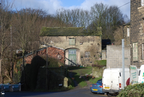 of buildings, once a large farm now all converted to domestic dwellings. I had assumed this is Leak Hall as the main house looks like a mixture of typical farmhouse with a rather more imposing section to the rear, but it appears this was simply the farm as I had first supposed and Leak Hall is no longer standing. A footpath leads across Cliff Hill where there is a small trough of water under a large Hawthorn – either the old well or a drain, there were both in the area according to the map. The path comes out into Cumberworth Lane. Just down the hill is the imposing Methodist chapel, built in 1799 and enlarged in 1859. This was the Wesleyan chapel, the Primitive chapel being on the hill opposite. Down the hill to the main road where stands the White Hart Inn, present in the early part of the 19th century and probably far older. I detour round Wood Nook which is a little loop of probably the original road, passing Wood Nook Farm with a splendid old barn whose roof is sagging conspicuously. A muddy track (too muddy for me) leads off, once it was Wood Lane. Then back down to Springfield Mill and up the other side of the valley to Holy Trinity church, constructed in 1938. It is a traditional shape but obviously
 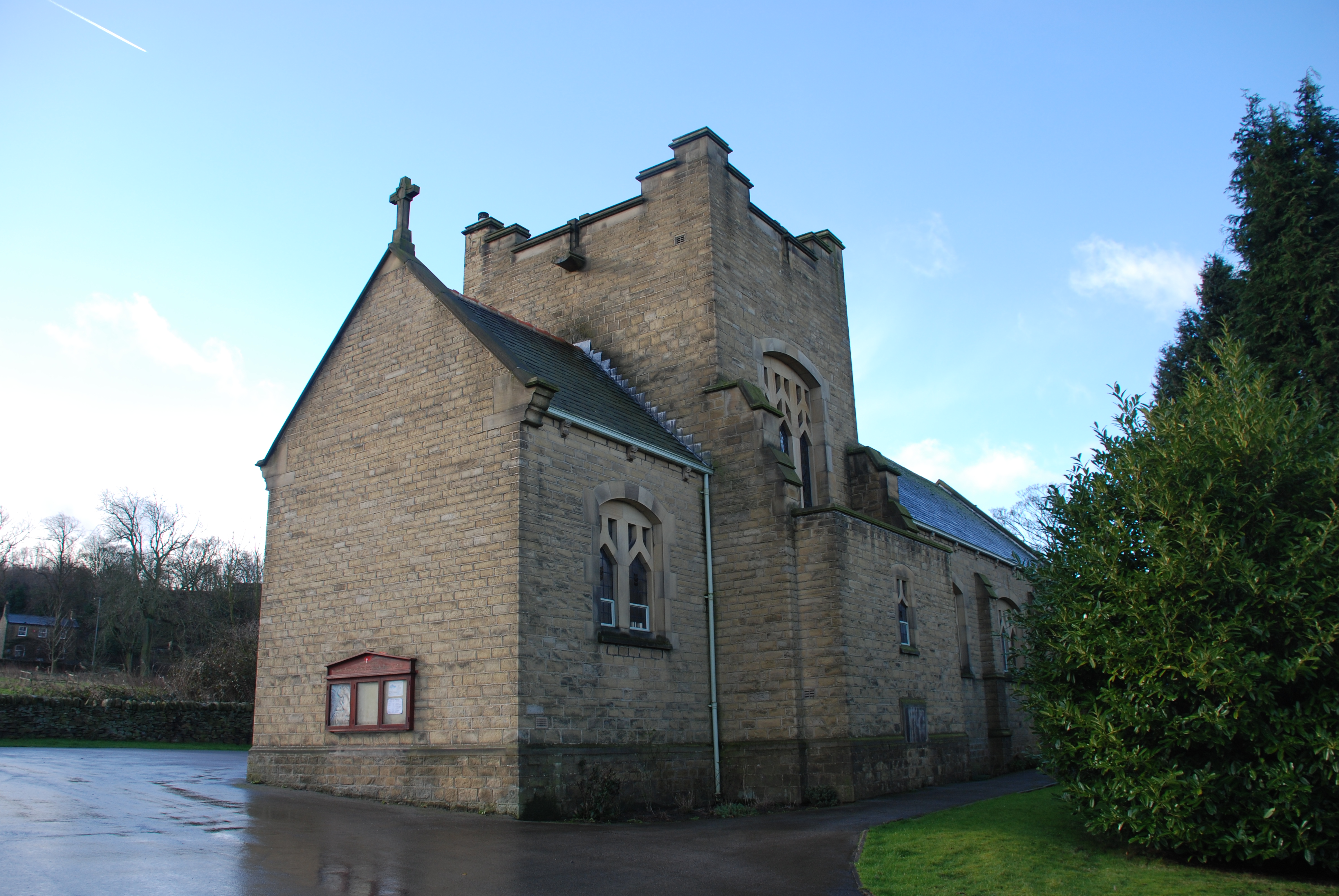 relatively modern and its date is a testament to the strength of the non-conformist movement here. Back down to the mill and then follow the Dearne up to the viaduct. A worn stone footbridge crosses the river, which is only a couple of yards across, by a weir that feeds into a small circular basin. Steps lead back up to the main road. There is little sign of what Denby Dale is famous for – its giant pies. The first Denby Dale Pie was made in 1788 and was said to celebrate the recovery of King George III from a bout of “madness”. The second was baked in 1815 celebrated the end of the war with France and the defeat of Napoleon. The pie, by today’s standards was relatively small and was said to contain “two sheep, twenty fowls and a half a peck of flour for the crust.” The third on August 19th 1846 celebrated the repeal of the Corn Laws. On August 27th 1887 a pie was baked to celebrate the Jubilee of Queen Victoria. However the pie was left for some days in hot weather and went rotten and had to be buried in a pit of quick lime. A second pie known as the “Resurrection Pie” was baked on September 3rd. A pie on August 1st 1896 celebrated the 50th anniversary of the Repeal of the Corn Laws, the next on on August 26th 1928 as a belated Victory pie and to raise money for the Huddersfield Royal Infirmary. On September 5th 1964 the eighth pie celebrated four Royal births, Prince Edward, Lady Helen Windsor, Lady Sarah Armstrong Jones and James Ogilvy. The next pie was baked on September 3rd 1988 celebrated the bi-centenary of the first pie. 2000 saw the making of the tenth record breaking Denby Dale Pie, weighing 12 tons and measuring 40 feet long. As well as obviously celebrating the new Millennium, The Millennium Pie coincided with the Queen Mother’s 100th birthday and the 150th anniversary of the Penistone Railway Line.
 which being impervious to water results in springs providing a good water supply. Igneous rocks have pushed through and into the limestone carrying ores, especially lead and fluorspar which is still mined locally. We start at the the Bull’s Head, built in 1606 and in the ownership of the Talbot family for centuries but is now, sadly flats. Past the Town Hall and opposite is the Plague Cottage where the plague started. Like the rest of Eyam it is a pretty building. It has a plaque outside recording the four persons who perished. A number of dwellings have these plaques but the beauty and tranquillity of the place refuses to convey the sheer horror of the days of the plague. It is not until later I begin to comprehend, maybe only slightly, how people must have felt watching their loved ones die, one after another, not knowing if they would be next.
 winds round lined by a delightful mixture of cottages and houses, one with a faint badge high on the side wall inscribed 1799. Hawk Hill leads off with another set of troughs and leads up to the site of now demolished Bradshaw Hall. The museum is sited here with surmounted by a weather vane bearing the image of a rat. Back up the main street is the only remaining part of Bradshaw Hall. The hall was built by Francis Bradshaw in the Tudor Period but was sited on a building from the reign of King John in the late 12th century. The Bradshaws left the village in 1660. On up the road and a fine house is identified as originally being an inn called “Heart of Oak”, a reference to British seamen. It was built in 1587 and rebuilt in 1660 and called the “Royal Oak” in tribute to restoration of the monarchy. The building was extensively rebuilt in 1907 and is now a private residence. A carving of an Oak tree adorns the portico over the front entrance. Next is the herbalist’s cottage, Humphrey Merrill. He died in September 1666, but his wife Anne survived as did Andrew Merrill who left the village and built a rough shelter on the edge of Eyam Moor where he lived with his pet cockerel until the plague had passed. We come to the house of Richard Furness, the poet, who was born here on 2nd August 1791 and died in Dore on 13th December 1857. West End Cottage was built in 1553 and nine members of the Willson family died there in the plague.
  Townhead Factory was built in 1735 to weave silk. Ralph Wain discovered how to weave a pattern on both sides of silk. In the apex is a pigeon loft used for carrier pigeons to take messages to the mills in Macclesfield. Town Head Inn opposite was built in the 17th century and lodged drovers who carried the mill’s silk to Macclesfield. Like most the other inns in the village it is now a private dwelling place.
 This was taken to be a depiction of the martyrdom of St Lawrence, however, the dedication of the church to him is only about 100 years old, before which the church was dedicated to St Helen. It is thus likely this is The Grim Reaper. There is also a fragment of a painting of a portion of the Creed. Near where there was originally a chapel of St Helen, used as a private pew for the Stafford and later the Bradshaw families, is a wall carving of a cross dedicated to St Helen. Here is also a fine Saxon font, which came from the garden of Brookfield Manor in Hathersage and was donated to the church by Sir Charles Cammell in 1888. The current font, by the church entrance is Norman. There are a number of good stained glass windows. Back outside in the graveyard are a number of interesting graves, including that of Catherine Mompesson, wife of the rector, who died of the plague. Down in the rear graveyard is the gravestone of Henry Bagshaw who played cricket for Derbyshire and the M.C.C. The stone depicts a ball sending stumps and bails flying with, at the top, the finger pointing upwards, indicating the player is out and has come the the end of his innings. The scripts records:
 chief tenant. The manor passed family of Vescy, one of whom, in the reign of Edward I gave it to Rufford Abbey, in Nottinghamshire. After the Dissolution, it was granted to the Earl of Shrewsbury and then passed down to the Effingham family. The town developed around the Rotherham Bridge where the Chapel of Our Lady was erected in 1483. Only four such chapels remain, many having been destroyed in the Dissolution. It is said that the Rotherham chapel survived because it is such an integral part of what was then the only bridge across the Rother here. The whole town around the centre has been
  destroyed by mid to late 20th century development of the poorest type. In the centre, above an open space now dominated by a huge television screen, stands the Minster of All Saints. The church is considered one of the finest examples of mediaeval perpendicular architecture in the country. The spire stands at 180 feet having been erected in the early 15th century. A Saxon church was recorded in the Domesday Book and a Norman church was built on the site in the late 11th century. In the nave, above the altar is the line of the roof of the Norman church, much lower than today. The ceiling is of oak with 77 carved bosses coloured gold. At the top of the nave pillars are carvings of the “Green Man”. The church was restored in 1873 by Sir Gilbert Scott who treated many of the original features sympathetically. The chancel has a fine painted ceiling and stone sedilla (seats for the clergy) and a squint beside them
  allowing people in the Jesus Chapel (created by Thomas Rotherham) to see the high altar. The organ dates from 1777 and was built and installed by Johann Snetzler, one of the best organ builders. A records chest from 1540 sits behind the organ. Nearby is a beautiful funerary brass dedicated to Robert and Ann Swyft dating from 1561. The Swyfts were ancestors of Jonathan Swift, author of Gulliver’s Travels. Outside the walls are local sandstone, Rotherham Red, with limestone from Roche used for details. Gargoyles stare out high on the tower and the windows have heads at their edges, one holding a large key. From the Minster I head up the hill to The Crofts. Here once stood the main market, one of the largest in South Yorkshire. In 1861, 3000 fat sheep and 200 fat cattle were sold a week. However, the market was closed for two years from 1865 because of the bovine disease, rinderpest. By the time the market reopened it had been superseded by Sheffield market. From here, a path drops down to Wellgate and then Doncaster Gate leads up to Clifton Park. Here stands Clifton House, built between 1783-4 for Joshua Walker, second son of Samuel Walker, founder of Rotherham Ironworks. The house was designed in the Palladian style by John Carr of York, who built Keppel’s Tower. It now houses the town museum.
 sliced off. Standing by the motorway bridge, the songs of a Song Thrush, Dunnock, Robins and Blue and Great Tits are constant despite the noise of traffic. The church was founded by a member of the de Laci family in the 12th century, but the present church is the result of rebuildings between 1480 and 1520. In 1484 King Richard III gave the living of Darton to Monk Bretton Priory in exchange for Holcombe Forest in Westmoreland. When King Richard III was defeated by Henry Tudor all his acts were revoked, and David Hunter, the first vicar of Darton, was replaced in 1486 but later re-instated. After the dissolution of Monk Bretton Priory, the advowson passed back to the crown, thence to the Marsh family at the end of the 16th century to their relative George Carr, and after the civil war to the Wentworth family of Woolley. At the end of the 18th century the patronage passed to the Beaumont family of Bretton Hall with whom it remained until 1959 when Viscount Allendale’s trustees gave the Right of Patronage to the Bishop of Wakefield. (This information was extracted from “A Short History of All Saints Church Darton” in Barnsley Central Library.) The church is closed, indeed
  there is a notice stating that it cannot remain open because of “repeated theft and vandalism”. The large graveyard has litter strewn about it. Strange how a nation that can get hysterical about the death of a princess who had very little bearing on their lives can be so uncaring about the remains of their own people. One gravestone appears to have a cut around the month of death. I wonder if the stone mason made an error and cut out it out and inserted a piece of stone with the correct month inscribed upon it. Another, one of the oldest, records the passing of Anthony Dury of Shires Moor 1723; I have been unable to locate Shires Moor. Snowdrops are in bloom. On into the village past a fine building that was once the vicarage. The village has little interest apart from the old Sunday School. There are signs of the recent flooding – the Post Office remains closed and sandbags litter the pavement. The road passes under the railway and then turns sharp right and heads for Mapplewell. The road rises past the old school, still in use and then past the wide open space where there were brickworks and the North Gawber Colliery Railway. As the road rises and turns a house stands with a black plaque high on the wall reading: “Mrs Fountain’s Nurse’s House 1908”. A park stands just further up. Starlings are chattering noisily at the top of a tree, whilst a small charm of Goldfinches twitters on a lower tree. From Mapplewell I turn down Spark Lane past Methodist Chapels, one still in use, and on down to Lower Barugh to The Millers where I partake of a pint before wandering back up the Huddersfield Road.
 Moor where the sails of the wind-farm are stationary except for a single windmill revolving slowly. Skylarks are rising into the air singing their little hearts out. The views from the lookout point are limited as there is quite a haze across the middle distance. Down through Millhouse Green, past the Flouch and up across the moors. I am able to stop at Saltersbrook bridge and look down the steep ravine to where the old Salt Road packhorse bridge crosses the stream. It is further down the hillside than I had thought. Next to it are the low walls of the ruined Miller’s Arms inn, which must have been a vision of heaven after the long haul up Longdendale.
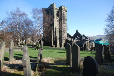 across the moors and the Calder valley towards Stoodley Pike Monument. Into the village past modern stone built council housing. The main street up through the village is narrow and cobbled. The cottages that line the street and lead off in small terraces from it all have the large windows associated with weavers’ cottages, and indeed this village was an early centre of the woollen trade. There had been a battle here in 1643 during the Civil War, resulting in much of the village being burnt. The Cloth Hall remained, situated on the main street and a ginnel leading towards the church and old Grammar School, now a museum and being re-roofed currently, built in 1642 from money left in the will of the Revd Charles Greenwood. The Cloth Hall was the trading centre for the woollen cloth produced in the cottages. It was built by the Lords of the Manor, the Greenwoods around the mid 16th century and originally named “Blackwell Hall” after the great cloth exchange in London. It is the oldest cloth hall in Yorkshire. The church comes as a surprise because there are two churches here. The original church was founded around 1172 and building continued until 1250. The church was dedicated to St Thomas à Beckett, who was canonised in the founding year. The church was closed as a result of “an effusion of blood” in 1482 - the precise historical details of the incident are unknown, but a local legend, ironically in a church dedicated to St Thomas à Becket, tells of a priest slain in the church for performing an illicit marriage. In 1530, 14 armed men entered the church and destroyed the seat
  used by the Wadworth family, (why, I know not). The building was enlarged in the 16th and 17th centuries. In 1765 it is recorded that, “The vestry of ye church of Heptonstall was broken open and out of ye chest there the communion plate was stolen on ye night between ye 15th and 16th December”. In 1779, John Wesley preached there and again in 1780 and 1786, when he remarked, “I preached at 10 in Heptonstall Church (the ugliest I know)”. In 1847, a great storm destroyed the roof and part of the walls. It was decided not to repair the church but build a new one in the Victorian Gothic style. The new church of St Thomas was finished in 1854 at a cost of £6666. In the 1960s the interior of the new church was modernised, causing considerable dissent in the village (and not without reason as it may look modern but has little character). An old painted panel of the Royal coat of arms hangs over the entrance. There are some pleasant stained glass windows, one with an unusual amount of green glass. Outside the majority of the churchyard between the two church buildings is covered by laid down gravestones. The site is said to contain over 100,000 corpses. Beyond the church wall is the new graveyard. Apart from a number of graves of Farrar’s, there is the grave of Sylvia Plath, the poet. She was married to the late Poet Laureate, Ted Hughes but committed suicide in 1963. On her headstone (which is regularly vandalised to remove “Hughes” from it) are the lines, “Even amidst fierce flames, The golden lotus can be planted”, which Hughes credited to the Hindu Bhagavad-Gita but
 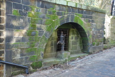 in fact comes from the 16th century book “Monkey” by Wu Ch’Eng-En, in which Monkey is taught the way of longevity. It is a peaceful in the brilliant sunshine. Starlings are chattering in the trees and keening of a Curlew floats from over the surrounding moorland. The Old Vicarage has a sign indicating that a cock-pit existed here in the times of the Napoleonic Wars. Back up the main street, where it is called “Top o’ th’ Town”, is a side lane that leads past a rough stone arch inscribed “IB 1778”. This leads to Whitehall Farm, which was previously called “Bentley’s” after the family who were copyholders until 1722. Several of the Bentleys were literary figures, especially Dr Richard Bentley, (1662-1742) who was Master of Trinity College, Cambridge. A little on, down on the steep hillside is the Methodist chapel, the oldest still in use in the world. The foundation stone was laid by John Wesley in 1764. Up the main street further is a pump and well, the Smith Well, one assumes as the street is now called that. At the Lane Top the road heads off into the moors.
 rather than an open space. Mellor Bridge is an old packhorse bridge which crosses the river to St Bartholomew’s church. The first chapel was built in 1453 and held 311 people. It had fallen into decay by 1480 as the locals were unable to afford its upkeep, so Edward IV gave an endowment of 4 Marks, which enabled the church to continue. In 1697, Isaac Walton, (not the Walton who wrote “The Complete Angler”) aged 24, was ordained and came to live in Clough Lea. 15 years later he was ordained a priest, and served for the next 32 years until his death in 1728, at the age of 56. He was a scholar who became known for his sermons, which were so long they were delivered in instalments. A new chapel was built on the same site in 1758, at a cost of £1,145. In 1779, the Reverend Lancelot Bellas became the minister – a preacher from Saddleworth who was the popular choice of the village. He was in Marsden for 36 years, 1779-1815, gaining a reputation for eloquence and his drinking habits. He left such an impression that Marsden was nicknamed, Bellas Town. In 1798, Black Fever killed 15% of the population. There was not enough room in the churchyard for the bodies, so its level was raised three feet by carting soil from Clough Lea. The church now standing was built in 1895, mainly through the efforts of Revd Buller. It has a large graveyard with a number of wonderfully pretentious Victorian headstones and monuments. Jackdaws are calling around the tops of the trees and the church tower. Marsden also has a strong tradition of non-conformism. John Wesley visited in 1746 and again in 1757, when he “road over the mountains to Huddersfield”. In Marsden he met, “A wilder people I have never saw in all England”. However, Methodism flourished.
 Institute, built in 1861 “to improve the intellect of the working classes”. Street names are displayed on small stone tablets. The high street leads up to the main A62 across which is a pleasant park with its bandstand. A road runs west past a new development of houses, which whilst built in the same pale stone as the rest of the town, still looks crowded and unpleasant. The local pub rejoices in the name of “The Old New Inn”. Up the road is a large mill. A temporary bridge has been placed over the road, from one side of which a rushing stream issues and runs under another large industrial building. A road leads back to the church passing under the A62. I head back up Station Road to the canal and follow it westwards. The canal is called the Huddersfield Narrow Canal, as opposed to the Broad Canal which runs east out of Huddersfield. It is clear why it is so named when one looks at
  some of the locks. They are truly the most narrow I have seen. The canal winds westward. Pairs of Mallard swim along, nearly always the female leading with the male following attentively – spring is coming! The canal used to end where the hills of Standedge rise and goods were then taken to and fro from Lancashire in the original way, by packhorse. In 1794 a 3¼ mile long tunnel was built under Standedge. It is the longest, deepest and highest canal tunnel in Britain. It is 5,500 yards long, 638 feet underground at the deepest point and 645 feet above sea level. It was never a great success, the lack of tow-path meant men had to lie on their backs and “leg” the boats through, whilst the horse was taken over the tops by Boat Lane. In 1849 the first railway tunnel was constructed, a second in 1870 and the present double track tunnel in 1894. The canal tunnel was closed in 1943 but reopened in 2001 and a large visitors’ centre opened. Up the hill is a reservoir feeding the canal via a water course that crosses the railway via a bridge which then curves round and down back under the railway and into the canal. Houses are scattered across the hillsides, one far above seems to have been built across a clough, or stream valley. High above, stands Pule Hill, site of both Mesolithic and Bronze Age sites. A mound and a cross stare out down the valley.
 and disappear into the whiteness of the fog. A junction appears at Lane Head. The road to Oughtibridge rises and then drops suddenly down to a sharp corner. The hill is called “Jawbone Hill”. One story states that whale jaw bones formed an arch on the hill top, whilst others think it was simply the bend in the road that resembles a jaw bone. Just off the road stands the Birley Stone, a standing stone, the base of which may be original although the shaft is later. The stone was first recorded in 1161 as the Burleistan, as a boundary marker between the lands of Richard de Louvetot, Lord of the Manor of Hallamshire and the monks of the Abbey of St Wandrille in Normandy, who founded the priory at Ecclesfield in 1273. By the stone is a “toposcope”, a plaque that points the direction of various landmarks from this point – none of which can be seen in the dense fog. It was erected by the Parish Council of Wortley to celebrate the Festival of Britain in 1951. I head back towards Grenoside, back past Lane Head and into Stephen Lane. It is a strange and quite exhilarating experience following the route with the 1855 map and all the landmarks lost in the fog. The cottages in the village are mainly 18th and 19th century with much 20th century infill. Off of Stephen Lane runs Middle Lane where a delightful old barn stands with its upper door having a double bow shaped hole for a window. Middle Lane forms a junction with Bower Lane, Top Lane and Rough Lane, the latter leading past a farm and new build onto a farm track. An old stone stile, well worn lies by the gate and a bright ginger hen scratches around it.
 singing, but they are subdued and the songs are short snatches. A crack of wings above and looking up to see the ghosts of Wood Pigeons disappearing into the mist. A ginnel leads down to Main Street and across is Grenogate. This leads down to a fine house, Greno Lodge, which looks like it is being renovated. A footpath leads to Lump Lane. The leads around an area called The Lump. From here Well Lane is a path to Norfolk Hill. The well is now under the car park of the new school opposite. The old Victorian school is boarded up and, sadly will be demolished for more housing. Down the hill is the Methodist Chapel. The original was built in 1807 but this building was built in 1919, designed according to a stone plaque, by LH Ward, Architect. Further down is a small row of cottages not in Woodside Lane, but were named Pitthroat Row on the 1855 map. The pit would have been once of the numerous sandstone quarries and mines around the area. Sandstone blocks were used for buildings both locally and in Sheffield and the mined sandstone was called ganister, a fine powdered stone used to make refactory bricks for lining furnaces. School Lane turns off Norfolk Hill. The school house has a sign dating it to 1737. School Lane turns left and travels to the Halifax Road, the A61, at the bottom, but this road was once called Riders Lane. Back up at the junction of Norfolk Hill and Main Street is the centre of the old village with The Angel and Old Harrow inns (the “old” being a modern addition to the name). Outside the Harrow on Boxing Day there is the
 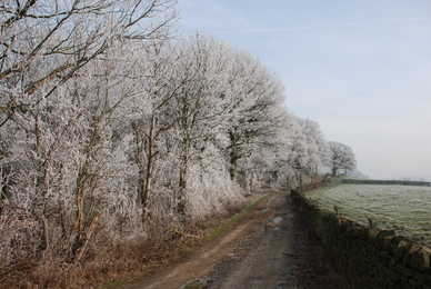 down Blacksmith Lane past St Mark’s Church built in 1884.
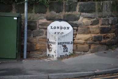 dead brown bracken. The road continues past a large hole, an old quarry. It then becomes Wentworth Road and reaches the junction with Station Road. The old railways are only discerned by the sides of a demolished bridge or a muddy track through thick woodland. Down Station Road to the Trans-Pennine Trail, which is on the old LNER line to Penistone. I wander along the trail and then up Edmund Road. There is a pub here, The Boat, that stood beside the Dove canal and one I have never visited. However, the presence of a funeral director’s car and a lot of people in black indicates that a wake is in progress and I decide to give it a miss. Through Worsbrough Dale and up the Sheffield Road. At the junction with Kingwell and Bank End Roads is an old milepost stating “Barnsley 2 miles, Sheffield 12 miles, London 175 miles”. One forgets the importance of this road before the M1 motorway was built. Whilst the main route out of London was The Great North Road, the A1, the A61, running from Derby to Thirsk, linked the major industrial centres of Leeds and Sheffield with the south and north. On the opposite corner is an old stone shelter with an ancient plank of wood for a seat. After a rest, I plod on up into Barnsley, pausing at the new refurbished Dove Inn, now an Old Mill Brewery house.
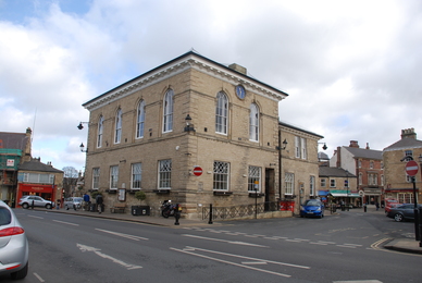 are numerous old coaching inns – Wetherby is more or less half way along its length from London to Edinburgh. The Angel had stabling for 100 horses, 40 of which were kept here for posting purposes. It had its own smithy and shoeing shop. In 1837 it serviced two mail coaches daily, between London and Edinburgh and Hull and Manchester. The Swan and Talbot, first licensed in 1678 had a soldiers’ room under the eaves and a malt kiln to brew beer. It had stabling for horses for the Leeds coach. Gas House Lane once was the site of gas works built in 1845.
 and gargoyles. Most are modern but there are some genuine mediaeval monsters costing nearly £2000. The main shopping street leads back towards the bridge. The market place contains the town hall, built in 1845 on the site of the old chapel of ease. It has a plaque with the market charter on the wall along with a memorial to Squadron Leader J.H. (Ginger) Lacey DFM and Bar, Croix de Guerre who was one of the most successful fighter pilots in the Battle of Britain, shooting down the Heinkel that bombed Buckingham Palace. Off of the market place is the Shambles, built in
  1811 by the Duke of Devonshire as ten butcher shops, only to open on market day. In 1888 they were converted to a covered market. Although there has been some modernisation and infilling with modern buildings, overall the town centre has retained its charm. Back down by the river, a splendid walk and viewing spot has been created. The steps lead down to the the Weir Garth where there was a mill since before 1221. A cog wheel from the mill stands beside the wide weir. Passing under the bridge, the arches of earlier bridges can be seen. The arched, hump-backed bridge was built in 1233 when Walter de Gray, Archbishop of York, forgave the sins of those who contributed towards its cost. The bridge was only 12 feet wide and in need of frequent repair. It was widened in 1773 and again to its present width in 1826.
 The Holmes, an area beside the Cod Beck, which was once said to be “the finest Willowgarth in the county”. The willows would be pollarded or coppiced to form growths of straight withies for basket making, a local industry. The church of St Mary Magdalene has been described as “the Cathedral of the Yale”. It stands on the site of a Norman church and building was started in 1430 and completed during the 16th Century. It is an excellent example of the perpendicular or florid style, the tower is 80 feet high finished with an embrasured and pierced battlement. Next to it is Thirsk Hall, home to the Lords of the Manor, the Bells and then the Franklands. It was built in 1723 and extended by John Carr of York in 1773. Kirk Gate (Church Lane) runs into town past the veterinary surgery where Alf Wight, who wrote as James Herriot, worked. It is now a museum. Also here stands the birthplace of Thomas Lord (1755-1832) who founded Lord’s Cricket Ground. The street enters the main square, still cobbled. The old Post Office is now tea rooms, well worth visiting. In the far corner stands one of the most imposing hotels of Thirsk, the Georgian Three Tuns Hotel was built in 1698, when it was a home to the Lords of the Manor. In 1740 the house was adapted to a coaching inn, being on the Leeds-Edinburgh coach run. The London, Edinburgh, Newcastle, Leeds and Darlington coaches all used the Three Tuns Hotel for bed and breakfast. A clock tower stands in the square. Finkle Street leads off across the beck. I have recorded before that Finkle is supposed to come from the Danish for a dogleg in a street, however recently I have seen the suggestion that it comes from the Flemish, vincle, meaning a covered wagon used as a stall for selling goods at a market. Over the river and off the main road beside a splendid crescent of houses, named unsurprisingly, The Crescent. Beyond is The Little Green, where a huge Elm tree stood under which election results were declared and the stocks stood. It was burned down in 1818 by some local boys but enough timber remained to make the Lord of the Manor, John Bell, two chairs. Six inns used to stand on The Green, today only The Lord Nelson survives. A path along the river takes us back to The Holmes.
 has here 1 plough; and 2 villagers and 2 smallholders with 1 plough. Woodland pasture, 1½ leagues long and as wide. Value before 1066 £3; now 10s. The land was seized from the six Saxon lords mentioned above and granted to Earl Waltheolf, but he was executed in 1086 after taking part in a rebellion against William and the lands went to Countess Judith. They were held on her behalf by Roger de Busli. It is worth noting the considerable drop in value of the land recorded in the Domesday Book. This would have been because of William’s “harrying of the north” wherein many manors were razed and the people killed and dispossessed. By the end of the 11th century the lands were passed to William de Lovetot, who held manors in the district. I start in Mill Road, formerly called Dog Leg Lane. The mill, a corn mill, stood at the bottom of the road on the junction with the main Sheffield-Chapeltown route. Here in Mill Road is a small estate of prefabs, single story box-like dwellings erected just after to the Second World War to alleviate the housing shortage due to bombing. Very few
  remain now. Mill Road joins Church Lane and up the hill where the church, St Mary’s, occupies a fine position on the crest. Dodsworth, the historian visited Ecclesfield in 1620 and said “The church is called (and that deservedly) by the vulgar The Mynster of the Moores, being the fairest church for stone, wood and glase and neat keeping, that I ever came in of country church”. Behind the church is The Hall, a fine house which incorporates part of the Ecclesfield Priory. Countess Judith endowed the monks of the Benedictine Monastery of St Wandrille, in Normandy, with lands in Northamptonshire and a satellite house was set up in the late 11th century here in Ecclesfield. In 1141, it is recorded that amongst the English possessions of the abbey of St Wandrille are “Aiglesfeld, a church with chapels, and tithes, and one mill.” De Lovetot bequested money for the founding of a church for the monks. This church may well have been built on the site of a far older one, indeed the church that gave Ecclesfield its name. In 1324 the total of the valuation of the priory was £30 17s 1d, which
  had grown to £46 1s 4d by 1337, when King Edward III seized the site as it was an “alien” establishment, administered from the parent abbey in Normandy and England was at war, again, with France. The King let out all the seized priories until in 1361, hostilities having ceased, he restored them to their former owners. In 1386 the priory was seized by the Crown for a final time, before being given to the Carthusian Monastery of St Anne, Coventry. It is believed that no Carthusian monks were ever in residence at Ecclesfield, but the estate was farmed out to someone in the neighbourhood who converted the monastic buildings into what became Ecclesfield Hall.
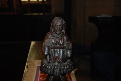 a reclining figure, looking not unlike alleged likenesses of William Shakespeare. In the south aisle is the shaft of a Celtic cross which could have been used as a preaching point for wandering priests before the church was built. The glass is mainly Victorian, with just one window consisting of fragments of mediaeval glass from windows destroyed by the Puritans. A marble tablet is a memorial to the Revd Dr Alfred Gatty, Vicar of the Parish from 1839-1903. He was a very influential figure in the community, but it was his wife, Margaret who is more well known as a writer of children’s books and her fame is eclipsed by her daughter, Juliana Ewing, whose books are even more well known. The Brownie movement took its name from one of her stories. The old stocks sit in the churchyard. At the Dissolution the church passed into the patronage of the Earls of Shrewsbury.