Sunday 1st March – Home – It has been a long week of greenhouse construction. It is a large edifice with appalling instructions and various other irritations such as screws that shear under limited pressure, seals that simply do not fit and glass breakages – the latter admittedly my fault! But, eight panels of glass aside, the greenhouse is up and ready for use. The first day of March is hopefully an omen, bright sunshine and warmth. The air above the lawn sparkles with tiny dancing insects. The snowdrops are beginning to go over, but crocuses and primulas are coming into flower. Wood Pigeons are calling incessantly. A Carrion Crow harasses a Common Buzzard overhead. The Minster bells ring.
Friday 6th March – Coxall Knoll – When I said the greenhouse was ready for use last Sunday, I was overlooking the time that would be needed in putting the staging together and making a path. The staging was more fiddly, badly guided and shoddy manufactured superstore stuff. But eventually it was finished and bright sunshine today means I can get out into the countryside in the first time for what seems an age. There was a sharp frost first thing. However, we avoided the heavy snow that has 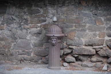 fallen in places. A picture in the newspaper shows queuing traffic on the A361 in north Devon, the route we took in balmy sunshine only a fortnight ago. Brampton Bryan is a village on the Herefordshire-Shropshire border. A long wall runs along the main road topped by an extraordinary, bulbous Yew hedge. Under it stands a cast iron water hydrant with a lion on it. Behind is a large 17th house and the ruins of a Marcher castle. The whole area is mainly owned by the Harley
  estate, the family having succeeded the Mortimers in the early 14th century. A road opposite the old forge leads past the church and up to Parson’s Pole Bridge, now a modern construction over the River Teme. The river is clear and flowing swiftly.
Over the bridge is a meadow of molehills. Common Buzzards are circling high above Coxall Knoll, a towering wooded hill to the north-west. The road continues between leafless hedgerows. A Nuthatch alights on a hedge twig, piping loudly. Great Tits wheel out their song. A Dunnock and Yellowhammer also are using the hedge as a perch. A few lonely yellow Celandines peek out of the foot of the hedge. The lane leads north-eastwards then a smaller lane, Weymore (Weymoor in Victorian times) Lane heads north. A footpath, barred by a tied gate, leads up to Coxall Knoll. A flock of Jacob’s sheep come to investigate us – Maddy seems to wish she was somewhere else! We enter the woods and follow a track that climbs high on the south side of the hill. Ravens cronk in tall conifers overhead. 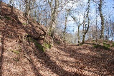 Another path leads to the outer ramparts of an Iron Age fort. The fort is reputed to be the site of Caradoc’s last stand in 51CE. The legendary British chieftain, called Caratacus by the Romans, had fought the Romans for years and by legend was finally beaten at British Camp in the Malverns. But the description of the defeat by Tacitus makes Coxall Knoll camp a more likely site:
A path follows the ditch then an entrance leads up to the interior of the fort. 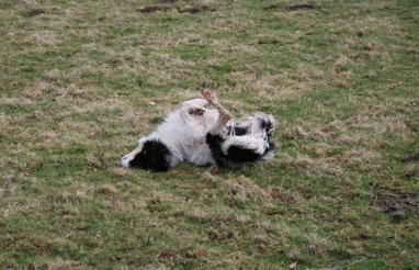 Another high tor rises from the interior of the fort with ramparts and a ditch on the east side. A track leads up to the summit. The view is magnificent! Northwards, over the village of Bucknell stands Bucknell Hill and Hopton Titterhill. Buzzards are mewing overhead. As we descend, a Fallow Deer stands and watches, huge dark ears erect. Of course, the moment I aim the camera and press the shutter, it has vanished into the woods. Paths wind round the hill and eventually back down to the road. Back down at the river and Maddy decides to prove she is a worthy heir to Dill the Dog and jumps in. I am somewhat panic-stricken as the current is strong and she has a real struggle getting out again. But she emerges, shakes herself all over me and rolls delightedly in the grass.
Tuesday 10th March – Leominster – Along the River Lugg in rain. However, it does brighten as Maddy and I walk. I am hoping to find some Wild Garlic – Ransoms – but no joy. Indeed, where Ransoms would grow, there are numerous arrow-shaped, deep green leaves of Wild Arum. Nettles are everywhere, but without gloves not much fun to collect. The Butterbur leaves that had turned black and rotten in the autumn have now rotted down and small heads of Butterbur are emerging, dark pink, multi-faceted buds. Hedge Mustard leaves grow under the waterside trees. A pair of Mute Swans glide upstream. Great Tits are calling constantly.
Wednesday 11th March – Barons Cross – An area to the west of the main town of Leominster. A large disused army camp lies to the west of a road junction, the former 25th General Hospital of the US Army, where pioneering surgical techniques were used to save the lives of wounded soldiers in the Second World War. The site was also used for German prisoners of war, troop demobilisation and by the Polish Army in exile. I head down a track towards a cottage we had thought about purchasing. A disused orchard has an overgrown hedgerow containing Greenfinches, Goldfinches, Chaffinches and a sole Fieldfare that flies up into one of the gnarled old trees.

Weobley – A village some ten miles south-west of Leominster. It is a typical “Black and White” Herefordshire village with lots of timber-framed houses, and a few too many infillings with modern premises. Untypically for villages today it retains a decent complement of shops – butchers, post office, grocers, newsagents, wholefood and greengrocers and even an electrical appliance shop! I count at least three pubs! The name probably derives from “Wibba’s Ley”, a woodland glade belonging to a Saxon landowner, Wibba. The village name was transcribed as Wibelai in The Domesday Book. To the south of the village there are earthworks, some which are probably Iron Age in origin and more extensive ones of a Norman castle. The latter was erected shortly after the Conquest by the de Lacy family. It was probably rebuilt around the early 13th century by Walter de Lacy. It was decayed by the time Leland visited in 1535. Nearby are the remains of extensive fishponds.
Friday 13th March – Stokesay – A hamlet on a loop in the River Onny a mile south of Craven Arms in Shropshire. There are a few houses, a farm, a church and one of the  best preserved late 13th century fortified manor houses in the country. Earthworks show a larger village than the present and the Domesday Book records Stoches, derived from the Saxon stoc meaning an enclosure. The entry records a mill and miller and, unusually, a beekeeper, but no church. The manor was taken by the de Lacy family after the Conquest and was tenanted by Theodoric de Say in 1115. Theodoric was possibly the brother (or certainly closely related to) Robert “Picot” de Say, Baron of Clun. The village was recorded as Stokesay in 1296 when Hugh de Say was tenant. The church, dedicated to St John the Baptist, was built sometime in the 12th century and has a Norman doorway. It was originally connected with the collegiate church of St Peter in Hereford and Wenlock Priory but was granted to Haughmond
 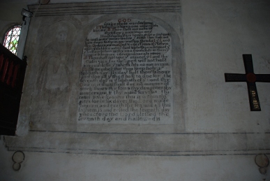 Abbey, north-east of Shrewsbury, in 1172 and remained in the Abbey’s charge until dissolution in 1539. The church was badly damaged during the Civil War and was rebuilt in 1654 and remains as a rare near complete Cromwellian and early Restoration church. The walls are white plaster and painted by “Mr Francis and his man” for the sum of Six pounds and ten shillings with texts within architectural surrounds. Much of the north wall of the nave contains two such paintings, that of Moses and Aaron, which are barely discernible and the Ten Commandments. The Creed is on the south wall. By the chancel, on the north side is a canopied pew with two compartments. On the opposite side is the pulpit of post-1660. To the west is a gallery with a delicate pipe organ. Two of the bells were recast in 1674 by William and Henry Clibury of Wellington and the tenor bell, dating from 1608 was recast by Barwell of Birmingham in 1900. The glass in the chancel windows is early, but the rest, including the coloured glass is late 19th and early 20th century.
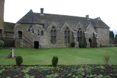
Stokesay castle dates from the late 13th century and apart from a 17th century house replacing the original gatehouse, little else has changed. The castle was built by Lawrence of Ludlow, a wool merchant at a period when there was relative peace, following the defeat of Llewelyn ap Gruffydd by Edward I. It is said Lawrence bought the land for the price of a “juvenile Sparrowhawk”. Building was started around 1281 and Lawrence obtained a “licence to crenellate” – effectively permission to fortify his building – from Edward I at Hereford in 1291. The castle consists of a curtain wall surrounded by a moat, a fine great hall, solar block – the private quarters of the lord of the manor and a very defensible south tower. Lawrence did not enjoy his new home for long as he drowned off Aldeburgh in 1294 on a trading mission to the Low Countries to raise money for King Edward’s war with France. The Ludlows held the castle until 1598 when the then owner, Henry Vernon (his father married Anne Ludlow, the last of that line) sold it to Sir George Mainwaring for £6000. The 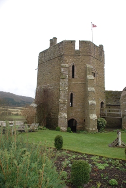 Mainwarings sold the castle and their estates locally to Dame Elizabeth Craven in 1620 for £13,500. It was tenanted to Charles Baldwyn in the 1630s and it was probably he who built the new gatehouse. The castle surrendered to the Parliamentary army in 1654 and was ordered to be slighted, i.e. levelled. However, little damage appeared to have been done other than removing the curtain walls. The Baldwyn’s ceased to live in the castle in 1706 and for the next 150 years it was used by the local farmers as farm buildings. By the early nineteenth century it was in poor condition but the Gothic revival sparked an interest in Stokesay and J.D. Allcroft, who had built himself a mansion at Stokesay Court in 1869, restored the castle. It was extensively repaired by English Heritage in the mid 1980s. The view from the south tower looks up and down the Onny valley. Daubenton’s Bats roost in the beams of the tower and there are Swallows nests on various ledges and in the corners of walls. A fine Jacobian carved fireplace stands in the solar rooms and the great hall is a magnificent space with a cruck roof and original mediaeval wooden staircase.
Craven Arms – We walk back to the town from Stokesay. Craven Arms was originally a small village called Newton. The Earl of Craven built a posting house and inn on the junction of a new turn-pike road in the early 19th century. The Shrewsbury and Hereford Railway Company built its line through the village in 1852. The Much Wenlock and Knighton branches were built over the next twenty years and Craven Arms became an important junction. The town grew up around the station to what is now a prominent South Shropshire conurbation.
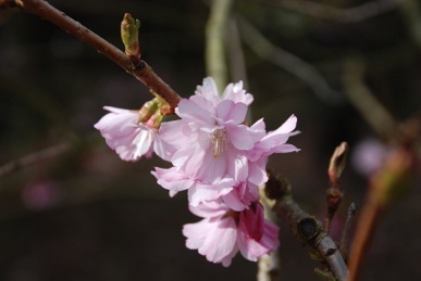
Tuesday 17th March – Dinmore – After doing some shopping in Hereford we stop off at the Queenswood Country Park. The place is busy with groups of school pupils, many just walking or sitting on the benches talking with their i-Pods plugged into their ears – no listening to the persistent calls of Great Tits, squeaks of Blue Tits, fluid songs of Song Thrush, Blackbird and Robin or just the peace in the trees. A few trees are coming into leaf and several cherries, (Prunus kursar and P. accolade) are in blossom. In some places white Wood Anemones, the Windflower, cover the ground. I listen in vain for the first warblers of spring.
Wednesday 18th March – Croft Ambrey – After a morning of mist, the afternoon turns to bright sunshine. We take the path from Croft Castle northwards towards the Iron Age fort of Croft Ambrey. The car park attendant asks us to keep Maddy on a lead through the first field which contains very pregnant cattle. This goes without saying. One cow has recently dropped her pretty grey calf which lays on the ground, eyes closed in the bright sunshine whilst its mother cleans her teats in preparation for his first meal. New wooden sapling protectors have been erected in the next field where the Spanish Chestnuts line up in decay. Holes have been dug but the new trees have not yet been planted. Croft Wood is quiet, as Forestry Commission softwood plantations often are. Occasionally a Blue Tits squeaks. The sheep on the common below the ramparts of the fort trot off when they see Maddy, although we again put her on the lead to stop any temptation on her part. We climb up through the western gate of the fort and across its plateau to the northern edge. The valley below and woods further up are covered in a hazy mist. We walk past the highest point where the granary stores stood in the Iron Age and on to the eastern gate, where the land falls away. A path then leads round the top of the ramparts. The path is only a few feet wide and either side the ground drops away steeply to the ditches below. These slopes would have been even more precipitous when the fort was built. Another, lower rampart lies beyond the ditch on the outside of the fort. An Oak tree bough forms an arch over the path.
Thursday 19th March – Bircher Common – This area is near to Croft Castle, on the hills that lead up to Croft Ambrey. The common is National Trust property and surrounded by a small village. An old Primitive Methodist chapel is now a domestic residence. Several of the houses are grand old country residences. The common rises with grass paths between stands of yellow Gorse and brown bracken dotted with Hawthorn and Birch. A pond is green with algae but some Water Coltsfoot bloom. There is ordinary Coltsfoot flowering by the path, yellow disks that emerge before the leaves. There are traces all over the Common of earthworks including Iron Age farmstead enclosures, mediaeval farming shelters and post-mediaeval houses and barns. A Comma butterfly flits around the ever-flowering Gorse. The path reaches Oaker Coppice where we stop and look back at the rather misty view over Herefordshire.
Friday 20th March – Home – At last I have finished the greenhouse. I had fitted the lower bars for the windows upside down, due to the poor quality instructions. The windows with the automatic openers had been sorted some time ago, but the other two had been left, but now they needed finishing with the manual openers fitting. The staging is covered with trays of seeds. I have planted tomatoes, chillies, lettuces, Purple Sprouting Broccoli and some more broad beans in modules and trays. Carrots, beetroot and leeks have gone into the beds under cloches. After being surprised I had heard no Chiffchaffs in the woods in recent days, one delights by calling from a nearby garden.
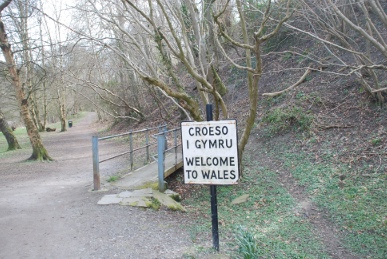
Friday 27th March – Knighton – A market town straddling both Offa’s Dyke and the Welsh border. The town rises to the south of the valley of the River Teme. In Welsh, the town is called Tref-y-Clawdd which means “Town on the Dyke”. There were two 12th century castles in the town. It received a charter and became a borough in 1203. The English name of Knighton comes from cniht and tun, meaning a farmstead of a soldier or freeman, which may mean the land was granted to freemen. From the town centre a road leads towards the railway station. A side road heads down towards the river. A small estate of mills and workshops is being demolished but a path 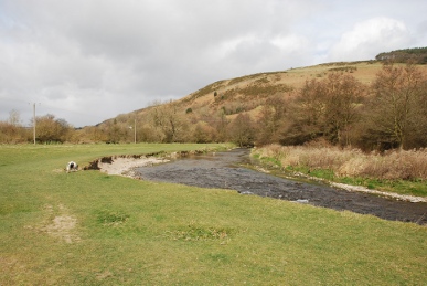 leads up beside the site to the cemetery. From here the road goes down to the river. A path follows the river. Beside the path is an eroded bank with tree roots exposed, twisted and tangled like a nest of vipers. Between the path and the river is a carpet of celandines. A small footbridge sits unused as the path has been built over the ditch that formally ran here. This ditch formed the border of England and Wales and an iron notice facing back says “Welcome to Wales, Croeso I Gymru”. Large lumps of masonry in the river indicate a lost crossing. A Chiffchaff sings nearby. The path enters an open field through which the river runs clear and sparkling. A railway line crosses the river and the path crosses the railway bridge and up a field beside a farm – Panpunton. Lambs stare at Maddy who gets rather excited and their mother gets rather concerned. However, Maddy is on the lead and the lambs trot off. Across a lane and then the path heads up Panpunton Hill. Sheep are noisy in the valley behind. Scrubby Birch and Ash give way to
 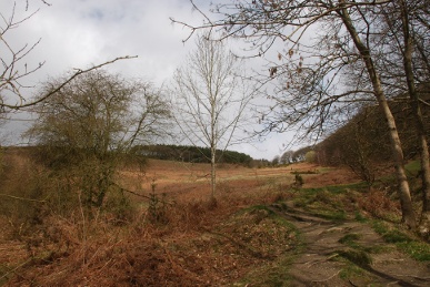 the regimented ranks of Forestry Commission conifers to the east, Kinsley Wood. Pale yellow jewels of Primroses light the shady wood. Deep old tracks are filled with dead leaves. A Nuthatch calls and runs, mouse-like along the branches. The path climbs steeply up the open hillside, brown with dead bracken, beside the conifer plantation. At the top the path heads north-west along Offa’s Dyke, the 8th century defence between Mercia and Wales. The view beyond is disappointing; one likes a good view on attaining a summit! More conifers hide the deep valley of Gander’s Neck and the hamlets of Lurkenhope, Five Turnings and New Invention. Behind, Knighton lays in the valley and Garth Hill rises, topped by an unsightly mobile telephone mast. The sky is darkening and by the time I get back down to the town it is beginning to rain. A noisy flock of Siskins are high in a tree outside the cemetery, males bright yellow with jaunty black caps.
Sunday 29th March – Leominster – A sharp overnight frost results in a cold dawn. The clocks have gone forward so the sun has yet to rise over Eaton Hill. A Great Spotted Woodpecker drums in the church yard, as he does every day but I have yet to see him. Small, noisy groups of Rooks fly over. A Chiffchaff calls from the bottom of the graveyard. Here there are a few Wild Garlic, Ransoms, which I have been cropping for the chickens (and a few for ourselves). Rabbits creep off before Maddy sees them, although she must be aware of their presence as she sniffs energetically.