Monday 3rd November – Home – Flocks of winter thrushes are flying over. Occasionally a few will descend to the top of the Ash or the Horse Chestnut. A Fieldfare stands high watching. A few Redwings explode out of the leaf cover and disappear away eastwards. The local Blackbirds are noisy. All three of the regular tit species, Coal, Blue and Great, are visiting a fat cake hung by the shed. A Greenfinch stands high in the apple tree. A Carrion Crow is in the Ash. Jackdaws fly up to the chimneys of neighbouring houses. A rasping Mistle Thrush passes over.
Aconbury – Down through Hereford and on down the A49 until a turning to King’s Thorn. This village runs into the next, Little Birch. The origin of the name Kingsthorn is obscure. The Dictionary of Herefordshire Place-names simply states, “There is in Much Birch also, in 1538, a King’s Close of Twenty acres.” I park outside the village hall and take a track that leads by the Primitive Methodist Church, built 1851 and rebuilt only seven years later. A hand water-pump stands here next 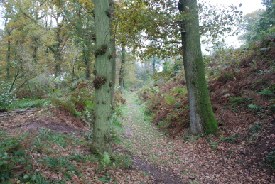 to a stone trough. A path leads off of the track up into Aconbury Woods, through a wood once called “The Warren”. Through some mature woodland and some open areas that have been recently felled. The path then reaches the ditch and ramparts of Aconbury Fort, an Iron Age hillfort. The Concise Oxford Dictionary of Place Names declares the name Aconbury to be recorded from 1213 as Akornebir meaning “Old Fort inhabited by squirrels”. Certainly, here is the old fort and there are plenty of squirrels in the woods, sadly only Grey Squirrels not the more delicate Red Squirrels that our 13th century person would have seen. Another name for the site is Caer Rhain. The fort was a rough rectangle enclosing some 17½ acres. It has a bank, ditch and counterscarp bank with in-turned entrances south-east and the south-west, the latter with an outwork. The bank rises to five metres and averages four metres along its length. The ditch has been destroyed on the west and north sides although a path follows its line. Pottery
 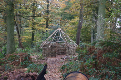 found on the site indicates it was permanently occupied from the 2nd century BCE until after the Roman Conquest. The interior of the camp is wooded and a path leads up to its highest point where there is a triangulation point – rather redundant given the density of the trees. On the eastern side, outside the fort, is a small encampment of the Wye Wood Project, a health development initiative to engage with key disadvantaged communities in rural areas and encourage them to get involved in walking, coppicing, conservation activities and rural crafts. A canvas covered area contains hand-made wood working tools. A part-built Iron Age house stands nearby. I follow the line of the camp bank round its north edge. It is very muddy but the view down Held Wood and across the Wye plain towards Hereford, which is standing in a pool of sunlight, is magnificent. To the west the path runs through a mature wood of Oak, Beech and Sweet Chestnut. It is very quiet with only an occasional Coal Tit cheeping. From the south side a track heads back down beside Skippitt Wood, past some cottages and houses to meet the road at King’s Thorn House. Across the road, the hillside continues to fall away across the A49 down to Hill Farm which is surrounded by acres of apple orchards.
I learn some years later that it was custom each year to send the monarch a cutting from the Glastonbury Thorn. One year, Charles I was staying in Much Birch when he received his cutting and he planted nearby in the place now known as King’s Thorn. There is still a descendent from that cutting growing in the neighbourhood.
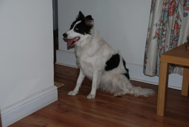
Tuesday 4th November – Home – The inevitable has happened! An advertisement in the pet shop window, a telephone call, a quick house call and we have Maddy. She is a Border Collie, a lot of white with big black patches; her head mainly black with a white blaze and brown eyebrows! Her previous owners have a child who has asthma and the condition was being made worse by Maddy, so they reluctantly had to let her go. She is rather nervous at the moment and I had forgotten what it is like to have a young (9 to 12 months) dog around the house. She also needs a lot of exercise – indeed she is a bit overweight. But it feels great to have a dog again.
Wednesday 5th November – Eaton Hill – Down the road and over the railway and river. It is very wet underfoot, the air is saturated but not actually raining at the moment. Maddy behaves well off the lead. In fact she is a bit wary and keeps close, but starts to gain confidence. She picks up sticks and expects me to throw them. By the horse paddocks she meets a small stumpy pony but when the larger horses gallop across the field towards her she gives a short bark and is off. It is a worrying moment, but she does not go far and is waiting round the bend for me. She allows herself to be led past the horses and is happy again. Up the path to the south end of Eaton Hill and then south again. A path leads up to a field but there is a sign stating the footpath is closed because of a dangerous footbridge ahead. A deep, old track leads back down the hill but stops at a large bramble thicket. So back down the footpath, which I notice crosses another old track which is also choked with undergrowth. Several flocks of winter thrushes fly overhead. Back across the rough pasture and down the road to Eaton Bridge. Maddy pulls a lot on the lead, a habit she will be cured of, and does not like traffic, which is no bad thing.
Friday 7th November – Hereford – Off to the big city by bus. The bus is larger than the ones I have seen on this route before and yet it is still full. From St Peter’s Square I head into High Street. Here stands “The Old House”, a Jacobean house now a museum. Built in 1621 it houses a large quantity of contemporary furniture, household goods and wall decorations. The dark woods used throughout could give the rooms a gloomy feel, but with the large fires lit I think cosiness would be a better description. Outside the city is bustling. I had thought of Hereford as a small city in a rural area – which it is – and thus different from the great cities of the North which I am used to. But in many ways it is just the same, and not my sort of place. I wander down to the cathedral but in here there is still a lack of tranquillity. Off to the east there is a large green with a mound in the centre containing a column commemorating the life of Lord Nelson. A pair of cannons stand at its base. This is Castle Green where Hereford Castle stood. The site is next to the River Wye and had been an important defensive site before the Conquest. The first wooden motte and bailey castle was erected here in 1052 by Ralph the Timid, son of the Count of Vexin. This castle was destroyed in 1055 by the Welsh under Gruffudd ap Llywelyn. A Norman castle was built on the site by William Fizt Osbern, Lord of Breteuil in Normandy and Earl of Hereford. His son lost the castle in 1075 after his marriage to Emma, daughter of Ralph Guader, Earl of Norfolk – a marriage prohibited by the King, William I. Roger and Ralph rebelled against William but were defeated. The castle changed hands during the wars between Matilda and Stephen in the 12th century before Matilda’s son, Henry II granted it to Roger of Gloucester, who also rebelled against his king and lost. Henry IV based himself in the castle from 1400 to 1411 whilst campaigning against Owain Glyndŵr. Although Hereford was a Royalist stronghold during the Civil War, the castle played little part in the conflict. It was sold to Sir Richard Hartley but went into decline and was largely destroyed by the 1650s. According to John Leyand, the castle was once “nearly as large as that of Windsor” and “one of the fairest and strongest in all England”. In 1746 the ruins were ordered to be dismantled and the site was transformed into the present Castle Green, the moat being turned into Castle Pool lake. I set off from here to find a pub for lunch, but am largely unsuccessful with most having a poor selection of beers.
Sunday 9th November – Leominster – A damp and miserable day. In the afternoon they sky turns extremely dark and there is a violent downpour, firstly of rain which streams down the roofs and bounces off missing the guttering. It then turns to hail and large patches of icy stones cover the pavement and road. In the evening we go to a concert in the Minster. The Border Voices sing and The Border Waites play mediaeval music by Michael Praetorius (1571-1621) and some of his contemporaries. It is wonderful to hear sackbuts, shawms, viols, recorders, a racket and crumhorns played in the Norman nave.
Tuesday 11th November – Leominster – It seems like the rain may stop for while, although it has not at dawn when I let the girls out. Mid-morning and off over the Kenwater which is even higher and flowing fast. Across the A44 and along beside the railway. The paths are, inevitably quagmires of mud. Maddy’s underparts are quickly coated. The path meets the River Lugg and a disused rail line, the old Leominster and Kington Railway, later the Great Western Railway Leominster and New Radnor line. The River Lugg here is a relatively new channel. In 1961, Mr S.R. Booth, the first Labour Mayor of Leominster, proposed: “A new cut to the north of the Kington line, under the main railway line, to rejoin the Lugg below Ridgemoor Bridge.” Work began in 1962 and has made the regular flooding of Bridge and Mill Streets a distant memory. Flocks of Redwings pass over, some alighting on the tops of tall trees before heading off again. A Grey Wagtail pipes as it flits up the river, landing briefly on the bank. Equally brief is the appearance of a Kingfisher which alights on a thick twig by the edge of the river but quickly notices my presence and is off upstream. A Wren calls from a patch of brambles. Large numbers of Blackbirds are moving through the gardens of the housing estate on what was called The Marsh before the river’s diversion. The path crosses North Road and continues as a metalled road down to a farm.
Friday 14th November – Stoke Prior – Down the road and along Southern Avenue and up over the old A44 bridge. The road is now pedestrianised but this was one of the main routes into Leominster before the bypass was built. Both on the west and east sides of the old road are heavily laden Hawthorns and large numbers of Redwings feeding on the crimson berries. Over Eaton Bridge and off south along the road to Stoke Prior. A Cormorant passes over high in the sky. Maddy does not like roads much but she needs to get used to such things. The road passes Eaton Hall, now a farm. The house, once moated, was the seat of the Hakluyts (a Welsh not Dutch name). It was been said that they were given the house by Owain Glyndŵr when he invaded in 1402. Richard Hakluyt (1553-1616) a noted Geographer lived here. A little further on is another fine building, Eaton House. The fields around here have large pools of standing water. One pool looks more permanent and contains a large flock of Lesser Black-backed Gulls (and interestingly, as far as I can make out, no other species of gull). There are also a couple of pairs of Mallard, a pair of Pochard and a male Goldeneye. It seems early for the Goldeneye to be present and the diving ducks indicate the pool is of some depth. Along the road some more past a house called “The Pound” where a willow is coming into blossom. Yet further on is another large house, “Wheelbarrow Castle”. The name may indicate that a barrow (Bronze Age burial site) was present in the vicinity.
Castle Field, a short distance further on is full of Fieldfares all chacking away noisily. Two large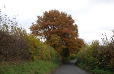 Oaks stand by the lane, gleaming gold against the grey skies. The lane enters Stoke Prior, a pleasant village with a mixture of old and newer properties. The village lost its railway in 1952 but a bus still passes through. The church, St Luke’s, was entirely rebuilt in 1863, although it may stand on Norman footings. A large set of farm buildings called “The Bury” have been converted into dwellings. The 1851 Directory recorded several tailors, a boot makes, shopkeeper and wheelwright as living in the village, although the majority of occupants were farmers or farm labourers. I head out of the village in a south-easterly direction until Hill Top farm. From here a Roman Road, believed to have been based on an older Iron Age trackway along the edge of the Marches, runs north-west on a ridge. It passes over the now almost unrecognisable disused railway line. Just beyond, to the north-east was the site of Blackwardine Roman fort, although some think it a village settlement. The site was damaged when the railway was built and limited excavation has taken place, but it seems to have been occupied in the late 60s to early 70s CE. However, a fort would make more sense at an earlier date, around 48CE when Ostorius Scapula advanced against the local tribes. A lane from here leads back down the hill to Stoke Prior. Past the local school and The Priory, a large house probably dating from the 14th century. On the other side of the lane is a large orchard. A sort of ride-on “mower” is collecting fallen apples and depositing them in a hopper on the back. The lane winds down to Great House farm, another fine farm house set in lawns. Back into the village past a barn that is being virtually demolished and built again, as a house I should imagine. The lane back to Leominster passes The Lamb public house. I tie Maddy up in the smoking area and head for the bar. She is unimpressed and barks loudly. I get a pint for me and some scratchings for her. As I leave to bar opposite far above the hillside, three Common Buzzards are hanging motionless in the wind. Then one without any perceptible movement of its wings, slips away before circling around and coming to a halt over another patch of countryside.
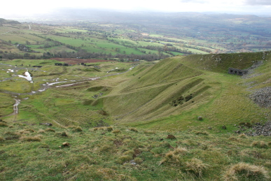
Tuesday 18th November – Clee Hills – The Clee Hills rise out of the valley of the River Teme in South Shropshire. They are the tallest hills in the district, indeed it is said that eastwards from them the next range of mountains is the Urals in Russia. They are formed of a red Devonian Sandstone, laid down when this was the southern edge of a continent, called appropriately “The Old Red Sandstone Continent”. There were mountains to the north and great rivers which brought down the red muds and sands that formed the beds that make up the Clee Hills. Titterstone Clee has eroded to expose Carboniferous limestones, gritstones and coal. Through all of these layers, volcanic rocks have pushed up, capping them with a hard black stone (dolerite) locally called Dhustone meaning simply “black stone”. The village of Clee Hill lies high on the flanks of the southmost hill over looking the Teme Valley. A common of grass and brown bracken spreads out down the hill. The view are extensive, although there is a considerable mist today which makes it harder to make out distance hill ranges such as the Cotswolds, the 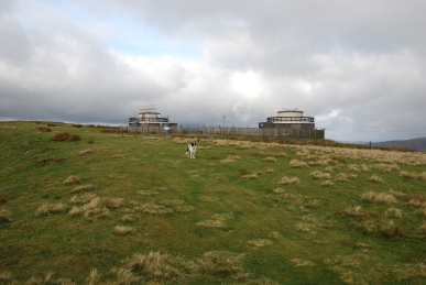 Black Mountains and the Brecon Beacons. Beyond the town, quarrying is still being carried out.
Back through through the town and out on the Ludlow road is a turning to Clee Titterstone summit. A narrow lane leads across fields and moorland up to a car park high on the hillside. Below are the remnants of years of quarrying and mining. Long inclined planes lead down from ruined buildings. Deep holes dot the landscape. A road leads round the hill and a path heads for the summit. The summit contains an extensive Iron Age fort, but it has been lost to a huge quarry that eats into the hillside and to the modern buildings containing radar equipment for the National Air Traffic Control Authority. Towers bristle with antennae, white “golf 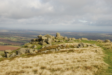 balls” sit silently and a receiver-dish sweeps round and round. At the far side, a scarp slope falls away steeply. A triangulation point stands by a circular enclosure dated to the Bronze Age. Lines of stone indicate where the walls of the fort stood – insufficient earth here to build ramparts. Another pile of boulders called the “Giant’s Chair”, a shattered mass of rock from the Devensian glaciation between 120,000BCE to 11,000BCE. There are many legends regarding the stones being left after a battle between giants and other tales relate that there was a great rocking-stone here which gave the hill its name “Titterstone”, originally “Tilterstone”. The hilltop is covered in tussocks of moss and scattered with numerous small fungi including, Tephrocybe palustre, Yellow-white Mycena, Small Bleeding Mycena and puff balls. Ravens call their guttural cries. In the distance tower blocks can be seen – Wolverhampton or maybe even Birmingham.
Thursday 20th November – Presteigne – A market town just over the Welsh border, formally the county town of Radnorshire, but now in Powys. It lies in the Lugg Valley, surrounded by gentle wooded hills. It probably developed as a small settlement around the Minster of St Andrew (the Welsh name of the town being Llanadras). In the 12th century the town was known as Presthemede, meaning the “border meadow of the 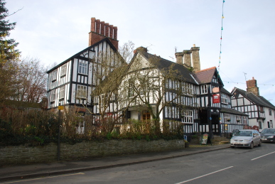 priests”. In the 13th century it was under the control of the Mortimers and passed to the Crown when they fell. The population was mainly English until the Black Death and the raids of Glyndŵr, after which the population became mainly Welsh. There were disastrous plague epidemics in the 16th and 17th centuries, and a great fire of 1681 which destroyed much of the town. Presteigne was the location for the Great Sessions from 1541, similar to the English Assizes, and later became the venue for the Quarter Sessions, which dealt with lesser crimes. The main street contains shops housed in a delightful variety of buildings, mainly late mediaeval. The Assembly Rooms were built in 1869 in a Gothic style with a tall thin tower. The magnificent Jacobean Radnorshire Arms has extensive subterranean passageways and a dungeon beneath it where Parliamentarian sympathisers in the Civil War
  were tortured by the Royalist governor of Hereford, William Vayasour. The owner of the house was John Bradshaw (1602-1659), one of the men who signed the death warrant of Charles I. In the 18th century it was owned by Sir Henry Vaughan, who was lynched on the premises and his dismembered body buried in the garden where a cherry tree now grows. The Warden is a wooded hilltop park where a Norman wooden motte and bailey castle stood until destroyed by Llewelyn the Last in the 13th century. It is noticeable how the wind blows when out of protection of town. Maddy chases her ball through swirling golden Beech leaves on what was a bowling green. Rooks and Jackdaws are calling overhead. Back into town and down past the church to the River Lugg. A small single carriage width bridge crosses the river and into England. The river is not deep but flows clear and swiftly under the ancient piles. Back up the street is Well House and behind it up an alley, Well Cottage. Steps lead down to a door which probably gave access to the well.
Tuesday 25th November – Hergest Ridge – At last some fine weather. Indeed, as Kay commented, at least we are getting weather now and not the continuous soul-destroying greyness day in day out. We park in Kington and set off for the road to the hills. Ridgebourne Road climbs steadily for nearly a mile passing pleasant houses and cottages. Beyond Hergest Croft, a huge house, is a large arboretum. Opposite, smoke rises from behind a hedge from chimney of Gardener’s Cottage. Finally we reach a gate and are out onto the wide expanse of Hergest Ridge. Grass trails pass through 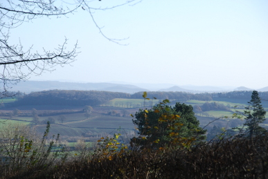 large areas of brown bracken. A JCB is clearing scrubby Hawthorn and piling it on a massive fire. We keep heading uphill. Carrion Crows pass over. To the north is Bradnor Hill, with a golf course on its flanks. Beyond that is Herrock Hill with what looks like a cave half way down its steep slopes. North-west Hanter Hill has a scrubby tree cover with large outcrops of limestone down its sides. Further north from Hanter Hill, Old Radnor Hill is scarred by a massive quarry – Gore Quarry that is still tearing down the hilltop. We reach a seat that faces east and we sit awhile. Looking back eastwards towards the way we have walked presents a glorious view. Hills, valleys, plains, fields and villages spread into the distance. The nearer hills such as the conical Pyon Hill and Dinmore Hill are dark with their conifer caps. Further, the Malverns, Shropshire Hills and the distant Cotswolds are indistinct in the mist – the “blue remembered hills” of Housman. It is easy here to throw a ball down the slope for Maddy to hurtle after and then she has to climb back up to us – good exercise for her at least!
Friday 28th November – Leominster – The morning is dark and freezing. The grass crunches underfoot. Maddy demands to have her ball thrown across the park despite the fact it is near invisible in the gloom. However, she does manage to catch it, most of the time. Once through the gate and onto the meadow she starts hurtling after rabbits, which are invisible to me. She disappears for some time along the row of trees and undergrowth at the edge of the churchyard and then re-emerges in full tilt. Later in the morning a mist has descended as we head off down Broad Street and into Vicarage Street. Brook Hall, both a masonic lodge and a church of sorts, stands on the corner. Behind the hall is an orangery, now a private dwelling and stables which look unimproved. The road ends and a footpath runs alongside the Kenwater. It is sodden underfoot. Robins, Chaffinches and Bullfinches flit up from the grass into the willows lining the bank. The Kenwater turns north and the path follows westwards along Pinsley Brook. An apple tree by the brook is surrounded with dropped fruit. The silence is broken as the path approaches a small weir across the brook. There are some large stones set into the far bank so the weir may well be man-made.
The path 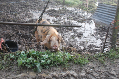 ends at a barbed wire fence so I retrace my steps and take another path south-westwards. This meets a well used path running through hedgerows. The path then runs alongside a field, across which the route of Pinsley Brook is marked by a line of trees. This path joins a track which leads to Wegnalls Farm. A black-spotted ginger pig rushes to the edge of its sty grunting loudly. A pair of farm dogs approach barking, sniff Maddy briefly and then follow us, barking continuously. Maddy is unimpressed and wishes to get away. The track joins Ginhall Lane. Along the lane for a short period and then a footpath heads northwards past the allotment site. Then heads along a track to the “Figure of 8” cat hotel! The name is old and refers to two loops of the brook forming a figure of 8, although the building used to be called “Waltons”. The path runs under Cursneh Hill, locally a high point with a triangulation point standing at 108 metres. From the hill sheep look down at Maddy, who looks then ignores them. This path crosses fields and stiles, one having what is close to a pond around its base! Another field is sweet corn stubble. The old maps seem to indicate this field was once an apple orchard. The path then arrives at the hamlet of Cholstrey. Down to the main road and back towards Leominster. Maddy does not like roads with traffic passing closely. A pile of prunings has fallen off a vehicle and blocks one carriageway. It causes quite a snarl-up until a council truck arrives to clear the obstruction away.
Saturday 29th November – Leominster – The Christmas Lights are to be switched on. We make our way to Corn Square where a crowd is growing. A van in the corner has a mobile disco and someone even dances. A children’s roundabout, hot-dog and candy floss stands and huge bundles of balloons keep the young happy. Possibly less happy is the cold young man handing out photocopied “extra discount” vouchers for Woolworth. (Woolies has gone into receivership and it looks possible that one of the great shopping institutions will be gone by Christmas.) Maddy behaves impeccably, sitting by the old Post Office and watching procedings. It is cold and getting colder by the minute. Eventually, a “parade” consisting of a Nativity party, the mayor, a skinny donkey and more children enters the Square and heads for the disco-van. The countdown begins and someone “switches” on the lights. Actually, a chap at the top of a ladder just down from us makes the connection in the junction box. A piano starts plunking out a carol and the words are beamed up onto the side of the Constitutional Club. We retreat, well chilled.