Monday 1st October – Hickleton – It is misty at dawn but the sun is slowly breaking through and the mist clearing. It is depressing to see a sign asking people not to steal stones from the old estate wall – the coping stones and several courses have been removed in places. A Nuthatch calls noisily from high in the trees lining the track. It is moving rapidly from branch to branch, pausing only a moment to seek out insects in the bark.
Barnburgh – Although I do not stop at this old village, I heard a tale about it in the pub on Saturday night. John H. (I secretly call him “Ahbut”. John is a typical Barnsley “glass half-empty” person. We can, for example,be celebrating a brilliant win by the football team and John will chip in with a sad shake of his head, “Ah but, they’ll never keep it up..”) Anyway, it transpires that a knight was travelling through Barnburgh, either returning from the Crusades or Doncaster market (something of a difference, John reckons!) when he is attacked by a wild cat. He tries to fight off the cat but it is too strong. He attempts to get to the church but falls in the porch and as he stretches out his legs and dies, he traps the cat against the gate of the porch and kills it. The “true” story is here.
River Dearne – There is a network of footpaths between Harlington and the River Dearne near Adwick-upon-Dearne. A leg of the Trans-Pennine Footpath comes through here. Goldfinches and Robins are flitting through the undergrowth. A new footbridge crosses the river parallel to the old road bridge. A Pied Wagtail is walking along a ledge under the old bridge. Fish break the water’s surface creating swirls. Clouds of midges hover over the river.
Hadden Green – Up the track that leads to Bank’s Hall in the mid-afternoon. A tall Oak has a huge white scar where a large branch and section of trunk has been ripped off. Jays screech in the woods. A Kestrel drifts over the fields. On the other side of the valley is a clay pit, the upper levels of which are now grassed over, whilst the lower levels are bare and black. It is windy and may the last days for the beautiful Red Admiral and Speckled Wood butterflies flitting down the track.
Tuesday 2nd October – Fleets Dam – A grey autumn morning. There are large piles of hardcore around the car park and down beside the river. If they are going to extend the six foot high banking to try to prevent flooding it will look rather a mess. Passing disturbs a Grey Heron on a fishing platform. This results in several herons chasing and squawking until they settle down again. A couple of Black-headed Gulls follow the herons around, hoping for dropped titbits. A Robin is singing in the woods. A couple of Swallows pass over. The Japanese Knotweed is spreading rapidly and a large patch has just finished flowering beside the path. A Dunnock hops through another patch by the entrance. A fair number of Swallows pass over.
Holme – A small village on the road that rises out of the Holme Valley towards Holme Moss. Opposite where I park is a spring emerging from a retaining wall under a garden. Cottages and farm buildings line the road, along with the village pub. Up the hill, Holme Moss is covered in low cloud. The gentle hummocks of Pennine ridges run across the skyline, cut deep by cloughs carrying streams that form the River Holme. The valley sides are often covered by Forestry Commission softwood plantations. Deciduous trees fill the valley bottoms in thin strips along the streams. A Mistle 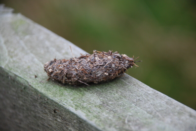 Thrush rasps from nearby. Blackbirds are in the fields and fly off into Hawthorns. Black cattle feed in a sedgy field across the valley. Behind are meadows below the open moor which are dotted with sheep. A cock Pheasant flies up onto a drystone wall and proceeds to pick his way delicately down the stones. The old school, now the Sunday School, has a bell in a little tower on the roof. Over the door is engraved “I.E. 1694” when it was built with money bequeathed by Joshua Earnshaw on land given by James Earnshaw. It was rebuilt in 1820 and again in 1838, closing in 1880. A little “square” of cobbles surrounded by cottages leads to a playground with an entrance marked “IA GB 1696”.
A road leads upwards, Meal Hill Road. Past some cottages, many with delightful displays of flowers, and the Liberal Club. The Board School that replaced the old village school is still in use with children rushing around noisily, hopefully for the teachers, burning off excess energy. There is a tall stone chimney at one end of the building with a bell in an alcove. The road steepens and passes Meal Hill, a row of cottages. The road turns into a track and crosses the hill. A spur heads off steeply down towards Digley Reservoir. Meal Hill Road continues straight across the hillside. In one field a bright orange waterpipe feeds an old moss-covered stone trough set into the ground. Meadow Pipits are numerous, squeaking continuously as they flit from wall to fence to heather and then start chasing one another. Another track heads off at right angles. The ruins of Green Sikes on Holme Moor can be seen straight on. I take the track off, a deeply 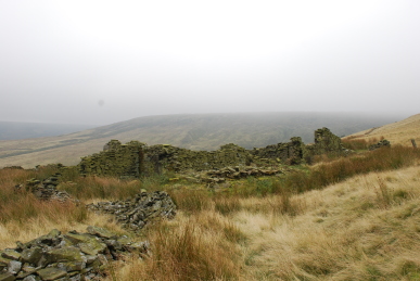 rutted affair once called Cliff Road. The path rises steadily between stone walls with fields beyond, some empty, others with sheep. To the north is Round Hill, followed by Round Hill Flat. The track ends at a gate. On the gate is an owl pellet, the regurgitated remains of its meal. Up here it is most likely a Short-eared Owl. There is an indicator that shows the path continues across the moorland. The path is a sedge strewn affair between a broken down wall and the
 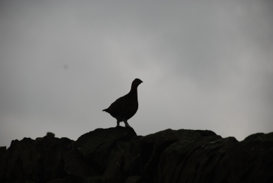 footings of another wall. It arrives at the ruins of Holme Cliff. Up the hill, in a notch, is a television aerial with a large solar panel. It is not obvious to me what it is for! The path is supposed to carry on across the hillside and then turn down towards the tiny hamlet of Lane. There is no discernible path, just a few sheep tracks. Toadstools, including some Liberty Caps nestle in the rough grasses and sedge. I reach the edge of a steep clough from which there is no sign of a path. Downwards looks steep and very rough, so after much checking my position I regretfully decide to return the way I came rather than risk my dodgy knees and ankles. On the way back, I slowly approach a Red Grouse standing on a wall. From the road up to Holme Moss, I can make out the path I could have taken down the hillside, but it is still unclear where it joined the path I was actually standing on.
Friday 5th October – Barnsley Canal – A bright sunny morning. The sky is “gin clear” as the weatherman described it twice in this morning’s forecast. A few patches of grass show a touch of frost. Crab apples are scattered along the tow-path having fallen from a heavily laden tree. Hawthorns are also full of dark red fruit. Vermilion rose hips adorn the briars. A Robin sings snatches of song.
Saturday 6th October – Glen Howe Park – This park is on the hillside above 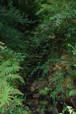 Wharncliffe Side on the opposite side of the Don valley from Wharncliffe Woods. The Park was given to the people of Wharncliffe Side in 1917 by local paper manufacturer Joseph Dixon and his friend John Mills, who had previously purchased the area for £1000, for use as a pleasure garden. Before this the area was previously known as Haw, How, Hall or Howe Wood. In 1974 it became administered by Sheffield City Council. An open area of green extends down from the car park. Up from this is a track that leads into the park. A small stream tumbles down the hillside beside the track. The woods are mature, dominated by Oak, Sycamore, Beech and Holly, with many other species present. A Jay calls high in the canopy. The track gently curves up to Glen Howe Tower, built in 1881 by John Mills who lived there until 1917. A little further up is a packhorse bridge that used to stand in the Ewden Valley. Built in 1734, it was moved to its present site in 1926 when More Hall reservoir was built. There are references to remains of a mediaeval moated hall here. There are memorials to Sir Arthur Cyril Pearson who was a wealthy London newspaper publisher who used his newspaper, “Pearson’s Weekly” to raise public donations for charitable purposes. One of these was “Pearson’s Fresh Air Fund”, established in 1892 to provide impoverished children from London’s East End with a day in the country. Having succeeded in raising large sums of money he proceeded to invite responsible organisations from other towns and cities to apply for funds to cover the cost of similar excursions. In 1893 a group of Sheffield teachers formed a “Fresh Air Group” and one of the most popular destinations was Glen Howe Park. We cross the bridge and follow a path through the woods that drops back down to the track. Back near the car park a Great Spotted Woodpecker is calling from a tree, but remains hidden.
Bradfield – Two villages make up the centre of the extensive Bradfield Parish, the largest in England, to the west of Sheffield, High and Low Bradfield. We stop at High Bradfield, whose name would simply have meant “Broad Field” meaning an open stretch of 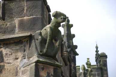 countryside. It stood on one of the Salt Roads that brought salt from the mines of Cheshire. At the end of a pretty street, Town Gate, stands the Church of St Nicholas. There is evidence of an Anglo-Saxon church having been on the site. In the 11th century a new church was built by the de Lovetot family, Lords of Hallamshire in Ecclesfield, followed by two chapels-of-ease, in Sheffield and Bradfield under the control of St Wandrille’s Abbey, a Benedictine house in Normandy. This chapel was replaced in the 14th and 15th centuries by the present church. Gargoyles look down from the roof, one is a dragon which recalls chivalry and good-versus-evil and another is a Talbot dog, for the Talbot family, Earls of Shrewsbury who were Lords of the Manor for over two centuries. Tomb stones are laid in the path leading to the entrance, some with beautiful script from the 18th century. In the porch one of the stones has a cross set sideways carved into it, a sign that it is a
  reused coffin lid. In the main body of the church there are oak chandeliers designed by G.G. Pace in 1951 when electricity reached the village. Although the roof beams are relatively new, the original bosses have been retained, ranging from simple foliage designs to heraldic shields and badges such as dragons, an antelope, badge of Henry VI, a pelican, a symbol of piety, a Talbot dog, a unicorn with a royal coronet around its neck, symbol of Christ through its purity and virtue and the Green Man, an ancient symbol of the seasons and the growth of crops. There are some fine stained glass windows, one depicting St William of York (Archbishop – 1141-1147) with St
 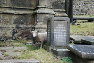 Andrew and St Peter, another was installed in 1877 using salvaged mediaeval glass and a fine window over the alter depicting the Nativity, Baptism, Crucifixion, Resurrection and Ascension. Near the organ, which is being tested, loudly, is a huge oak chest made out of a single tree trunk in the 12th century. It measures 9′ 3″ in length, 2′ wide and 20″ deep and weighs nearly half a ton. It has been strengthened with iron straps. On the wall nearby is a wooden plaque commemorating the disaster on March 11th 1864 when Dale Dyke Reservoir embankment above the village of Low Bradfield collapsed releasing 600 million gallons of water down the Loxley valley towards Sheffield resulting in the loss of over 240 lives. There are extensive graveyards by the church and out on the hillside. Some record the losses of young men in the wars, one in particular who died in a POW camp in Borneo in 1945. Sheep graze the grass in the graveyards. To the north is a large motte and bailey of a Norman castle, now covered in trees.
Monday 8th October – Hoylandswaine – The church of St John the Evangelist stands away from the main village at what was once called Lower Haigh. Further down the road is the National School, now Hoylandswaine J&I School. The church is surrounded by tall Horse Chestnuts which makes it look like it is in a dell. Shiny conkers lay on the path. The building is closed. Behind the clock tower, a pillory, where a miscreant would have his head put through a hole in a hinged board and his hands through either side and be left to be abused by the good people, stands against the wall. A man is in the graveyard and tells me he is looking for a watercourse running through the area. “If I find it today, I be very pleased, but also very surprised,” he states. He is looking for a slight dip running across the grass which may reveal the course. The road heads up past the Pinfold and onto the Barnsley Road, at what was once called Greenside. The village has now been bypassed to the south. The Rose and Crown is an old pub. There was the Blacksmith’s Arms further up the hill, but this seems now to be a row of cottages. Opposite the junction is an overgrown apple orchard and the war memorial. Normally there are long lists of those who died in the First World War and a much shorter list of those who died in the Second World War, but here there are only four names for the first conflict and three for the second. Down from the junction is Mustard Hill, a place where mustard seed was grown? Between here and the Pinfold is the cricket ground and bowling green. Mustard Hill Cottages and others down the hill look like they date from the 18th century, but many other modern buildings have filled the area. The Post Office is shut down. The 1925 OS mark is at the base of its wall. Mustard Hill Well is behind a little wooden door in a brick built surround, restored in 1999. Skin Pit Lane heads up towards the bypass. There would have been evil smelling pits here, using large amounts of urine, to cure leather. Over the main A628 is a small group of cottages once known as “Top of the Green”.
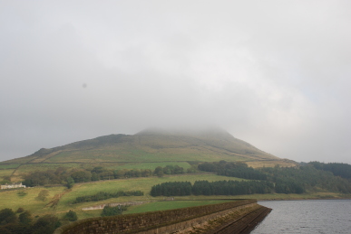
Wednesday 10th October – Dovestones Reservoir – This reservoir is in a valley outside the village of Greenfield, in the district of Oldham. The journey over the Wessenden and Saddleworth Moors was unpleasant with heavy fog and an idiot right up behind me all the way. Dropping below the clouds into Greenfield was a relief. The reservoir was built in 1967  to provide water for both surrounding villages and Great Manchester. Greenfield Brook ran down the valley and was dammed in 1880 to form the Yeoman Hey reservoir and again in 1902 to form the Greenfield reservoir. It is apparently called Dovestones because of a rock formation on the skyline that looks like a dove, however, some of us have always called in Duckstones as there is a formation looking far more duck-like! There has also been a moor called Dove Stone Moss for many years. It has been many years since I was last here – indeed, I think the last time was a rather illicit visit early one morning with Beardy Dave (now, sadly deceased) to collect magic mushrooms, now completely illegal! A track runs round the reservoir. It is busy. A large flock of Mallard are expecting to be fed. Black-headed Gulls keep watch slightly further out on the water, whilst a flock of motley feral pigeons watch
  from the roof of the sailing club. Old Beeches stand near the path, their roots probably in not much soil as large rocks abound. Here and down to the water are new trees planted in memory of loved ones in the “Life for Life” scheme. Over the far side of the valley, Alderman’s Hill is still topped by cloud.
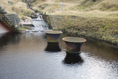
The path crosses Chew Brook bubbling down from the moors. All around are steep hillsides topped with crags. Further along the path is Ashway Gap where a fine Gothic house stood. Built in 1850 by John Platt as a hunting lodge, it fell empty in 1871. The Ashton, Stalybridge and Dukinworth Joint Waterworks used it as a committee room during the 20th century apart from war time, when in the First World war it was used as a hospital with 50 patients and in the Second World War as an Italian prisoner of war camp. Sadly, it was demolished in 1981. There are marker posts with “ASDWW”, initials of the water company all round the reservoir. Just further up the valley was the filter plant, built in 1912 and demolished in 1989. At this point I leave the path and follow the stepped water channel running down the hillside. It is a steady climb. Meadow Pipits and a Wren dart about the bracken and heather. The channel comes to an iron bridge with two bell-shaped water chutes emerging from the bed of the 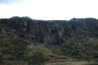 channel. Beyond is a steep channel rising up to a tunnel, 1260 yards long that bypassed the earlier reservoirs to provide water for the mills down the valley. Burnsie and his mates have apparently walked through this tunnel during a dry spell many summers ago. High on the edge of the moor above is a cross, a memorial to James Platt, brother of John and MP for Oldham, who was accidentally shot and killed on a grouse shoot. Red Grouse are calling across the hillside. A path crosses the hillside, the Rough, passing under Dean Rocks, Great and Little Dove Stone Rocks, which have been quarried in the past and are now a rock-climbing venue of note (although many of the rock faces look green with algae and there is not a lot of evidence of chalk marks left by climbers, maybe not so popular these days.) The path is rough here with boulders and rocks emerging from the thin soil. The path descends into what were called Higher and Lower Hollins Plantations, but the trees here are young and much of the areas of plantation are now open sheep pasture. A pair of Red-legged Partridge are pecking at the seed heads of grasses. There is less wind here, although it is not a lot lower, and the sun is now hot having burned off the mist and raised the cloud level.
Friday 12th October – Heath – A very picturesque village to the south-east of Wakefield. Passing through the open common, with horses grazing, the Whittling Well is a Georgian stone arch which was a watering station for the animals and a pump for fresh water. Beyond is Lady Bolles Water Tower, a restored tower that pumped water up 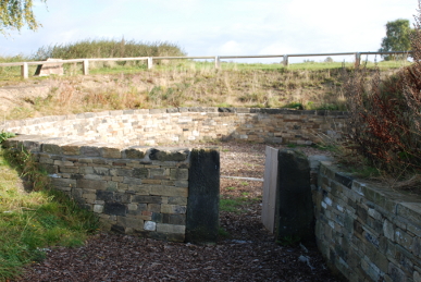 from a spring to provide it for a local iron works and a gravity feed to Heath Old Hall. A car park is on the edge of the village by the common. A little way into the common is the Pinfold, which has been restored recently by the village. It consists of a circular stone lined pen built into the hillside with the entrance on the lower part. A Pinder would use the pinfold to hold stray animals on the common, releasing them for a fee. Beautiful Silver Birches shine in the morning sun. A small flock of Jackdaws flies over. The village is scattered around large open green spaces. The Kings Arms is a 17th century inn. A Magpie used to a regular, nipping into the pub and pinching people’s beer, but it got banned! I have visited the pub long ago and well remember the stone flag floors, gas mantle lighting and fine ales. Beyond, to the north-east is a line of fine houses. The Manor House, Beech Lawn, Dower House and Heath Hall. Then round to the north is Heath House. These are all large 17th and 18th century country houses. Most have “ha-ha’s”, a ditch by the walls that meant that animals could be kept out without a tall wall to spoil the view. Interspersed between these mansions are smaller cottages of the villagers. The history of Heath goes back much further than the present houses. It is said that near Heath was the moot, the Viking parliament for the West Riding. Near the Manor House is a long footpath between two hedges. It leads to a field of some plants with long thin leaves with a pale stripe up the centre. I wonder if they are a sort of switchgrass, grown for bio-fuels? Beyond the field is a well made drystone wall and Gled Hill. The name is usually reckoned to be from the Old English for “a hill with Kites”, although it is not clear why the bird would frequent this hill in particular. Another source considers it to be an old Norse personal name.
Monday 15th October – Barnsley Canal – The leaves are changing colour quickly. Throughout the country there are wonderful vistas of reds, golds and browns. On Willowbank in a soft morning sun, a tall Silver Birch glitters with golden leaves next to an Ash which is turning a delicate yellow. Down through the thickets and along the canal there is a constant 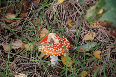 rustling and slithering as leaves fall in little gusts of wind. The thicket of Japanese Knotweed beyond the footbridge is turning yellow. It looks beautiful and it is such a pity it is such an invasive plant. Many red and white Fly Agaric nestle in the grass under the birches, but no boletus. It maybe that now celebrity chefs and Sunday newspapers have popularised wild fungi, collectors have already taken them. Various chirps and cheeps come from tits in the bushes and short bursts of song from Wrens and Robins. Half a dozen Mallard rise up noisily as I approach and Moorhens swim jerkily across the canal into the reed bed. Many rose briars have the spiky red bedeguar galls on their stems. I take a look down the old footpath across the meadow to the North Gawber bridge. There is now a small pond across the path and extensive reed beds to the north. Tiny yellow flowers of Black Medick are like little jewels in the long grass. A huge and ugly warehouse is being constructed on the edge of the industrial estate to the north of the end of the canal. Water cress is growing in the channel that drains the field up to Greenfoot. It tastes hot and peppery but I am not sure of the source of the water so I do not risk swallowing any leaves. A huge black slug is crossing the path.
Tuesday 16th October – Burton Bank – Kay and I wander along the paths of this reclaimed slope above the Wakefield Road. From here one can see Barnsley lying on the hill up from the River Dearne. I have commented before on the poor architectural merit of the view and it has not improved. A sickly green curve stands above the new transport interchange. A block of offices has been built in County Way with long panels of timber which have no resonance with the surrounding sandstone buildings. Westgate has joined John Rideal House as eyesores on the top of the hill, overshadowing the Town Hall and Parish Church. Behind are the 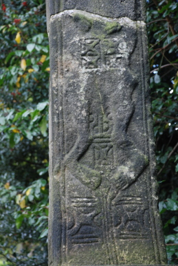 Council’s pride and joy, four towering cranes on the construction site of the Gateway Plaza. Yet again, the lessons of the past have not been learned.
Cawthorne – In the churchyard of All Saints Church stands a cross. The top and base are probably 10th century Anglo-Saxon with a more modern central column. The base is square with carvings, those on the western side depicting a pair of legs. Sadly, the continuation of these legs is missing. There is the head of another cross is built into the wall under the East Window of the North Chancel Aisle. Charles Tiplady Pratt, writing “A History of Cawthorne” in 1881, considered the cross to be of the 11th or early part of the 12th century. On the other side of the path, behind a thick hedge, is the family mausoleum of the Spencer-Stanhope family. It is a sizeable construction built into a bank. The gravestones in the churchyard start in the mid 17th century, Tiplady Pratt records one of 1630. By the path, lying flat is the grave of John Lindley who was interred in 1654. A number of occupations are recorded – Thomas Walton, a wheelwright who departed in 1701; George Marsden, a carpenter, 1850; Mark Hall, a blacksmith, 1727 and Matthias Greenwood, Parish Clerk, 1852.
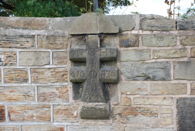
Emley – A quick stop at St Michael the Archangel’s Church. Graves seem to have been built into the wall between the vast green churchyard and the road. One looks like the arched entrance to a vault with the words “Wiglesworth 1673” carved into it. Another is a small black plaque recording “John Jackson, Schoolma 1732” and a third is a double armed cross with “PH 1683”. A little up the road is a small open space created around the old pump. The shelter has, unfortunately, suffered at the hands of vandals with spray cans. At the top of the road is the stump of the market cross, destroyed in the Civil War.
Thornhill – Up the hill to Combs Hall, built in 1661, surrounded by new housing. Further up the hill is the old school, supposedly now a community centre but is a very dilapidated state. Opposite, the Old School House is a nice residence. A path leads into the cemetery of the church of St Michael and All Angels. Here there is reported to be parts of another Anglo-Saxon cross, but it would appear they are in the locked church. A blue plaque on the wall records that John Michell BD, FRS, 1724-1793 was rector here. He was famous in the field of magnetism and astronomy and made a torsion balance to weigh the world! In a corner of the churchyard is a small monument in remembrance of the 139 men and boys killed in the Combs Colliery disaster of 1893 and 12 men of the Thornhill Ingham Colliery who were killed in 1947. Near the church building is the gravestone of Richard Swallow, who died in 1703 at, for the time, the extraordinary age of 101.
Wednesday 17th October – Crofton – A former pit village south of Wakefield that is now more of a dormitory town for the city. It is recorded in the Domesday Book as Scroftune. I am looking for two Anglo-Saxon crosses but as yesterday, it appears they are in the church. Beyond the church gate are the old stocks. Outside the church building are gravestones laying on and beside the path as is so common around here. They are from the early 18th century onwards. The building dates from 1430 but probably on a far older structure. Against the wall is a stone coffin. In the lower graveyard is a large mausoleum of the Wilson family of Crofton Hall, which laid to the north-west of the village. The hall was built in the 1750s but the Wilsons moved away in 1935 and the building was demolished in 1980. A large Ivy bush nearby is being visited by numerous bees and a Red Admiral butterfly. The main road seems to be mainly modern housing with a large school standing beside the Old Hall. There is a terrace with a relief celebrating the Diamond Jubilee of Queen Victoria. Another range of buildings in Stack Lane also has a smaller relief. These would date the whole area to this period. Otherwise, there are extensive modern housing estates.
Friday 19th October –Woolley –The village of Woolley lies on the slopes of Woolley Edge above the Wakefield Road. It is over the hill from the now closed Woolley Colliery. It is an old village, dating to before the Norman Invasion. Pre-invasion it was called Wiluelai and was held by Turchil, a Saxon and valued at twelve carucates for geld. There was land for eight ploughs, one villein, one sokeman, and one bordar with two ploughs and one acre of meadow. It was then worth three pounds. In “The Manor and Church of Woolley”, by J. W. Walker, O.B.E., F.S.A. (Yorkshire Archaeological Journal, vol. 27, pp. 249-318 (1924)), Walker states that, “About 1210 John Tyrel of Burchesclive (Bushcliff) let lands in Woolley lying next the Wolfpit to Thomas de Dicton, son of Geoffrey Butler (Pincerna) of Dicton (near Huddersfield). This Thomas and his brother Henry bought much land in Woolley from the Tyrels, the Crigglestones, the Brettons of West Bretton, and the Mores. Henry de Dicton, ..., married Eva, widow of Henry de Wolvelay, who was lord of the manor of Woolley, and she brought as her dower the lordship of Woolley, lands in Woolley, and two parts of the mill of Woolley, which came to her from her late husband. As there was no issue of this marriage Henry de Dicton granted to his brother Thomas the homage and service of all his lands in Wolvelay whether in demesne or socage; and bequeathed a moiety of the mill of Woolley with his body to St Oswald of Nostell; to be buried at Nostell Priory; 1188-1190.” Thomas de Dicton’s daughter, Margaret, married John de Stainton and had five sons, John, Thomas, Robert, William and Godfrey. Godfrey received 116 acres of land with the lordship of Woolley from his mother. Godfrey de Stainton was murdered at Ackworth in 1330, and left a son John and a daughter Elizabeth. Margaret de Stainton held Courts Leet at Woolley in the early years of the 14th century. She died in 1316 and was succeeded at Woolley by her eldest son John, who died leaving four daughters, Isabel, Elizabeth, Joan, and Alice. His widow Joan married Hugh de Tuttehill, son of Thomas Tuttehill of Tothill, near Brighouse, who married two of his sons to Isabel and Joan, and placed Elizabeth and Alice as nuns at Kirklees Priory. Elizabeth became Prioress of Kirklees Abbey and it is said she brought about the death of Robin Hood:-
From Walker:
Now Robin is to fair Kirkley gone,
As fast as he can win;
But before he came there, as we do hear,
He was taken very ill.
And when that he came to fair Kirkley-hall,
He knock’d all at the ring,
But none was so ready as his cousin herself
For to let bold Robin in.
Will you please to sit down, cousin Robin, she said,
And drink some beer with me?
“No, I will neither eat nor drink,
Till I am blooded by thee.”
Well, I have a room, cousin Robin, she said,
Which you did never see,
And if you please to walk therein,
You blooded by me shall be.
She took him by the lilly-white hand,
And led him to a private room,
And there she blooded bold Robin Hood,
Whilst one drop of blood would run.
She blooded him in the vein of the arm,
And lock’d him up in the room;
There did he bleed all the live-long day,
Until the next day at noon.
|
From “A Gest of Robyn Hoode” 1490
Robyn dwelled in grene wode,
Twenty yere and two;
For all drede of Edwarde our kynge,
Agayne wolde he not goo.
Yet he was begyled, iwys,
Through a wycked woman,
The pryoresse of Kyrkely,
That nye was of hys kynne,
For the love of a knyght,
Syr Roger of Donkesly,
That was her owne speciall;
Full evyll mote they the!
They toke togyder theyr counsell
Robyn Hode for to sle,
And how they myght best do that dede,
His banis for to be.
Than bespake good Robyn,
In place where as he stode,
“To morow I muste to Kyrkely,
Craftely to be leten blode.”
Syr Roger of Donkestere,
By the pryoresse he lay,
And there they betrayed good Robyn Hode,
Through theyr false playe.
Cryst have mercy on his soule,
That dyded on the Rode!
For he was a good outlawe,
And dyde pore men moch god.
|
The lands and hall became the property of the Woodroffe family until 1559 when it was sold to the Wentworths. It is a cold and damp autumn morning. A large spreading Sycamore dominates the village green. Up High Street where there is a mixture of old and newer properties and a farm. There are several working farms or former farms in the village. High Street comes to a junction with Church Street and Finkle Street. Along Church Street is St Peter’s Church. There was probably a wooden Anglo-Saxon church here which was replaced by a small stone church around 1150. The church was extended in the 13th and 14th centuries and rebuilt between 1470 and 1520. The interior was rebuilt in 1871. Outside is a circular cross base, probably medieval, in which is sunk a short section of the square cross shaft. A goodly number of finely carved grave slabs lay on the south side. A grave of Susanna and Anne Fretwell, 1707 and 1714, which are Grade II listed, refer to them as “of Britain”. They were certainly from Bretton, which is usually taken to have come from a “farm of the Brettas”, they being a local Celtic tribe. One wonders if “Britain” is simply a spelling error? Also Grade II listed are the pair of shrine-like tomb chests - of uncertain date but possibly Norman. Walker mentions that Dr Johnston observed them, and was told that “they were the tombs of the builders of the church”. A pair of Common Pheasants stand on the churchyard wall. Holly trees in the graveyard have variegated leaves and are heavy with a very good crop of vermilion berries. Back to Finkle Street. As mentioned before, Finkle is supposed to come from the Old Norse meaning a bend or dog-leg. There is a bend in the road, but it is slight. The road ends at the Old School House. Beyond there is a large flock of finches over the fields where a crop is still standing, looking like maize but I cannot see any cobs. Starlings are on the wires and Mistle Thrushes rasp overhead. Beyond, Wakefield is laying in mist.
Saturday 20th October – Barnsley Canal, Old Mill – There has been a frost overnight. A faint mist lingers in the morning air, soon to be burned off by the sun. Water vapour rolls along the canal like wisps of smoke. There seem to be more than usual numbers of Mallard in the canal, heads bobbing up to see if Dill the Dog and I are a risk. Dill the Dog is plodding along steadily. Her back legs are very weak now.
Denby – A large skein of geese, over one hundred in number, pass along the Upper Dearne Valley.
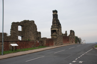
Monday 22nd October – Sheffield – A brief wander around City Road cemetery. This massive burial ground opened in 1881, named Intake Road cemetery, and is still in use. There is a large unused area, so one imagines it will be in use for many more years when many cemeteries are being declared as full. This as yet unused area is called Manor Fields Park and in the late 18th and early 19th centuries was mined for coal. Then onto Sheffield Manor. It has taken years for me to find this ruined building. There are signs far away near the city centre, but they point in the general direction of the area called The Manor, not to the place itself, and there is few signs within the estate. So after all this time, it is depressing to see a fairly sorry sight. The ruins are surrounded by high iron fences and locked gates. A sign states that funding has been obtained to undertake extensive restoration – and it needs it. The Manor, also known as Manor Lodge, is on a hill to the the east of Sheffield which was granted by William the Conqueror to William de Lovetot as part of the Manor of Hallamshire. By 1200, the de Lovetot family had built a church and founded a wooden bailey castle near the confluence of the Rivers Don and Sheaf. The De Furnivals, Lords of Hallamshire during the 13th and 14th centuries, rebuilt the castle in stone and granted a charter to the town of Sheffield in 1297. In 1406, John Talbot, the first Earl of Shrewsbury, acquired, through his wife, Sheffield Castle and its estates, which included the deer park and a hunting lodge on the hill.
In 1516, a grand manor house was constructed on the site of the hunting lodge by George, the fourth Earl of Shrewsbury. it was situated in the midst of the great deer park, which Norfolk Park is now a small remnant. In 1530, Thomas Wolsey was charged with high treason and arrested in York. He stayed at Manor Lodge as a guest of the fourth Earl for 18 days after which he was forced to continue his journey, but died two weeks later at Leicester Abbey, never reaching London. The sixth Earl of Shrewsbury, another George Talbot, married the rich and powerful Bess of Hardwick. Due to her influence, he significantly enlarged and improved Manor Lodge and other buildings on the site. In 1574,Talbot added the three-storey turret house that still stands today. Mary Queen of Scots and her entourage were held between Sheffield Manor Lodge and Sheffield Castle for 14 years, by order of Elizabeth I. By 1650, the lodge had been abandoned and by the 18th century the 8th Duke of Norfolk, Thomas Howard, partially demolished the abandoned manor complex, sold off stone and timber and removed what little furnishings remained. Parts of the manor buildings were let to tenant farmers, craftsmen, and labourers. John Fox, a potter, had a pioneering industrial scale kiln in the remains of the Wolsey tower.
The decline of the grand house continued and in 1793 a gale force wind destroyed the last of the two entrance towers to the manor on the hill. In 1953, The Norfolk Estate granted a 999 year lease of Sheffield Manor Lodge to the City of Sheffield. Archaeological digs uncovered the only pottery kiln to have been found in Sheffield. In the 1980s, the turret house was opened as a museum centred around the finds but a lack of funding meant it had to close. In 1995 a Friends group was established to generate support for restoration work, develop visitor facilities and manage open days. Thus today, Sheffield Council has done little to maintain one of last remaining pieces of the older heritage of the city. The castle, incidently, has long gone, a department store was built on its site, which is now being redeveloped again.
Tuesday 23rd October – Willowbank – A number of thrush-sized birds fly up from the slope of Willowbank into a dense Hawthorne thicket. Gradually birds begin to emerge, a Great Tit, several Blue Tits, a number of Blackbirds and finally a Redwing – my first winter thrush of the season.
Friday 26th October – Hooton Pagnall – Possibly the prettiest village in the 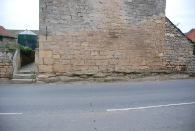 area, Hooton Pagnall is a fine example of a 16th century estate village with a Norman church next to a large hall. The village is on a hillside consisting of a buff coloured limestone, made of a bryozoan (tiny colonial sea creatures, not unlike corals) reef of the Permian era, laid down some 250 million years ago. The reef can be seen at the base of a number of houses and in a cliff face behind the war memorial. Hooton Pagnall derives its name from Ralph de Paganel or Paynel, to whom the manor belonged at the time of the Conquest. It is said that the de Paganels came from a line of Roman pagans who moved to Normandy and lived in villages called pagi. The family took their name from the villages. The history of the hall site is very unclear. It appears there was a mediaeval peel tower here, but who built it is unknown. At some stage, the de Paganels passed the property to the Luttrells, Sir John holding the property in the reigns of Henry I and Stephen (and interestingly Sir Geoffrey Luttrell who died in 1216, was married to Frethesant Paynell, William de Paganell’s daughter). It then passed to Sir Richard Hutton (1561-1639), and lastly to Colonel Bierley who sold it to the Warde family in the late 17th century. The Wardes, now Warde-Aldham, were descended from Sir Patience Warde (1629-1696), a townsman of Pontefract, whose success in commerce led to him becoming Master of the Merchant
  Tailor’s company and then Lord Mayor of London in 1680. The house, which remains private, was greatly enlarged in the late 18th century and modified again in the early 20th century from profits of coal mining royalties from Frickley colliery.
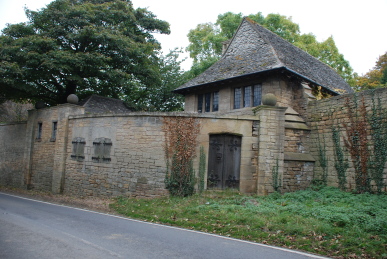
Situated next to the hall is the church, All Saints, Norman in origin, although it suffered the usual Victorian restoration in the 1870s by J.M. Neale. The base of the square tower looks original but the rest looks more modern. There is a small door on the side of the nave which looks old, iron studded with 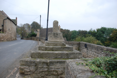 ornate hinges. In the churchyard are the broken stones of a sun dial. The hall stands on the edge of the village. Outside the entrance, where steps lead up to the church, are stone steps rising part way up the tall wall used to assist dismounting from a horse. There is a gate house behind a tall walls that has wooden shuttered windows in it. Back towards the village the road splits, one part rising around some houses and the war memorial and the other section dropping down and then back up to join up again. On the top road is the stump of the Butter Cross, erected in 1540-50 to mark the granting of a market charter in 1293 to Sir Geoffrey Luterel. Below is the village pound, considered to be Norman and was still used for stray cattle in the 20th century. Along the road is the old forge, now an outbuilding of a cottage. The village club, closed because of financial difficulties, is a strange mock Elizabethan half-timbered black and white construction built in 1903. The school bell rings out from way down the hill and the noisy shouts of the children fall silent.
Monday 29th October – Hathersage – This village sits at the foot of one of the side valleys off the wide Hope Valley in Derbyshire. It was the last village on the pack-horse route between Manchester and Sheffield before the long and,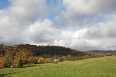 in winter conditions, dangerous haul up over the moors to the latter city. Built of gritstone and overlooked by Stanage and Millstone Edges, the village was originally up the hill around the church of St Michael and All Angels. We walk up Baulk Lane, passing Besom Lane (a besom being a sweeping brush made of twigs, much used in the steel industry) and then up a path to the churchyard. The most famous grave is that of “Little John”, Robin Hood’s close friend. It is said he died in a cottage, now destroyed, to
  the east of the graveyard. In 1780 James Shuttleworth claims to have unearthed a thigh bone measuring 28½ inches which would have made Little John over 8 feet in height. Robin, known as Locksley may have come from Loxley, only 8 miles away. Little John’s bow used to hang in the church where it was noticed by the Oxford historian, Ashmole, during the reign of James I, but was later removed along with the thigh bone to Cannon Hall, Barnsley from where they disappeared in the 1950s. The church is of a mid-14th century style, but certainly built on an older place of worship, indeed probably a pre-Christian site. No church is mentioned in the Domesday Book, when the manor of “Hereseige” was held by Lavenot and Levric. The first mention of a church is in 1130, in the reign of Henry I. The first rector named was William in 1281 and the list is complete, with John Rolfe being the first vicar in 1422.
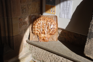
The building was inevitably restored by the Victorians, although prior to this the state of repair was reportedly very poor. In the porch, probably built 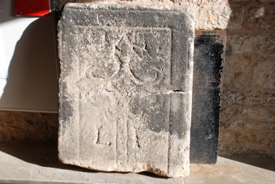 by Robert Eyre in about 1500 is a harvest loaf and an old tomb slab, probably 13th century and claimed to be Little John’s original tombstone. It is engraved with a fleur-de-lys, two shields and the letters “LI”. Entering the church one passes the hexagonal font dating from the mid-15th century. At the end of the nave is the Parish Chest with three locks which would have held the parish records. A bronze War Memorial occupies the place on the wall opposite the entrance. There are six bells in the tower and they ring out the hour as we visit. At the east end of the north aisle are two ornately carved Austrian chairs, used by Queen Victoria and Prince Albert at the inauguration of St George’s Hall, Liverpool which were given to the parish in recognition that the stone for the hall came from local quarries. Above is a tessellated tablet commemorating A.L. Cammel who, “died in America as the result of a fall, 1891”. Apparently, popular belief locally is that he was killed in a gunfight. Behind the altar is the Kempe Glass window which, along with the pitch pine pews in the Lady Chapel, originally were in Derwent church which was submerged when Ladybower Reservoir was built. On the south wall of the chancel is a collection of brasses of the Eyre family, one of whom fought with Prince Harry at Agincourt. Opposite is the large arched tomb of Robert Eyre.
Charlotte Brontë stayed at the old Vicarage and would have known the Eyre family of North Lees Hall. Many of the locations in “Jane Eyre” match Hathersage, which she called Morton and Mr Rochester’s home “Thornfield” could have been based on North Lees as “Thorn” is an anagram of “North” and “Lees” is an old word for fields. To the east of the church is a fine house on Camp Green, a mound which held a fortification from 850CE, probably built by Danes. The road drops steeply down Church Bank and back into the village. Hathersage was once quite industrialised with five mills with chimneys pouring out black smoke. It was a centre for needle, pin and wire drawing industries. Brass buttons were also manufactured and in 1847 Samuel Fox designed his Fox Frame lightweight umbrellas. Those industries vanished around 1900 although four mills still remain but now have different uses. Back over the moors towards Sheffield, just beyond Burbage Bridge, a huge vista of the city and beyond opens out. The steam from a distant power station is a smudged rainbow.
Wednesday 31st October – Fleets Dam – The River Dearne is low. A Wood Pigeon clatters noisily out of the trees with a flash of blue-grey. A chipping Great Spotted Woodpecker flies around high above the trees. Fallen leaves dot the river water. Long-tailed Tits call constantly in nearby bushes. The flood protection bank has been built, rather unhelpfully across the path. Given the power of the floods in the summer, it is hard to imagine this two foot high earth bank will stop anything much. A Grey Heron on the water conditioning mechanism extends a wing to help it balance in the brisk and gusty wind. A pair of Great Crested Grebes are on the water. Tall trees shine copper and gold in the bright sunshine that dazzles blindingly off the river.
 Thrush rasps from nearby. Blackbirds are in the fields and fly off into Hawthorns. Black cattle feed in a sedgy field across the valley. Behind are meadows below the open moor which are dotted with sheep. A cock Pheasant flies up onto a drystone wall and proceeds to pick his way delicately down the stones. The old school, now the Sunday School, has a bell in a little tower on the roof. Over the door is engraved “I.E. 1694” when it was built with money bequeathed by Joshua Earnshaw on land given by James Earnshaw. It was rebuilt in 1820 and again in 1838, closing in 1880. A little “square” of cobbles surrounded by cottages leads to a playground with an entrance marked “IA GB 1696”.
 rutted affair once called Cliff Road. The path rises steadily between stone walls with fields beyond, some empty, others with sheep. To the north is Round Hill, followed by Round Hill Flat. The track ends at a gate. On the gate is an owl pellet, the regurgitated remains of its meal. Up here it is most likely a Short-eared Owl. There is an indicator that shows the path continues across the moorland. The path is a sedge strewn affair between a broken down wall and the
  footings of another wall. It arrives at the ruins of Holme Cliff. Up the hill, in a notch, is a television aerial with a large solar panel. It is not obvious to me what it is for! The path is supposed to carry on across the hillside and then turn down towards the tiny hamlet of Lane. There is no discernible path, just a few sheep tracks. Toadstools, including some Liberty Caps nestle in the rough grasses and sedge. I reach the edge of a steep clough from which there is no sign of a path. Downwards looks steep and very rough, so after much checking my position I regretfully decide to return the way I came rather than risk my dodgy knees and ankles. On the way back, I slowly approach a Red Grouse standing on a wall. From the road up to Holme Moss, I can make out the path I could have taken down the hillside, but it is still unclear where it joined the path I was actually standing on.
 Wharncliffe Side on the opposite side of the Don valley from Wharncliffe Woods. The Park was given to the people of Wharncliffe Side in 1917 by local paper manufacturer Joseph Dixon and his friend John Mills, who had previously purchased the area for £1000, for use as a pleasure garden. Before this the area was previously known as Haw, How, Hall or Howe Wood. In 1974 it became administered by Sheffield City Council. An open area of green extends down from the car park. Up from this is a track that leads into the park. A small stream tumbles down the hillside beside the track. The woods are mature, dominated by Oak, Sycamore, Beech and Holly, with many other species present. A Jay calls high in the canopy. The track gently curves up to Glen Howe Tower, built in 1881 by John Mills who lived there until 1917. A little further up is a packhorse bridge that used to stand in the Ewden Valley. Built in 1734, it was moved to its present site in 1926 when More Hall reservoir was built. There are references to remains of a mediaeval moated hall here. There are memorials to Sir Arthur Cyril Pearson who was a wealthy London newspaper publisher who used his newspaper, “Pearson’s Weekly” to raise public donations for charitable purposes. One of these was “Pearson’s Fresh Air Fund”, established in 1892 to provide impoverished children from London’s East End with a day in the country. Having succeeded in raising large sums of money he proceeded to invite responsible organisations from other towns and cities to apply for funds to cover the cost of similar excursions. In 1893 a group of Sheffield teachers formed a “Fresh Air Group” and one of the most popular destinations was Glen Howe Park. We cross the bridge and follow a path through the woods that drops back down to the track. Back near the car park a Great Spotted Woodpecker is calling from a tree, but remains hidden.
 countryside. It stood on one of the Salt Roads that brought salt from the mines of Cheshire. At the end of a pretty street, Town Gate, stands the Church of St Nicholas. There is evidence of an Anglo-Saxon church having been on the site. In the 11th century a new church was built by the de Lovetot family, Lords of Hallamshire in Ecclesfield, followed by two chapels-of-ease, in Sheffield and Bradfield under the control of St Wandrille’s Abbey, a Benedictine house in Normandy. This chapel was replaced in the 14th and 15th centuries by the present church. Gargoyles look down from the roof, one is a dragon which recalls chivalry and good-versus-evil and another is a Talbot dog, for the Talbot family, Earls of Shrewsbury who were Lords of the Manor for over two centuries. Tomb stones are laid in the path leading to the entrance, some with beautiful script from the 18th century. In the porch one of the stones has a cross set sideways carved into it, a sign that it is a
  reused coffin lid. In the main body of the church there are oak chandeliers designed by G.G. Pace in 1951 when electricity reached the village. Although the roof beams are relatively new, the original bosses have been retained, ranging from simple foliage designs to heraldic shields and badges such as dragons, an antelope, badge of Henry VI, a pelican, a symbol of piety, a Talbot dog, a unicorn with a royal coronet around its neck, symbol of Christ through its purity and virtue and the Green Man, an ancient symbol of the seasons and the growth of crops. There are some fine stained glass windows, one depicting St William of York (Archbishop – 1141-1147) with St
  Andrew and St Peter, another was installed in 1877 using salvaged mediaeval glass and a fine window over the alter depicting the Nativity, Baptism, Crucifixion, Resurrection and Ascension. Near the organ, which is being tested, loudly, is a huge oak chest made out of a single tree trunk in the 12th century. It measures 9′ 3″ in length, 2′ wide and 20″ deep and weighs nearly half a ton. It has been strengthened with iron straps. On the wall nearby is a wooden plaque commemorating the disaster on March 11th 1864 when Dale Dyke Reservoir embankment above the village of Low Bradfield collapsed releasing 600 million gallons of water down the Loxley valley towards Sheffield resulting in the loss of over 240 lives. There are extensive graveyards by the church and out on the hillside. Some record the losses of young men in the wars, one in particular who died in a POW camp in Borneo in 1945. Sheep graze the grass in the graveyards. To the north is a large motte and bailey of a Norman castle, now covered in trees.
 to provide water for both surrounding villages and Great Manchester. Greenfield Brook ran down the valley and was dammed in 1880 to form the Yeoman Hey reservoir and again in 1902 to form the Greenfield reservoir. It is apparently called Dovestones because of a rock formation on the skyline that looks like a dove, however, some of us have always called in Duckstones as there is a formation looking far more duck-like! There has also been a moor called Dove Stone Moss for many years. It has been many years since I was last here – indeed, I think the last time was a rather illicit visit early one morning with Beardy Dave (now, sadly deceased) to collect magic mushrooms, now completely illegal! A track runs round the reservoir. It is busy. A large flock of Mallard are expecting to be fed. Black-headed Gulls keep watch slightly further out on the water, whilst a flock of motley feral pigeons watch
  from the roof of the sailing club. Old Beeches stand near the path, their roots probably in not much soil as large rocks abound. Here and down to the water are new trees planted in memory of loved ones in the
  channel. Beyond is a steep channel rising up to a tunnel, 1260 yards long that bypassed the earlier reservoirs to provide water for the mills down the valley. Burnsie and his mates have apparently walked through this tunnel during a dry spell many summers ago. High on the edge of the moor above is a cross, a memorial to James Platt, brother of John and MP for Oldham, who was accidentally shot and killed on a grouse shoot. Red Grouse are calling across the hillside. A path crosses the hillside, the Rough, passing under Dean Rocks, Great and Little Dove Stone Rocks, which have been quarried in the past and are now a rock-climbing venue of note (although many of the rock faces look green with algae and there is not a lot of evidence of chalk marks left by climbers, maybe not so popular these days.) The path is rough here with boulders and rocks emerging from the thin soil. The path descends into what were called Higher and Lower Hollins Plantations, but the trees here are young and much of the areas of plantation are now open sheep pasture. A pair of Red-legged Partridge are pecking at the seed heads of grasses. There is less wind here, although it is not a lot lower, and the sun is now hot having burned off the mist and raised the cloud level.
 from a spring to provide it for a local iron works and a gravity feed to Heath Old Hall. A car park is on the edge of the village by the common. A little way into the common is the Pinfold, which has been restored recently by the village. It consists of a circular stone lined pen built into the hillside with the entrance on the lower part. A Pinder would use the pinfold to hold stray animals on the common, releasing them for a fee. Beautiful Silver Birches shine in the morning sun. A small flock of Jackdaws flies over. The village is scattered around large open green spaces. The Kings Arms is a 17th century inn. A Magpie used to a regular, nipping into the pub and pinching people’s beer, but it got banned! I have visited the pub long ago and well remember the stone flag floors, gas mantle lighting and fine ales. Beyond, to the north-east is a line of fine houses. The Manor House, Beech Lawn, Dower House and Heath Hall. Then round to the north is Heath House. These are all large 17th and 18th century country houses. Most have “ha-ha’s”, a ditch by the walls that meant that animals could be kept out without a tall wall to spoil the view. Interspersed between these mansions are smaller cottages of the villagers. The history of Heath goes back much further than the present houses. It is said that near Heath was the moot, the Viking parliament for the West Riding. Near the Manor House is a long footpath between two hedges. It leads to a field of some plants with long thin leaves with a pale stripe up the centre. I wonder if they are a sort of switchgrass, grown for bio-fuels? Beyond the field is a well made drystone wall and Gled Hill. The name is usually reckoned to be from the Old English for “a hill with Kites”, although it is not clear why the bird would frequent this hill in particular. Another source considers it to be an old Norse personal name.
 rustling and slithering as leaves fall in little gusts of wind. The thicket of Japanese Knotweed beyond the footbridge is turning yellow. It looks beautiful and it is such a pity it is such an invasive plant. Many red and white Fly Agaric nestle in the grass under the birches, but no boletus. It maybe that now celebrity chefs and Sunday newspapers have popularised wild fungi, collectors have already taken them. Various chirps and cheeps come from tits in the bushes and short bursts of song from Wrens and Robins. Half a dozen Mallard rise up noisily as I approach and Moorhens swim jerkily across the canal into the reed bed. Many rose briars have the spiky red bedeguar galls on their stems. I take a look down the old footpath across the meadow to the North Gawber bridge. There is now a small pond across the path and extensive reed beds to the north. Tiny yellow flowers of Black Medick are like little jewels in the long grass. A huge and ugly warehouse is being constructed on the edge of the industrial estate to the north of the end of the canal. Water cress is growing in the channel that drains the field up to Greenfoot. It tastes hot and peppery but I am not sure of the source of the water so I do not risk swallowing any leaves. A huge black slug is crossing the path.
 Council’s pride and joy, four towering cranes on the construction site of the Gateway Plaza. Yet again, the lessons of the past have not been learned.

 area, Hooton Pagnall is a fine example of a 16th century estate village with a Norman church next to a large hall. The village is on a hillside consisting of a buff coloured limestone, made of a bryozoan (tiny colonial sea creatures, not unlike corals) reef of the Permian era, laid down some 250 million years ago. The reef can be seen at the base of a number of houses and in a cliff face behind the war memorial. Hooton Pagnall derives its name from Ralph de Paganel or Paynel, to whom the manor belonged at the time of the Conquest. It is said that the de Paganels came from a line of Roman pagans who moved to Normandy and lived in villages called pagi. The family took their name from the villages. The history of the hall site is very unclear. It appears there was a mediaeval peel tower here, but who built it is unknown. At some stage, the de Paganels passed the property to the Luttrells, Sir John holding the property in the reigns of Henry I and Stephen (and interestingly Sir Geoffrey Luttrell who died in 1216, was married to Frethesant Paynell, William de Paganell’s daughter). It then passed to Sir Richard Hutton (1561-1639), and lastly to Colonel Bierley who sold it to the Warde family in the late 17th century. The Wardes, now Warde-Aldham, were descended from Sir Patience Warde (1629-1696), a townsman of Pontefract, whose success in commerce led to him becoming Master of the Merchant
  Tailor’s company and then Lord Mayor of London in 1680. The house, which remains private, was greatly enlarged in the late 18th century and modified again in the early 20th century from profits of coal mining royalties from Frickley colliery.
 ornate hinges. In the churchyard are the broken stones of a sun dial. The hall stands on the edge of the village. Outside the entrance, where steps lead up to the church, are stone steps rising part way up the tall wall used to assist dismounting from a horse. There is a gate house behind a tall walls that has wooden shuttered windows in it. Back towards the village the road splits, one part rising around some houses and the war memorial and the other section dropping down and then back up to join up again. On the top road is the stump of the Butter Cross, erected in 1540-50 to mark the granting of a market charter in 1293 to Sir Geoffrey Luterel. Below is the village pound, considered to be Norman and was still used for stray cattle in the 20th century. Along the road is the old forge, now an outbuilding of a cottage. The village club, closed because of financial difficulties, is a strange mock Elizabethan half-timbered black and white construction built in 1903. The school bell rings out from way down the hill and the noisy shouts of the children fall silent.
 in winter conditions, dangerous haul up over the moors to the latter city. Built of gritstone and overlooked by Stanage and Millstone Edges, the village was originally up the hill around the church of St Michael and All Angels. We walk up Baulk Lane, passing Besom Lane (a besom being a sweeping brush made of twigs, much used in the steel industry) and then up a path to the churchyard. The most famous grave is that of “Little John”, Robin Hood’s close friend. It is said he died in a cottage, now destroyed, to
  the east of the graveyard. In 1780 James Shuttleworth claims to have unearthed a thigh bone measuring 28½ inches which would have made Little John over 8 feet in height. Robin, known as Locksley may have come from Loxley, only 8 miles away. Little John’s bow used to hang in the church where it was noticed by the Oxford historian, Ashmole, during the reign of James I, but was later removed along with the thigh bone to Cannon Hall, Barnsley from where they disappeared in the 1950s. The church is of a mid-14th century style, but certainly built on an older place of worship, indeed probably a pre-Christian site. No church is mentioned in the Domesday Book, when the manor of “Hereseige” was held by Lavenot and Levric. The first mention of a church is in 1130, in the reign of Henry I. The first rector named was William in 1281 and the list is complete, with John Rolfe being the first vicar in 1422.
 by Robert Eyre in about 1500 is a harvest loaf and an old tomb slab, probably 13th century and claimed to be Little John’s original tombstone. It is engraved with a fleur-de-lys, two shields and the letters “LI”. Entering the church one passes the hexagonal font dating from the mid-15th century. At the end of the nave is the Parish Chest with three locks which would have held the parish records. A bronze War Memorial occupies the place on the wall opposite the entrance. There are six bells in the tower and they ring out the hour as we visit. At the east end of the north aisle are two ornately carved Austrian chairs, used by Queen Victoria and Prince Albert at the inauguration of St George’s Hall, Liverpool which were given to the parish in recognition that the stone for the hall came from local quarries. Above is a tessellated tablet commemorating A.L. Cammel who, “died in America as the result of a fall, 1891”. Apparently, popular belief locally is that he was killed in a gunfight. Behind the altar is the Kempe Glass window which, along with the pitch pine pews in the Lady Chapel, originally were in Derwent church which was submerged when Ladybower Reservoir was built. On the south wall of the chancel is a collection of brasses of the Eyre family, one of whom fought with Prince Harry at Agincourt. Opposite is the large arched tomb of Robert Eyre.